

<< Our Photo Pages >> Clach Ossian - Natural Stone / Erratic / Other Natural Feature in Scotland in Perth and Kinross
Submitted by hamish on Monday, 17 October 2005 Page Views: 12998
Natural PlacesSite Name: Clach Ossian Alternative Name: Ossian's Stone; Cairn Ossian; Clach-na-Ossian; Giant's Grave; Ossian's Grave; Soldier's GraveCountry: Scotland
NOTE: This site is 3.5 km away from the location you searched for.
County: Perth and Kinross Type: Natural Stone / Erratic / Other Natural Feature
Nearest Town: Crieff
Map Ref: NN8953130593
Latitude: 56.454506N Longitude: 3.794003W
Condition:
| 5 | Perfect |
| 4 | Almost Perfect |
| 3 | Reasonable but with some damage |
| 2 | Ruined but still recognisable as an ancient site |
| 1 | Pretty much destroyed, possibly visible as crop marks |
| 0 | No data. |
| -1 | Completely destroyed |
| 5 | Superb |
| 4 | Good |
| 3 | Ordinary |
| 2 | Not Good |
| 1 | Awful |
| 0 | No data. |
| 5 | Can be driven to, probably with disabled access |
| 4 | Short walk on a footpath |
| 3 | Requiring a bit more of a walk |
| 2 | A long walk |
| 1 | In the middle of nowhere, a nightmare to find |
| 0 | No data. |
| 5 | co-ordinates taken by GPS or official recorded co-ordinates |
| 4 | co-ordinates scaled from a detailed map |
| 3 | co-ordinates scaled from a bad map |
| 2 | co-ordinates of the nearest village |
| 1 | co-ordinates of the nearest town |
| 0 | no data |
Internal Links:
External Links:
I have visited· I would like to visit
markj99 visited on 30th Nov 2018 There is a passing place at NN 8952 3051 on the A822 to park up carefully. There is a gateway E of the passing place into a rough field. Clach Ossian is c. 90 yards N of the gate.
hamish have visited here
")
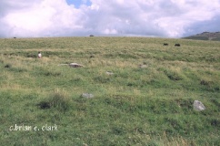
This is a glacial erratic in a field off the road through The Sma' Glen. It was reputed to be the grave of the Bard Ossian. When it was moved out of the way by General Wade's road builders ' with much effort ' it is said a cavity 2ft square was found under it. This contained ashes, scraps of bone and bits of burned heather. The contents were removed with great ceremony by the local Highlanders and reburied in Glen Almond.
For more information see Canmore site no. 25554, extracts of which read: "There is nothing here but a huge upright boulder, to which Wade's road has obviously been aimed at from the S. Remains of the road and stone wall beside it are plainly to be seen. There is no evidence of a cairn or of the four stones mentioned ... 27 April 1940." and updated in 1970 to say: "Ossian's Stone" is surrounded by the remains of a turf-covered stone wall, rather than a stone circle. The E half is as planned but the W half has obliterated except for two surviving stones. No trace of a cist was found."
This stone is also featured on The Northern Antiquarian (TNA), - see their entry for Ossian’s Stone, Sma’ Glen, Fowlis Wester, Perthshire, which has directions for finding this site, together with photographs, a 1834 sketch, Cole's 1911 plan, a drawing and an archaeology & history which draws from several references.
You may be viewing yesterday's version of this page. To see the most up to date information please register for a free account.
")
")
")
")
")
")
")
")
")
")
")
")
Do not use the above information on other web sites or publications without permission of the contributor.
Click here to see more info for this site
Nearby sites
Key: Red: member's photo, Blue: 3rd party photo, Yellow: other image, Green: no photo - please go there and take one, Grey: site destroyed
Download sites to:
KML (Google Earth)
GPX (GPS waypoints)
CSV (Garmin/Navman)
CSV (Excel)
To unlock full downloads you need to sign up as a Contributory Member. Otherwise downloads are limited to 50 sites.
Turn off the page maps and other distractions
Nearby sites listing. In the following links * = Image available
1.3km SE 136° Saddlin' Mare (Sma' Glen)* Standing Stone (Menhir) (NN90422964)
1.4km SE 135° Sma' Glen* Cairn (NN90502956)
3.6km S 173° Foulford Inn Cup and Ring marked stone* Rock Art (NN899270)
4.3km S 190° Falls of Monzie* Rock Art (NN88662637)
5.1km WNW 285° Conichan East (Glen Almond) Ancient Village or Settlement (NN8464532074)
5.6km SSW 194° Keppoch Standing Stones (NN87982517)
6.4km SSE 152° Fowlis Wester West* Stone Circle (NN9240124916)
6.4km SSE 152° Fowlis Wester East* Stone Circle (NN9242624917)
6.5km SSW 192° Witches' Stone, Monzie* Standing Stone (Menhir) (NN87982431)
6.6km S 191° Monzie Circle* Stone Circle (NN88162417)
6.9km WNW 288° Clach Na Tiompan* Stone Circle (NN82963286)
7.0km SW 216° Stonefield Circle Stone Circle (NN85252505)
7.0km SSE 158° Thorn Stone Pair* Standing Stones (NN92032404)
7.1km SSE 158° Thorn Recumbent Stones* Standing Stones (NN92042397)
7.1km WNW 289° Well of the Mosses (Glen Almond) Holy Well or Sacred Spring (NN8286533096)
7.1km S 181° Cultoquhey* Chambered Cairn (NN8923723485)
7.3km SSE 152° Fowlis Wester 2* Class III Pictish Cross Slab (NN92812408)
7.3km SSE 152° Fowlis Wester 1* Class II Pictish Symbol Stone (NN92772404)
7.3km WNW 288° Glenshervie Burn* Stone Circle (NN82593299)
7.6km N 9° Innercochill* Rock Art (NN909381)
7.8km E 93° Kor Stone* Standing Stone (Menhir) (NN97333004)
7.8km SSW 195° Ferntower B* Standing Stones (NN8728023069)
8.0km SSE 155° New Fowlis* Stone Circle (NN92712329)
8.3km SSW 193° Ferntower* Stone Circle (NN874226)
8.4km SSW 199° Cradle Stone* Natural Stone / Erratic / Other Natural Feature (NN8654522730)
View more nearby sites and additional images


 We would like to know more about this location. Please feel free to add a brief description and any relevant information in your own language.
 Wir möchten mehr über diese Stätte erfahren. Bitte zögern Sie nicht, eine kurze Beschreibung und relevante Informationen in Deutsch hinzuzufügen.
 Nous aimerions en savoir encore un peu sur les lieux. S'il vous plaît n'hesitez pas à ajouter une courte description et tous les renseignements pertinents dans votre propre langue.
 Quisieramos informarnos un poco más de las lugares. No dude en añadir una breve descripción y otros datos relevantes en su propio idioma.