


<< Our Photo Pages >> Castleton 5 - Rock Art in Scotland in Stirling
Submitted by SolarMegalith on Thursday, 24 December 2015 Page Views: 2472
Rock ArtSite Name: Castleton 5Country: Scotland
NOTE: This site is 1.758 km away from the location you searched for.
County: Stirling Type: Rock Art
Nearest Town: Plean
Map Ref: NS85548811
Latitude: 56.072072N Longitude: 3.840312W
Condition:
| 5 | Perfect |
| 4 | Almost Perfect |
| 3 | Reasonable but with some damage |
| 2 | Ruined but still recognisable as an ancient site |
| 1 | Pretty much destroyed, possibly visible as crop marks |
| 0 | No data. |
| -1 | Completely destroyed |
| 5 | Superb |
| 4 | Good |
| 3 | Ordinary |
| 2 | Not Good |
| 1 | Awful |
| 0 | No data. |
| 5 | Can be driven to, probably with disabled access |
| 4 | Short walk on a footpath |
| 3 | Requiring a bit more of a walk |
| 2 | A long walk |
| 1 | In the middle of nowhere, a nightmare to find |
| 0 | No data. |
| 5 | co-ordinates taken by GPS or official recorded co-ordinates |
| 4 | co-ordinates scaled from a detailed map |
| 3 | co-ordinates scaled from a bad map |
| 2 | co-ordinates of the nearest village |
| 1 | co-ordinates of the nearest town |
| 0 | no data |
Internal Links:
External Links:
I have visited· I would like to visit
SolarMegalith visited on 4th Mar 2015 - their rating: Cond: 3 Amb: 4 Access: 4
")
Two faint cup-and-ring marks located on the outcrop over the edge of a cliff, east of Castleton 7a panel.
For more information see Castleton 5 at Canmore, an extract from their 1969 entry reads: "a) a clear cup-and-four-rings and cup-and-three rings, (b) 2yds E, faint cup-and-three rings; (c) 8yds NE, faint cup-and-ring and (d) 8yds N, faint cup-and-ring."
An entry from 1986 adds: "About 8m NE of Castleton 5a is a single cup and one ring, 9cm in diameter on a very large domed outcrop sloping 20 degrees S where carved."
You may be viewing yesterday's version of this page. To see the most up to date information please register for a free account.
")
")
Do not use the above information on other web sites or publications without permission of the contributor.
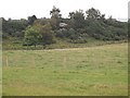
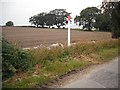
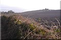
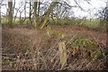
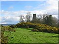
Nearby Images from Geograph Britain and Ireland:
©2010(licence)
©2010(licence)
©2017(licence)
©2017(licence)
©2005(licence)
The above images may not be of the site on this page, they are loaded from Geograph.
Please Submit an Image of this site or go out and take one for us!
Click here to see more info for this site
Nearby sites
Key: Red: member's photo, Blue: 3rd party photo, Yellow: other image, Green: no photo - please go there and take one, Grey: site destroyed
Download sites to:
KML (Google Earth)
GPX (GPS waypoints)
CSV (Garmin/Navman)
CSV (Excel)
To unlock full downloads you need to sign up as a Contributory Member. Otherwise downloads are limited to 50 sites.
Turn off the page maps and other distractions
Nearby sites listing. In the following links * = Image available
80m NNW 345° Castleton 7a* Rock Art (NS8552188188)
335m NE 52° Castleton 2* Rock Art (NS85818831)
438m NE 47° Castleton 1* Rock Art (NS85878840)
623m SE 128° Castleton 8* Rock Art (NS86028771)
3.8km SSW 214° Torwood Broch* Broch or Nuraghe (NS8333584986)
3.8km SSW 198° Dunipace Marching Camp Not Known (by us) (NS84258450)
4.3km WNW 296° St Ninians Cursus Cursus (NS81679012)
4.4km WNW 296° St Ninians Cursus Cursus (NS81599016)
5.9km NE 36° Hawk Hill Cairn (Alloa) Cairn (NS89119282)
6.0km SSE 155° Arthur’s O’on Ancient Temple (NS87968262)
6.1km S 181° Lochlands Temporary Camp 1 Not Known (by us) (NS85268199)
6.5km NE 44° Parkmill Cross (Alloa) Ancient Cross (NS9013392661)
6.6km NE 56° Lady Well (Clackmannan) Holy Well or Sacred Spring (NS91129166)
6.6km N 359° Haer Stane* Standing Stone (Menhir) (NS85659475)
6.6km S 181° Lochlands Temporary Camp 2 Not Known (by us) (NS85308147)
6.7km NE 54° Stone of Mannan* Standing Stone (Menhir) (NS91119188)
6.7km NE 54° Mercat Cross (Clackmannan)* Ancient Cross (NS9111091889)
6.7km NE 47° Hawk Hill (Alloa) Stone Circle (NS906926)
6.9km S 179° Bogton Roman Camp Not Known (by us) (NS85468125)
7.1km S 177° Carmuirs Roman Camps Ancient Village or Settlement (NS85758100)
7.1km NW 305° Wester Livilands* Broch or Nuraghe (NS7979692369)
7.2km N 3° Priest's Well (Tullibody) Holy Well or Sacred Spring (NS8606995324)
7.2km N 2° The Maiden Stone (Tullibody)* Sculptured Stone (NS86039533)
7.4km N 359° Lady's Well (Tullibody) Holy Well or Sacred Spring (NS85639548)
7.4km S 172° Camelon Roman Fort and Gask Ridge Signal Station Promontory Fort / Cliff Castle (NS86378077)
View more nearby sites and additional images


 We would like to know more about this location. Please feel free to add a brief description and any relevant information in your own language.
 Wir möchten mehr über diese Stätte erfahren. Bitte zögern Sie nicht, eine kurze Beschreibung und relevante Informationen in Deutsch hinzuzufügen.
 Nous aimerions en savoir encore un peu sur les lieux. S'il vous plaît n'hesitez pas à ajouter une courte description et tous les renseignements pertinents dans votre propre langue.
 Quisieramos informarnos un poco más de las lugares. No dude en añadir una breve descripción y otros datos relevantes en su propio idioma.