


<< Text Pages >> Mary's Well (East Morton) - Holy Well or Sacred Spring in Scotland in Dumfries and Galloway
Submitted by Anne T on Friday, 08 July 2022 Page Views: 673
Springs and Holy WellsSite Name: Mary's Well (East Morton)Country: Scotland
NOTE: This site is 1.2 km away from the location you searched for.
County: Dumfries and Galloway Type: Holy Well or Sacred Spring
Nearest Town: Thornhill Nearest Village: Durisdeer
Map Ref: NS88870123
Latitude: 55.292601N Longitude: 3.751609W
Condition:
| 5 | Perfect |
| 4 | Almost Perfect |
| 3 | Reasonable but with some damage |
| 2 | Ruined but still recognisable as an ancient site |
| 1 | Pretty much destroyed, possibly visible as crop marks |
| 0 | No data. |
| -1 | Completely destroyed |
| 5 | Superb |
| 4 | Good |
| 3 | Ordinary |
| 2 | Not Good |
| 1 | Awful |
| 0 | No data. |
| 5 | Can be driven to, probably with disabled access |
| 4 | Short walk on a footpath |
| 3 | Requiring a bit more of a walk |
| 2 | A long walk |
| 1 | In the middle of nowhere, a nightmare to find |
| 0 | No data. |
| 5 | co-ordinates taken by GPS or official recorded co-ordinates |
| 4 | co-ordinates scaled from a detailed map |
| 3 | co-ordinates scaled from a bad map |
| 2 | co-ordinates of the nearest village |
| 1 | co-ordinates of the nearest town |
| 0 | no data |
Be the first person to rate this site - see the 'Contribute!' box in the right hand menu.
Internal Links:
External Links:
Holy Well or Sacred Spring in Dumfries and Galloway
Classified by Canmore as a holy well - see their entry for Site ID 46356, 'East Morton, Mary's Well', their first entry from Ramage's 1876 publication "Drumlanrig Castle and the Douglases with the early history and ancient remains of Durisdeer, Closeburn and Morton", page 328, simply says: "Mary's Well, a holy well, is situated on a hill at East Morton farm".
The OS name book of 1856 adds: "A well supplied by several surrounding springs. The name is ancient, but it cannot be ascertained whether it was a sacred well or not".
The Canmore entry was updated in January 1978 to say: "All that can be seen at the published site is a modern water storage tank. There is no longer any trace of a well." The well was marked on the OS 6-inch map of 1957, although not named on the 18th century estate map of East Morton farm (see plan by Leslie, James, ca. 1758-75 [NLS link shared by their Creative Commons licence CC-BY]
Does anyone have any historical information and/or drawings of this well? Are you able to confirm this well has holy associations? There appears to be no church or chapel nearby, although there are castles and mottes in the area.
Has anyone visited this site, and have any photographs you can add? Thank you.
You may be viewing yesterday's version of this page. To see the most up to date information please register for a free account.
Do not use the above information on other web sites or publications without permission of the contributor.
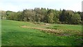
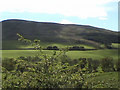
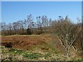
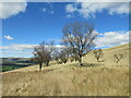
Nearby Images from Geograph Britain and Ireland:
©2019(licence)
©2006(licence)
©2021(licence)
©2023(licence)
©2020(licence)
The above images may not be of the site on this page, they are loaded from Geograph.
Please Submit an Image of this site or go out and take one for us!
Click here to see more info for this site
Nearby sites
Key: Red: member's photo, Blue: 3rd party photo, Yellow: other image, Green: no photo - please go there and take one, Grey: site destroyed
Download sites to:
KML (Google Earth)
GPX (GPS waypoints)
CSV (Garmin/Navman)
CSV (Excel)
To unlock full downloads you need to sign up as a Contributory Member. Otherwise downloads are limited to 50 sites.
Turn off the page maps and other distractions
Nearby sites listing. In the following links * = Image available
5.3km SSW 206° Penpont Cursus Cursus (NX86409658)
6.1km SSW 197° Nith Bridge Cross* Ancient Cross (NX8689095471)
7.4km S 188° Templand Mains* Standing Stone (Menhir) (NX87719396)
7.4km WSW 239° Honeyhole White Cairn* Cairn (NX82389757)
8.8km SW 224° Grennan Hill Hillfort (NX82549507)
10.0km SSW 209° Capenoch Cairn (NX8385092608)
10.0km SW 222° Tynron Doon* Hillfort (NX8197093927)
10.3km S 171° My Lady's Well (Brownhill) Holy Well or Sacred Spring (NX90279100)
10.6km S 175° Kirkpatrick Hill (Closeburn) Holy Well or Sacred Spring (NX896906)
10.8km SE 135° Gulfhill Rig Cairn (NX963933)
13.6km E 96° Lonnachie Rig Cairn (NY024995)
13.7km NNE 28° Daer valley Ancient Village or Settlement (NS956132)
13.8km SSW 214° Glencairn Cursus Cursus (NX80948993)
14.3km SSW 192° Fleuchlarg White Cairn* Chambered Cairn (NX85438734)
14.8km WSW 244° St. Conal's Well* Holy Well or Sacred Spring (NX75399508)
15.1km NW 311° Crawick Multiverse* Modern Stone Circle etc (NS7763311439)
15.4km E 98° Stiddrig* Cairn (NY04139877)
16.3km SSE 168° Temple Wood (Dunscore)* Modern Stone Circle etc (NX91848522)
16.5km SSE 153° Clonfeckle Cairn (NX960863)
16.9km S 191° White Cairn, Gilmerston Cairn (NX853847)
16.9km S 177° Springfield Hill Hillfort (NX89448431)
17.0km SSW 201° West Skelston White Cairn* Cairn (NX82358551)
17.2km NNE 24° Bodsberry Hill* Hillfort (NS963168)
17.7km SSW 196° Glenesslin Schoolhouse* Cairn (NX83488433)
18.9km ESE 112° Crunzierton Wood Scooped Settlement* Ancient Village or Settlement (NY0625093750)
View more nearby sites and additional images


 We would like to know more about this location. Please feel free to add a brief description and any relevant information in your own language.
 Wir möchten mehr über diese Stätte erfahren. Bitte zögern Sie nicht, eine kurze Beschreibung und relevante Informationen in Deutsch hinzuzufügen.
 Nous aimerions en savoir encore un peu sur les lieux. S'il vous plaît n'hesitez pas à ajouter une courte description et tous les renseignements pertinents dans votre propre langue.
 Quisieramos informarnos un poco más de las lugares. No dude en añadir una breve descripción y otros datos relevantes en su propio idioma.