<< Our Photo Pages >> Dunraven - Hillfort in Wales in South Glamorgan
Submitted by vicky on Wednesday, 25 February 2004 Page Views: 12374
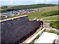
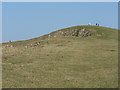
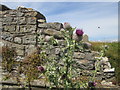
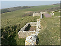
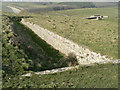
Iron Age and Later PrehistorySite Name: DunravenCountry: Wales County: South Glamorgan Type: Hillfort
Nearest Town: Brigend Nearest Village: St Bride`s Major
Map Ref: SS887728 Landranger Map Number: 170
Latitude: 51.443220N Longitude: 3.602852W
Condition:
| 5 | Perfect |
| 4 | Almost Perfect |
| 3 | Reasonable but with some damage |
| 2 | Ruined but still recognisable as an ancient site |
| 1 | Pretty much destroyed, possibly visible as crop marks |
| 0 | No data. |
| -1 | Completely destroyed |
| 5 | Superb |
| 4 | Good |
| 3 | Ordinary |
| 2 | Not Good |
| 1 | Awful |
| 0 | No data. |
| 5 | Can be driven to, probably with disabled access |
| 4 | Short walk on a footpath |
| 3 | Requiring a bit more of a walk |
| 2 | A long walk |
| 1 | In the middle of nowhere, a nightmare to find |
| 0 | No data. |
| 5 | co-ordinates taken by GPS or official recorded co-ordinates |
| 4 | co-ordinates scaled from a detailed map |
| 3 | co-ordinates scaled from a bad map |
| 2 | co-ordinates of the nearest village |
| 1 | co-ordinates of the nearest town |
| 0 | no data |
Internal Links:
External Links:
I have visited· I would like to visit
jlfern2 visited - their rating: Cond: 3 Amb: 4 Access: 4
")
Have you visited this site? Please add a comment below.
You may be viewing yesterday's version of this page. To see the most up to date information please register for a free account.
")
")
")
Do not use the above information on other web sites or publications without permission of the contributor.
Nearby Images from Geograph Britain and Ireland:
©2015(licence)
©2009(licence)
©2014(licence)
©2009(licence)
©2009(licence)
The above images may not be of the site on this page, they are loaded from Geograph.
Please Submit an Image of this site or go out and take one for us!
Click here to see more info for this site
Nearby sites
Key: Red: member's photo, Blue: 3rd party photo, Yellow: other image, Green: no photo - please go there and take one, Grey: site destroyed
Download sites to:
KML (Google Earth)
GPX (GPS waypoints)
CSV (Garmin/Navman)
CSV (Excel)
To unlock full downloads you need to sign up as a Contributory Member. Otherwise downloads are limited to 50 sites.
Turn off the page maps and other distractions
Nearby sites listing. In the following links * = Image available
1.5km SE 135° Cwm Bach Hillfort Hillfort (SS89727175)
2.3km N 352° Heol y Mynydd Round Barrow* Round Barrow(s) (SS8841275126)
3.9km SE 140° New Mill Farm Enclosure* Ancient Village or Settlement (SS91156978)
4.2km N 352° Ogmore Cross Shaft* Early Christian Sculptured Stone (SS88177698)
4.4km SE 142° Nash Point Barrows* Round Barrow(s) (SS91376926)
5.0km NW 325° Merthyr Mawr Warren 3 Cairn (SS859770)
5.1km NW 320° Merthyr Mawr Warren 2 Cairn (SS855768)
5.1km SE 146° Nash Point* Promontory Fort / Cliff Castle (SS915685)
5.3km N 1° Chapel Hill Camp Hillfort (SS88887806)
5.4km SE 146° Cae'r-Eglwys Long Cairn* Long Barrow (SS91666825)
5.6km NW 317° Merthyr Mawr Warren 1 Cairn (SS850770)
5.7km NNW 335° Cae Summerhouse* Ancient Village or Settlement (SS86397798)
6.8km NW 311° St John's Well (South Glamorgan)* Holy Well or Sacred Spring (SS8366877335)
6.8km NW 310° St John's Well (Newton)* Holy Well or Sacred Spring (SS836773)
6.8km NNW 340° Tythegston* Chambered Tomb (SS86467925)
6.9km NNE 11° Bridgend Recreation Centre* Standing Stone (Menhir) (SS90217951)
7.9km NNW 332° Mynydd Herbert* Round Barrow(s) (SS85137983)
8.2km N 351° Cae'r-hen-Eglwys* Standing Stones (SS8753380886)
8.3km NW 308° Ffynnon Fawr* Holy Well or Sacred Spring (SS82227808)
8.6km NE 53° St Canna's Church (Llangan)* Ancient Cross (SS957778)
8.7km NE 36° St Crallog (Coychurch)* Ancient Cross (SS93997970)
8.7km NE 36° Ebissar Stone* Ancient Cross (SS93997971)
8.7km NW 320° Mount Pleasant, Newton Nottage Round Cairn (SS83257960)
8.8km NNE 17° Pond Cairn* Ring Cairn (SS914812)
8.8km NW 310° St David's Well (South Glamorgan)* Holy Well or Sacred Spring (SS8203578604)
View more nearby sites and additional images


 We would like to know more about this location. Please feel free to add a brief description and any relevant information in your own language.
 Wir möchten mehr über diese Stätte erfahren. Bitte zögern Sie nicht, eine kurze Beschreibung und relevante Informationen in Deutsch hinzuzufügen.
 Nous aimerions en savoir encore un peu sur les lieux. S'il vous plaît n'hesitez pas à ajouter une courte description et tous les renseignements pertinents dans votre propre langue.
 Quisieramos informarnos un poco más de las lugares. No dude en añadir una breve descripción y otros datos relevantes en su propio idioma.