<< Our Photo Pages >> Rhyd Blaen-Y-Cwm Enclosure - Misc. Earthwork in Wales in West Glamorgan
Submitted by Baldrick on Sunday, 18 February 2007 Page Views: 12114
Multi-periodSite Name: Rhyd Blaen-Y-Cwm EnclosureCountry: Wales County: West Glamorgan Type: Misc. Earthwork
Nearest Town: Margam
Map Ref: SS833880
Latitude: 51.578743N Longitude: 3.685552W
Condition:
| 5 | Perfect |
| 4 | Almost Perfect |
| 3 | Reasonable but with some damage |
| 2 | Ruined but still recognisable as an ancient site |
| 1 | Pretty much destroyed, possibly visible as crop marks |
| 0 | No data. |
| -1 | Completely destroyed |
| 5 | Superb |
| 4 | Good |
| 3 | Ordinary |
| 2 | Not Good |
| 1 | Awful |
| 0 | No data. |
| 5 | Can be driven to, probably with disabled access |
| 4 | Short walk on a footpath |
| 3 | Requiring a bit more of a walk |
| 2 | A long walk |
| 1 | In the middle of nowhere, a nightmare to find |
| 0 | No data. |
| 5 | co-ordinates taken by GPS or official recorded co-ordinates |
| 4 | co-ordinates scaled from a detailed map |
| 3 | co-ordinates scaled from a bad map |
| 2 | co-ordinates of the nearest village |
| 1 | co-ordinates of the nearest town |
| 0 | no data |
Internal Links:
External Links:
")
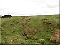
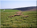
Easy access from the track running along side. Half hours walk from the road were I parked at SS845883. There is a hill fort, Y Bwlwarcau, marked on the map to the north east but disappointingly it's almost completely ploughed flat.
You may be viewing yesterday's version of this page. To see the most up to date information please register for a free account.
")
")
")
Do not use the above information on other web sites or publications without permission of the contributor.
Nearby Images from Geograph Britain and Ireland:
©2024(licence)
©2005(licence)
©2005(licence)

©2017(licence)
©2019(licence)
The above images may not be of the site on this page, they are loaded from Geograph.
Please Submit an Image of this site or go out and take one for us!
Click here to see more info for this site
Nearby sites
Key: Red: member's photo, Blue: 3rd party photo, Yellow: other image, Green: no photo - please go there and take one, Grey: site destroyed
Download sites to:
KML (Google Earth)
GPX (GPS waypoints)
CSV (Garmin/Navman)
CSV (Excel)
To unlock full downloads you need to sign up as a Contributory Member. Otherwise downloads are limited to 50 sites.
Turn off the page maps and other distractions
Nearby sites listing. In the following links * = Image available
795m N 352° Twmpath Diwlith Round Barrow(s) (SS83218879)
1.3km SW 217° Ton-Mawr Hill Fort* Hillfort (SS825870)
2.8km WNW 287° Ergyd Uchaf Cairn 2 Cairn (SS80618887)
3.0km WSW 243° Mynydd y Castell* Hillfort (SS806867)
3.1km WSW 245° Lady's Well (South Glamorgan)* Holy Well or Sacred Spring (SS80478675)
3.1km WNW 292° Ergyd Uchaf Cairn Cairn (SS80438922)
3.2km WSW 249° Ffynnon Gyffyr* Holy Well or Sacred Spring (SS8030486920)
3.6km WSW 248° Half Moon Camp Ancient Village or Settlement (SS79968673)
3.6km WSW 242° Margam Stones Museum* Museum (SS801864)
3.9km W 278° Ergyd Isaf 2 Round Barrow(s) (SS79458866)
3.9km W 278° Ergyd Isaf 1 Round Barrow(s) (SS79438864)
4.0km WSW 245° Margam Gorsedd Stone Circle* Modern Stone Circle etc (SS7961886387)
4.0km WSW 247° Ffynnon Pedr* Holy Well or Sacred Spring (SS79538654)
4.3km W 274° Mynydd Brombil Ancient Village or Settlement (SS79048839)
5.2km SW 214° Tyn'r y selar* Standing Stone (Menhir) (SS80248374)
5.4km S 169° Pen-Y-Castell (Cynffig)* Ancient Village or Settlement (SS84228270)
5.8km S 189° Pyle Slab Early Christian Sculptured Stone (SS82238232)
5.8km NW 309° Pen-Y-Castell (Cwmavon) Ancient Village or Settlement (SS78859175)
6.3km SSW 202° Croes Y Ddadl Ancient Village or Settlement (SS80868222)
6.3km SSW 210° Ffynnon Lygad Holy Well or Sacred Spring (SS79968261)
6.7km SE 141° Cefn Cribbwr* Standing Stone (Menhir) (SS8738882634)
7.0km SSE 162° Ty Du Stone or Scratching Post?* Standing Stone (Menhir) (SS85338133)
8.1km WNW 294° Mynydd Dinas* Hillfort (SS760915)
8.3km SSE 148° Cae'r-hen-Eglwys* Standing Stones (SS8753380886)
8.4km SSE 166° Mynydd Herbert* Round Barrow(s) (SS85137983)
View more nearby sites and additional images


 We would like to know more about this location. Please feel free to add a brief description and any relevant information in your own language.
 Wir möchten mehr über diese Stätte erfahren. Bitte zögern Sie nicht, eine kurze Beschreibung und relevante Informationen in Deutsch hinzuzufügen.
 Nous aimerions en savoir encore un peu sur les lieux. S'il vous plaît n'hesitez pas à ajouter une courte description et tous les renseignements pertinents dans votre propre langue.
 Quisieramos informarnos un poco más de las lugares. No dude en añadir una breve descripción y otros datos relevantes en su propio idioma.