


<< Text Pages >> Blackhill (Hazelbank) - Standing Stone (Menhir) in Scotland in South Lanarkshire
Submitted by Anne T on Saturday, 29 April 2017 Page Views: 1851
Neolithic and Bronze AgeSite Name: Blackhill (Hazelbank)Country: Scotland
NOTE: This site is 0.8 km away from the location you searched for.
County: South Lanarkshire Type: Standing Stone (Menhir)
Nearest Town: Kirkmuirhill Nearest Village: Hazelbank
Map Ref: NS82904423
Latitude: 55.677388N Longitude: 3.863717W
Condition:
| 5 | Perfect |
| 4 | Almost Perfect |
| 3 | Reasonable but with some damage |
| 2 | Ruined but still recognisable as an ancient site |
| 1 | Pretty much destroyed, possibly visible as crop marks |
| 0 | No data. |
| -1 | Completely destroyed |
| 5 | Superb |
| 4 | Good |
| 3 | Ordinary |
| 2 | Not Good |
| 1 | Awful |
| 0 | No data. |
| 5 | Can be driven to, probably with disabled access |
| 4 | Short walk on a footpath |
| 3 | Requiring a bit more of a walk |
| 2 | A long walk |
| 1 | In the middle of nowhere, a nightmare to find |
| 0 | No data. |
| 5 | co-ordinates taken by GPS or official recorded co-ordinates |
| 4 | co-ordinates scaled from a detailed map |
| 3 | co-ordinates scaled from a bad map |
| 2 | co-ordinates of the nearest village |
| 1 | co-ordinates of the nearest town |
| 0 | no data |
Internal Links:
External Links:
Standing Stone (Menhir) in South Lanarkshire
This standing stone, of which no trace is visible today, is recorded on Canmore ID 46673. Their entry tells us that in 1898, the stone was recorded as "being the only one remaining in the district. It stands fully 6ft (1.83m) high above ground, and is sunk about 4ft (1.22m). In 1954, a site visit reported: "No trace of this stone is visible in or around this field, which has been under plough for some time. The son of the tenant of Blackhill farm remembers this stone having stood at the point indicated on OS 6", but it was removed some years ago."
The Northern Antiquarian (TNA) also feature a page on this standing stone. See their entry for Blackhill, Hazelbank, Lanarkshire, which also confirms the stone was "sadly uprooted sometime before 1954."
It would be interesting to find if the stone has been reused somewhere else on the surrounding farmland.
Note: Have you visited this site? Do you have any photographs or further information you can add?
You may be viewing yesterday's version of this page. To see the most up to date information please register for a free account.
Do not use the above information on other web sites or publications without permission of the contributor.
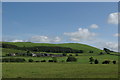
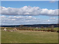
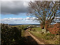
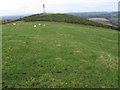
Nearby Images from Geograph Britain and Ireland:
©2012(licence)
©2018(licence)
©2018(licence)
©2007(licence)
©2012(licence)
The above images may not be of the site on this page, they are loaded from Geograph.
Please Submit an Image of this site or go out and take one for us!
Click here to see more info for this site
Nearby sites
Key: Red: member's photo, Blue: 3rd party photo, Yellow: other image, Green: no photo - please go there and take one, Grey: site destroyed
Download sites to:
KML (Google Earth)
GPX (GPS waypoints)
CSV (Garmin/Navman)
CSV (Excel)
To unlock full downloads you need to sign up as a Contributory Member. Otherwise downloads are limited to 50 sites.
Turn off the page maps and other distractions
Nearby sites listing. In the following links * = Image available
1.7km SSE 168° Clarkston (Dillarburn) Standing Stone (Menhir) (NS832426)
4.0km NNE 20° Braidwood (Carluke) Standing Stone (Menhir) (NS84354799)
4.6km E 96° St Patrick's Well (Lanark) Holy Well or Sacred Spring (NS8744443652)
7.1km NNW 334° Dalserf Sculptured Stone (NS79985071)
9.6km NW 311° Larkhall Prehistoric Settlement Complex* Ancient Village or Settlement (NS7585850718)
11.5km SW 216° Standingstone Hill (Lesmahagow) Standing Stone (Menhir) (NS759351)
12.5km W 269° St Anne's Well (Strathaven) Holy Well or Sacred Spring (NS70394438)
13.3km W 273° Three Stanes (Strathaven) Standing Stones (NS69574524)
15.2km ESE 118° Fallburn at Tinto Hillfort (NS96193674)
15.5km WNW 287° Shawton (Chapeltown) Standing Stone (Menhir) (NS68124906)
16.5km ESE 112° Boatbridge Quarry Cist (NS981376)
17.9km SSE 161° Wildshaw Burn* Stone Circle (NS882271)
18.6km ENE 68° Wester Yard Houses Souterrain* Souterrain (Fogou, Earth House) (NT004508)
19.6km SSW 214° Muirkirk Stane* Standing Stone (Menhir) (NS71622821)
20.1km E 84° Weston henge* Henge (NT03004578)
20.2km ESE 111° Biggar Cursus Cursus (NT01663657)
20.2km SE 140° Devonshaw Hill* Hillfort (NS954283)
20.6km ENE 74° Burngrange Cairn (NT029494)
20.9km E 85° Tod Holes (Weston) Sculptured Stone (NT03844560)
21.3km E 100° Carwood Farm Ancient Village or Settlement (NT039401)
22.0km SSE 149° Cold Chapel prehistoric settlement* Ancient Village or Settlement (NS93782512)
22.0km ESE 105° Moat Park Heritage Centre Museum (NT040378)
22.3km ESE 119° Culterpark Hill* Hillfort (NT02213305)
22.3km SSE 159° Blackhill Hillfort (NS9032423216)
22.7km ESE 119° Snaip Hill* Hillfort (NT02463269)
View more nearby sites and additional images


 We would like to know more about this location. Please feel free to add a brief description and any relevant information in your own language.
 Wir möchten mehr über diese Stätte erfahren. Bitte zögern Sie nicht, eine kurze Beschreibung und relevante Informationen in Deutsch hinzuzufügen.
 Nous aimerions en savoir encore un peu sur les lieux. S'il vous plaît n'hesitez pas à ajouter une courte description et tous les renseignements pertinents dans votre propre langue.
 Quisieramos informarnos un poco más de las lugares. No dude en añadir una breve descripción y otros datos relevantes en su propio idioma.