<< Our Photo Pages >> The Sleeping Giant - Natural Stone / Erratic / Other Natural Feature in Wales in Powys
Submitted by sem on Monday, 14 November 2011 Page Views: 4898
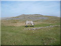
Natural PlacesSite Name: The Sleeping GiantCountry: Wales County: Powys Type: Natural Stone / Erratic / Other Natural Feature
Nearest Village: Abercraf
Map Ref: SN830145
Latitude: 51.816843N Longitude: 3.698777W
Condition:
| 5 | Perfect |
| 4 | Almost Perfect |
| 3 | Reasonable but with some damage |
| 2 | Ruined but still recognisable as an ancient site |
| 1 | Pretty much destroyed, possibly visible as crop marks |
| 0 | No data. |
| -1 | Completely destroyed |
| 5 | Superb |
| 4 | Good |
| 3 | Ordinary |
| 2 | Not Good |
| 1 | Awful |
| 0 | No data. |
| 5 | Can be driven to, probably with disabled access |
| 4 | Short walk on a footpath |
| 3 | Requiring a bit more of a walk |
| 2 | A long walk |
| 1 | In the middle of nowhere, a nightmare to find |
| 0 | No data. |
| 5 | co-ordinates taken by GPS or official recorded co-ordinates |
| 4 | co-ordinates scaled from a detailed map |
| 3 | co-ordinates scaled from a bad map |
| 2 | co-ordinates of the nearest village |
| 1 | co-ordinates of the nearest town |
| 0 | no data |
Internal Links:
External Links:
I have visited· I would like to visit
sem has visited here
")
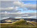
A natural formation that does look like a man asleep. Maybe he is resting after building the nearby cairns.
You may be viewing yesterday's version of this page. To see the most up to date information please register for a free account.
Do not use the above information on other web sites or publications without permission of the contributor.
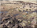
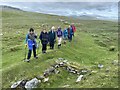
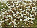
Nearby Images from Geograph Britain and Ireland:
©2012(licence)
©2022(licence)
©2022(licence)
©2011(licence)
©2023(licence)
The above images may not be of the site on this page, they are loaded from Geograph.
Please Submit an Image of this site or go out and take one for us!
Click here to see more info for this site
Nearby sites
Key: Red: member's photo, Blue: 3rd party photo, Yellow: other image, Green: no photo - please go there and take one, Grey: site destroyed
Download sites to:
KML (Google Earth)
GPX (GPS waypoints)
CSV (Garmin/Navman)
CSV (Excel)
To unlock full downloads you need to sign up as a Contributory Member. Otherwise downloads are limited to 50 sites.
Turn off the page maps and other distractions
Nearby sites listing. In the following links * = Image available
339m SSW 208° Cribarth Cairns* Cairn (SN8283514203)
618m NNW 348° Pwll-y-Wythen Fach* Ancient Village or Settlement (SN8288115107)
948m NNE 17° Saith Maen Cairn Ring Cairn (SN833154)
949m NNE 17° Saith Maen NW* Stone Row / Alignment (SN8330615399)
1.8km NNE 25° Dan-yr-Ogof* Cave or Rock Shelter (SN838161)
2.2km ENE 65° Powell's Cave Cave or Rock Shelter (SN84991535)
2.4km N 6° Twyn Ddu* Cairn (SN833169)
3.2km ENE 72° Penwyllt Cairn* Cairn (SN8606715391)
3.2km E 87° Saith Maen SE* Stone Row / Alignment (SN862146)
3.3km E 85° The Gnomen Standing Stone (Menhir) (SN8635214716)
3.4km ENE 77° Careg Lywd 2* Stone Row / Alignment (SN8629315186)
3.4km E 97° Pump Maen (Five Stones)* Stone Row / Alignment (SN86361400)
3.4km E 83° Saith Maen East Cairn* Cairn (SN8642414831)
3.7km NNW 346° Waun Fignen Felen Ancient Village or Settlement (SN82201810)
4.4km NNW 333° Pwll-y-Cig Cairn* Cairn (SN8105818446)
4.4km W 275° Llorfa* Stone Circle (SN7861915010)
4.8km ENE 66° The Nipple* Cairn (SN87441635)
4.8km ENE 74° Carreg Cadno* Stone Row / Alignment (SN87671569)
4.9km NW 318° Banwen Gwys 2* Cairn (SN7977318259)
5.1km NW 320° Banwen Gwys 1* Cairn (SN7984818471)
5.2km ENE 58° Pwll Byfre Hut Circle 2 Ancient Village or Settlement (SN87471711)
5.2km W 275° Llwyncwmstabl* Cairn (SN77851509)
5.2km ENE 58° Pwll Byfre Hut Circle 1 Ancient Village or Settlement (SN87501711)
5.7km W 266° Dorwen* Standing Stones (SN7730414239)
6.0km S 175° Cwm Irfon Standing Stones (Seven Sisters) Standing Stones (SN834085)
View more nearby sites and additional images


 We would like to know more about this location. Please feel free to add a brief description and any relevant information in your own language.
 Wir möchten mehr über diese Stätte erfahren. Bitte zögern Sie nicht, eine kurze Beschreibung und relevante Informationen in Deutsch hinzuzufügen.
 Nous aimerions en savoir encore un peu sur les lieux. S'il vous plaît n'hesitez pas à ajouter une courte description et tous les renseignements pertinents dans votre propre langue.
 Quisieramos informarnos un poco más de las lugares. No dude en añadir una breve descripción y otros datos relevantes en su propio idioma.