<< Text Pages >> Ogof Rhiwleden - Cave or Rock Shelter in Wales in Conwy
Submitted by coldrum on Friday, 22 July 2011 Page Views: 3728
Natural PlacesSite Name: Ogof RhiwledenCountry: Wales County: Conwy Type: Cave or Rock Shelter
Map Ref: SH81538269
Latitude: 53.327824N Longitude: 3.780295W
Condition:
| 5 | Perfect |
| 4 | Almost Perfect |
| 3 | Reasonable but with some damage |
| 2 | Ruined but still recognisable as an ancient site |
| 1 | Pretty much destroyed, possibly visible as crop marks |
| 0 | No data. |
| -1 | Completely destroyed |
| 5 | Superb |
| 4 | Good |
| 3 | Ordinary |
| 2 | Not Good |
| 1 | Awful |
| 0 | No data. |
| 5 | Can be driven to, probably with disabled access |
| 4 | Short walk on a footpath |
| 3 | Requiring a bit more of a walk |
| 2 | A long walk |
| 1 | In the middle of nowhere, a nightmare to find |
| 0 | No data. |
| 5 | co-ordinates taken by GPS or official recorded co-ordinates |
| 4 | co-ordinates scaled from a detailed map |
| 3 | co-ordinates scaled from a bad map |
| 2 | co-ordinates of the nearest village |
| 1 | co-ordinates of the nearest town |
| 0 | no data |
Be the first person to rate this site - see the 'Contribute!' box in the right hand menu.
Internal Links:
External Links:
Cave in Conwy (Bwrdeistref Sirol)
Coflein entry:
"Rhiwledyn cave was noted in January 1974 in the sheer cliff, access only being possible by using mountaineering equipment. The entrance does not seem to have been disturbed, and the disturbance inside is minimal. However, inside the cave a chamber was found to have a small pit in the floor, possibly dug by an antiquarian many years ago. While debris was being cleared human and animal bones were found under a stalagmite floor. It is hoped to excavate later in 1974. "
Read More at Coflein (https://www.coflein.gov.uk/en/site/307851
You may be viewing yesterday's version of this page. To see the most up to date information please register for a free account.
Do not use the above information on other web sites or publications without permission of the contributor.
Nearby Images from Geograph Britain and Ireland:
©2016(licence)
©2018(licence)
©2018(licence)
©2022(licence)
©2009(licence)
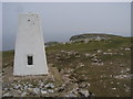
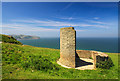
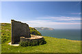
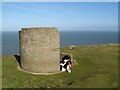
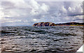
The above images may not be of the site on this page, they are loaded from Geograph.
Please Submit an Image of this site or go out and take one for us!
Click here to see more info for this site
Nearby sites
Key: Red: member's photo, Blue: 3rd party photo, Yellow: other image, Green: no photo - please go there and take one, Grey: site destroyed
Download sites to:
KML (Google Earth)
GPX (GPS waypoints)
CSV (Garmin/Navman)
CSV (Excel)
To unlock full downloads you need to sign up as a Contributory Member. Otherwise downloads are limited to 50 sites.
Turn off the page maps and other distractions
Nearby sites listing. In the following links * = Image available
1.3km SSW 212° Ogof Pant-Y-Wennol Cave Cave or Rock Shelter (SH80818161)
1.9km SW 234° Ogof Tan-Y-Bryn Cave or Rock Shelter (SH79948160)
2.3km SW 219° Coed Gaer Hut Circle* Ancient Village or Settlement (SH80028092)
3.0km ESE 120° St Trillo's Holy Well & Chapel* Holy Well or Sacred Spring (SH84138113)
3.2km SW 221° Llanrhos church Inscribed Stone Early Christian Sculptured Stone (SH79338032)
3.3km SW 223° Ffynnon Santes Fair Holy Well or Sacred Spring (SH792803)
3.3km SSE 149° Bryn Euryn* Hillfort (SH832798)
3.4km W 275° Llandudno Eisteddfod Circle* Modern Stone Circle etc (SH7816883048)
3.5km W 270° Lower Kendrick's Cave Cave or Rock Shelter (SH780828)
3.5km W 264° Llandudno Museum* Museum (SH78008240)
3.5km W 271° Upper Kendrick's Cave* Cave or Rock Shelter (SH7798182821)
3.6km W 272° St Tudno's Cradle* Natural Stone / Erratic / Other Natural Feature (SH779829)
3.6km W 273° Pen-y-Dinas (Conwy)* Hillfort (SH779830)
3.8km W 278° Great Orme Lost Chamber* Burial Chamber or Dolmen (SH778833)
4.0km SSW 204° Bodysgallen* Hillfort (SH798791)
4.3km W 272° Lletty'r Filiast* Burial Chamber or Dolmen (SH7721382950)
4.4km W 271° Great Orme barrow* Round Barrow(s) (SH771829)
4.5km W 274° Great Orme Mine* Ancient Mine, Quarry or other Industry (SH7707683100)
4.6km W 278° Brynia Poethion Ancient Village or Settlement (SH76998343)
4.6km WNW 282° St Tudno's Well* Holy Well or Sacred Spring (SH77068378)
4.6km SW 224° Deganwy Castle* Ancient Village or Settlement (SH7822579455)
5.0km WNW 281° Ffynnon Rufeinig* Holy Well or Sacred Spring (SH766838)
5.0km W 273° Bishop's Quarries Hut Circle Ancient Village or Settlement (SH76498311)
5.1km WNW 284° Hwylfa’r Ceirw Stone Alignment* Stone Row / Alignment (SH76568409)
5.3km WNW 284° Hafnant Ancient Village or Settlement (SH76398409)
View more nearby sites and additional images


 We would like to know more about this location. Please feel free to add a brief description and any relevant information in your own language.
 Wir möchten mehr über diese Stätte erfahren. Bitte zögern Sie nicht, eine kurze Beschreibung und relevante Informationen in Deutsch hinzuzufügen.
 Nous aimerions en savoir encore un peu sur les lieux. S'il vous plaît n'hesitez pas à ajouter une courte description et tous les renseignements pertinents dans votre propre langue.
 Quisieramos informarnos un poco más de las lugares. No dude en añadir una breve descripción y otros datos relevantes en su propio idioma.