


<< Our Photo Pages >> The Great Stane O' Pendreigh - Standing Stone (Menhir) in Scotland in Stirling
Submitted by peigimccann on Sunday, 20 August 2017 Page Views: 2432
Neolithic and Bronze AgeSite Name: The Great Stane O' PendreighCountry: Scotland County: Stirling Type: Standing Stone (Menhir)
Nearest Town: Bridge of Allan
Map Ref: NS8138299686
Latitude: 56.175006N Longitude: 3.912218W
Condition:
| 5 | Perfect |
| 4 | Almost Perfect |
| 3 | Reasonable but with some damage |
| 2 | Ruined but still recognisable as an ancient site |
| 1 | Pretty much destroyed, possibly visible as crop marks |
| 0 | No data. |
| -1 | Completely destroyed |
| 5 | Superb |
| 4 | Good |
| 3 | Ordinary |
| 2 | Not Good |
| 1 | Awful |
| 0 | No data. |
| 5 | Can be driven to, probably with disabled access |
| 4 | Short walk on a footpath |
| 3 | Requiring a bit more of a walk |
| 2 | A long walk |
| 1 | In the middle of nowhere, a nightmare to find |
| 0 | No data. |
| 5 | co-ordinates taken by GPS or official recorded co-ordinates |
| 4 | co-ordinates scaled from a detailed map |
| 3 | co-ordinates scaled from a bad map |
| 2 | co-ordinates of the nearest village |
| 1 | co-ordinates of the nearest town |
| 0 | no data |
Internal Links:
External Links:
")
It is reputed to have been placed to commemorate Wallace’s victories. Some say it was placed in memory of the Shepherd of Braco who dispatched with his broadsword a large number of dragoons who are now buried beneath the stone. However, the stone is several thousand years older than the tales it supposedly commemorates.
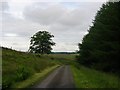
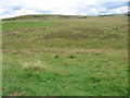
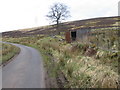
The stone is located 670 yards west of the old Sheriffmuir Road (Bridge of Allan to Greenloaning) on the edge of the Ochil Hills. Paths up to the stone vary from year to year, but access isn’t difficult. The view from the hill is 360º with Dumyat to the south.
This standing stone is also recorded as Canmore ID 47124, the latest entry from 1978 reading: "This fallen standing stone measures 1.4m broad, 0.5m thick and 4m in length."
The Northern Antiquarian (TNA) also features a page for this stone - see their entry for Pendreich Muir, Dunbland, Stirlingshire, which gives directions for finding this site, together with a photograph and a brief archaeology & history. TNA describe this as "a wonderful spot, located at the highest point on this small, lowland region of the western edge of the Ochil Hills."
You may be viewing yesterday's version of this page. To see the most up to date information please register for a free account.
")
")
Do not use the above information on other web sites or publications without permission of the contributor.
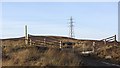
Nearby Images from Geograph Britain and Ireland:
©2005(licence)
©2007(licence)
©2012(licence)
©2008(licence)

©2014(licence)
The above images may not be of the site on this page, they are loaded from Geograph.
Please Submit an Image of this site or go out and take one for us!
Click here to see more info for this site
Nearby sites
Key: Red: member's photo, Blue: 3rd party photo, Yellow: other image, Green: no photo - please go there and take one, Grey: site destroyed
Download sites to:
KML (Google Earth)
GPX (GPS waypoints)
CSV (Garmin/Navman)
CSV (Excel)
To unlock full downloads you need to sign up as a Contributory Member. Otherwise downloads are limited to 50 sites.
Turn off the page maps and other distractions
Nearby sites listing. In the following links * = Image available
341m SSW 205° Pendreich 2 (Bridge of Allan) Cairn (NS81239938)
459m SSW 214° Split Stone (Bridge of Allan) Standing Stone (Menhir) (NS8111699311)
470m SSW 195° Pendreich 1 (Bridge of Allan) Cairn (NS8124499236)
484m SSW 194° Pendreich 3 (Bridge of Allan) Cairn (NS81259922)
1.1km WSW 239° Cuparlaw Wood (Bridge of Allan) Cairn (NS80469916)
1.6km S 180° Fairy Well (Logie)* Holy Well or Sacred Spring (NS81359804)
2.3km SW 228° Fairy Knowe (Bridge of Allan)* Cairn (NS79619818)
2.5km N 351° The Gathering Stone* Standing Stone (Menhir) (NN8105602191)
2.7km S 175° Logie Old Kirk (Stirling)* Early Christian Sculptured Stone (NS81549696)
2.8km SSW 207° Lentran (Bridge of Allan) Cist (NS80039720)
2.9km SSW 194° Pathfoot Stone* Standing Stone (Menhir) (NS8060496871)
3.1km S 178° The Victoria Stone* Marker Stone (NS8141296608)
3.1km W 281° Kippenross House (Dunblane) Cairn (NN78370036)
3.2km NE 34° Sheriff Muir Row* Stone Row / Alignment (NN83240226)
3.2km S 178° Airthrey Stone* Standing Stone (Menhir) (NS81409650)
3.6km WNW 296° Dunblane Museum* Museum (NN7819301343)
3.6km WNW 296° Dunblane Cathedral* Class III Pictish Cross Slab (NN78170139)
4.0km S 191° Bel Stane (Causewayhead) Standing Stone (Menhir) (NS805958)
4.1km S 185° Abbey Craig Vitrified Fort* Hillfort (NS80949565)
4.3km NNE 33° Harperstone (Dunblane) Stone Circle (NN838032)
4.6km N 349° White Stone* Standing Stones (NN80630420)
5.4km ENE 79° Bengengie North Ancient Village or Settlement (NN8668000601)
5.5km SSW 200° Our Lady's Well (Stirling) Holy Well or Sacred Spring (NS79329454)
5.9km W 276° Doune (Glenhead)* Stone Row / Alignment (NN7549300457)
6.0km SE 133° Lady's Well (Tullibody) Holy Well or Sacred Spring (NS85639548)
View more nearby sites and additional images


 We would like to know more about this location. Please feel free to add a brief description and any relevant information in your own language.
 Wir möchten mehr über diese Stätte erfahren. Bitte zögern Sie nicht, eine kurze Beschreibung und relevante Informationen in Deutsch hinzuzufügen.
 Nous aimerions en savoir encore un peu sur les lieux. S'il vous plaît n'hesitez pas à ajouter une courte description et tous les renseignements pertinents dans votre propre langue.
 Quisieramos informarnos un poco más de las lugares. No dude en añadir una breve descripción y otros datos relevantes en su propio idioma.