<< Other Photo Pages >> Tombuie Cottage - Rock Art in Scotland in Perth and Kinross
Submitted by davidmorgan on Wednesday, 05 December 2012 Page Views: 3646
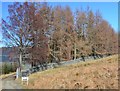
Rock ArtSite Name: Tombuie CottageCountry: Scotland
NOTE: This site is 0.9 km away from the location you searched for.
County: Perth and Kinross Type: Rock Art
Nearest Town: Aberfeldy
Map Ref: NN791451
Latitude: 56.582198N Longitude: 3.969891W
Condition:
| 5 | Perfect |
| 4 | Almost Perfect |
| 3 | Reasonable but with some damage |
| 2 | Ruined but still recognisable as an ancient site |
| 1 | Pretty much destroyed, possibly visible as crop marks |
| 0 | No data. |
| -1 | Completely destroyed |
| 5 | Superb |
| 4 | Good |
| 3 | Ordinary |
| 2 | Not Good |
| 1 | Awful |
| 0 | No data. |
| 5 | Can be driven to, probably with disabled access |
| 4 | Short walk on a footpath |
| 3 | Requiring a bit more of a walk |
| 2 | A long walk |
| 1 | In the middle of nowhere, a nightmare to find |
| 0 | No data. |
| 5 | co-ordinates taken by GPS or official recorded co-ordinates |
| 4 | co-ordinates scaled from a detailed map |
| 3 | co-ordinates scaled from a bad map |
| 2 | co-ordinates of the nearest village |
| 1 | co-ordinates of the nearest town |
| 0 | no data |
Internal Links:
External Links:
")
Around Tombuie Cottage there are many cup and ring marked rocks. Canmore lists possibly 18 separate sites.
You may be viewing yesterday's version of this page. To see the most up to date information please register for a free account.
Do not use the above information on other web sites or publications without permission of the contributor.
Nearby Images from Geograph Britain and Ireland:
©2009(licence)
©2014(licence)
©2009(licence)
©2016(licence)
©2016(licence)
The above images may not be of the site on this page, they are loaded from Geograph.
Please Submit an Image of this site or go out and take one for us!
Click here to see more info for this site
Nearby sites
Key: Red: member's photo, Blue: 3rd party photo, Yellow: other image, Green: no photo - please go there and take one, Grey: site destroyed
Download sites to:
KML (Google Earth)
GPX (GPS waypoints)
CSV (Garmin/Navman)
CSV (Excel)
To unlock full downloads you need to sign up as a Contributory Member. Otherwise downloads are limited to 50 sites.
Turn off the page maps and other distractions
Nearby sites listing. In the following links * = Image available
1.6km N 5° Taymouth (1)* Standing Stones (NN793467)
1.7km NNW 345° Comrie Bridge Stone Circle (NN787468)
1.8km W 268° Spar Island* Crannog (NN773451)
2.1km W 263° Scottish Crannog Centre* Museum (NN7704444910)
2.2km NNW 345° An Tobar* Holy Well or Sacred Spring (NN786472)
2.2km E 89° Craig Hill* Rock Art (NN81334506)
2.2km NNE 15° Croft Moraig Carving 1 Rock Art (NN7974647251)
2.3km NNE 15° Croft Moraig* Stone Circle (NN79774727)
2.3km SW 230° Balmacnaughton* Rock Art (NN7729043649)
2.6km NE 37° St Adamnan's Well* Holy Well or Sacred Spring (NN807471)
2.8km NNE 19° Taymouth (2) Standing Stones (NN801477)
3.3km N 9° Tirinie Farm Circle Stone Circle (NN797484)
3.4km N 10° Tirinie Farm Barrow Round Barrow(s) (NN798484)
3.5km SW 229° Queen's Wood (Acharn) Rock Art (NN76404291)
3.5km SW 220° Acharn Falls* Stone Circle (NN7678742495)
3.6km NNE 18° Carse Farm 2* Stone Circle (NN80284846)
3.7km SW 233° Acharn Burn* Cairn (NN76074294)
3.8km NNE 15° Carse Farm I* Stone Circle (NN80224873)
4.2km NNE 15° Appin of Dull* Rock Art (NN803491)
4.2km NNE 22° Dull Cairn* Cairn (NN808490)
4.3km NNE 20° Dull Cross (Aberfeldy) Ancient Cross (NN8070649135)
4.6km NNE 27° Nether Tullicro* Standing Stone (Menhir) (NN81294916)
4.9km WNW 290° Fortingall S* Stone Circle (NN7454746927)
4.9km WNW 291° Fortingall NE* Stone Circle (NN7453546977)
4.9km WNW 290° Fortingall SW* Stone Circle (NN7451446960)
View more nearby sites and additional images


 We would like to know more about this location. Please feel free to add a brief description and any relevant information in your own language.
 Wir möchten mehr über diese Stätte erfahren. Bitte zögern Sie nicht, eine kurze Beschreibung und relevante Informationen in Deutsch hinzuzufügen.
 Nous aimerions en savoir encore un peu sur les lieux. S'il vous plaît n'hesitez pas à ajouter une courte description et tous les renseignements pertinents dans votre propre langue.
 Quisieramos informarnos un poco más de las lugares. No dude en añadir una breve descripción y otros datos relevantes en su propio idioma.