


<< Text Pages >> Mynydd Brombil - Ancient Village or Settlement in Wales in West Glamorgan
Submitted by coldrum on Tuesday, 12 January 2010 Page Views: 6622
Multi-periodSite Name: Mynydd BrombilCountry: Wales
NOTE: This site is 1.7 km away from the location you searched for.
County: West Glamorgan Type: Ancient Village or Settlement
Map Ref: SS79048839
Latitude: 51.581349N Longitude: 3.747134W
Condition:
| 5 | Perfect |
| 4 | Almost Perfect |
| 3 | Reasonable but with some damage |
| 2 | Ruined but still recognisable as an ancient site |
| 1 | Pretty much destroyed, possibly visible as crop marks |
| 0 | No data. |
| -1 | Completely destroyed |
| 5 | Superb |
| 4 | Good |
| 3 | Ordinary |
| 2 | Not Good |
| 1 | Awful |
| 0 | No data. |
| 5 | Can be driven to, probably with disabled access |
| 4 | Short walk on a footpath |
| 3 | Requiring a bit more of a walk |
| 2 | A long walk |
| 1 | In the middle of nowhere, a nightmare to find |
| 0 | No data. |
| 5 | co-ordinates taken by GPS or official recorded co-ordinates |
| 4 | co-ordinates scaled from a detailed map |
| 3 | co-ordinates scaled from a bad map |
| 2 | co-ordinates of the nearest village |
| 1 | co-ordinates of the nearest town |
| 0 | no data |
Be the first person to rate this site - see the 'Contribute!' box in the right hand menu.
Internal Links:
External Links:
Ancient Village or Settlement in West Glamorgan
From Coflein: "A linear earthwork feature that runs at least c.300m ENE-WSW, then turning about a wide, round angle, to pass at least 150m to thec SSE, apparently partly defining a rectilinear enclosure, set on relatively level ground on the summit of Mynydd Brombil."
You may be viewing yesterday's version of this page. To see the most up to date information please register for a free account.
Do not use the above information on other web sites or publications without permission of the contributor.
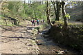
Nearby Images from Geograph Britain and Ireland:
©2011(licence)
©2008(licence)
©2008(licence)
©2022(licence)
©2022(licence)
The above images may not be of the site on this page, they are loaded from Geograph.
Please Submit an Image of this site or go out and take one for us!
Click here to see more info for this site
Nearby sites
Key: Red: member's photo, Blue: 3rd party photo, Yellow: other image, Green: no photo - please go there and take one, Grey: site destroyed
Download sites to:
KML (Google Earth)
GPX (GPS waypoints)
CSV (Garmin/Navman)
CSV (Excel)
To unlock full downloads you need to sign up as a Contributory Member. Otherwise downloads are limited to 50 sites.
Turn off the page maps and other distractions
Nearby sites listing. In the following links * = Image available
462m NE 56° Ergyd Isaf 1 Round Barrow(s) (SS79438864)
490m NE 55° Ergyd Isaf 2 Round Barrow(s) (SS79458866)
1.6km ENE 58° Ergyd Uchaf Cairn Cairn (SS80438922)
1.6km ENE 72° Ergyd Uchaf Cairn 2 Cairn (SS80618887)
1.9km SSE 150° Half Moon Camp Ancient Village or Settlement (SS79968673)
1.9km SSE 164° Ffynnon Pedr* Holy Well or Sacred Spring (SS79538654)
1.9km SE 138° Ffynnon Gyffyr* Holy Well or Sacred Spring (SS8030486920)
2.1km SSE 163° Margam Gorsedd Stone Circle* Modern Stone Circle etc (SS7961886387)
2.2km SE 138° Lady's Well (South Glamorgan)* Holy Well or Sacred Spring (SS80478675)
2.3km SSE 151° Margam Stones Museum* Museum (SS801864)
2.3km SE 136° Mynydd y Castell* Hillfort (SS806867)
3.1km SE 146° Margam Roman Villa* Ancient Village or Settlement (SS8072085752)
3.4km N 355° Pen-Y-Castell (Cwmavon) Ancient Village or Settlement (SS78859175)
3.7km ESE 111° Ton-Mawr Hill Fort* Hillfort (SS825870)
4.2km E 83° Twmpath Diwlith Round Barrow(s) (SS83218879)
4.3km E 94° Rhyd Blaen-Y-Cwm Enclosure* Misc. Earthwork (SS833880)
4.3km NW 314° Mynydd Dinas* Hillfort (SS760915)
4.8km SSE 164° Tyn'r y selar* Standing Stone (Menhir) (SS80248374)
5.3km NW 314° The Cross of Brancuf* Early Christian Sculptured Stone (SS753922)
5.8km NNW 333° Buarth y Gaer* Misc. Earthwork (SS765936)
5.9km S 170° Ffynnon Lygad Holy Well or Sacred Spring (SS79968261)
6.0km NW 317° Baglan Gorsedd Circle* Modern Stone Circle etc (SS7500492891)
6.4km NNW 336° Gaer Fawr (Baglan)* Hillfort (SS766943)
6.4km SSE 162° Croes Y Ddadl Ancient Village or Settlement (SS80868222)
6.9km SSE 151° Pyle Slab Early Christian Sculptured Stone (SS82238232)
View more nearby sites and additional images


 We would like to know more about this location. Please feel free to add a brief description and any relevant information in your own language.
 Wir möchten mehr über diese Stätte erfahren. Bitte zögern Sie nicht, eine kurze Beschreibung und relevante Informationen in Deutsch hinzuzufügen.
 Nous aimerions en savoir encore un peu sur les lieux. S'il vous plaît n'hesitez pas à ajouter une courte description et tous les renseignements pertinents dans votre propre langue.
 Quisieramos informarnos un poco más de las lugares. No dude en añadir una breve descripción y otros datos relevantes en su propio idioma.