<< Text Pages >> Troed Y Rhiw 1 - Cairn in Wales in Ceredigion
Submitted by coldrum on Monday, 11 January 2010 Page Views: 2315
Neolithic and Bronze AgeSite Name: Troed Y Rhiw 1 Alternative Name: Troed-Y-RhiwCountry: Wales
NOTE: This site is 1.0 km away from the location you searched for.
County: Ceredigion Type: Cairn
Map Ref: SN7636468372
Latitude: 52.299514N Longitude: 3.814517W
Condition:
| 5 | Perfect |
| 4 | Almost Perfect |
| 3 | Reasonable but with some damage |
| 2 | Ruined but still recognisable as an ancient site |
| 1 | Pretty much destroyed, possibly visible as crop marks |
| 0 | No data. |
| -1 | Completely destroyed |
| 5 | Superb |
| 4 | Good |
| 3 | Ordinary |
| 2 | Not Good |
| 1 | Awful |
| 0 | No data. |
| 5 | Can be driven to, probably with disabled access |
| 4 | Short walk on a footpath |
| 3 | Requiring a bit more of a walk |
| 2 | A long walk |
| 1 | In the middle of nowhere, a nightmare to find |
| 0 | No data. |
| 5 | co-ordinates taken by GPS or official recorded co-ordinates |
| 4 | co-ordinates scaled from a detailed map |
| 3 | co-ordinates scaled from a bad map |
| 2 | co-ordinates of the nearest village |
| 1 | co-ordinates of the nearest town |
| 0 | no data |
Be the first person to rate this site - see the 'Contribute!' box in the right hand menu.
Internal Links:
External Links:
Cairn in Ceredigion
From Coflein: "A mound, 6m in diameter and 0.2m high which may represent a small Bronze Age sepulchral cairn. A similar feature lies 40m to the south-west (NPRN: 405571). These are near, but distinct from, areas of later (modern) stone piles and are situated in an area where a series of heavily abraded boundaries represent the remains of an earlier field system, parts of which could conceivably be of prehistoric date (NPRN: 300572)."
You may be viewing yesterday's version of this page. To see the most up to date information please register for a free account.
Do not use the above information on other web sites or publications without permission of the contributor.
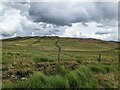
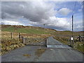
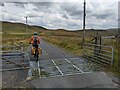
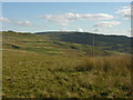
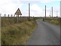
Nearby Images from Geograph Britain and Ireland:
©2023(licence)
©2024(licence)
©2023(licence)
©2007(licence)
©2005(licence)
The above images may not be of the site on this page, they are loaded from Geograph.
Please Submit an Image of this site or go out and take one for us!
Click here to see more info for this site
Nearby sites
Key: Red: member's photo, Blue: 3rd party photo, Yellow: other image, Green: no photo - please go there and take one, Grey: site destroyed
Download sites to:
KML (Google Earth)
GPX (GPS waypoints)
CSV (Garmin/Navman)
CSV (Excel)
To unlock full downloads you need to sign up as a Contributory Member. Otherwise downloads are limited to 50 sites.
Turn off the page maps and other distractions
Nearby sites listing. In the following links * = Image available
2.0km S 180° Troed Y Rhiw 2 Cairn (SN76336634)
2.5km NE 35° Blaen Marchnant Cairn (SN77857040)
2.6km SW 234° Pen-y-Bannau* Hillfort (SN74196689)
2.9km ENE 78° Craig Fawr Cairn (SN792689)
2.9km NE 55° Llan Ddu Fawr Cairn* Cairn (SN78766998)
3.0km NW 311° Carreg Samson, Llethr* Standing Stone (Menhir) (SN74157038)
3.1km ENE 61° Waun Claerddu Cist* Cist (SN79106980)
3.1km SSW 212° Strata Florida Sculptured Stone* Early Christian Sculptured Stone (SN74646577)
3.4km NE 51° Carn-Y-Rhyrddod* Cairn (SN7906670426)
3.5km S 190° Ffynnon Llygaid (Drefach)* Holy Well or Sacred Spring (SN7564064940)
3.7km ENE 64° Carreg Naw Llyn* Standing Stone (Menhir) (SN79716989)
4.4km S 183° Glasffrwyd Holy Well* Holy Well or Sacred Spring (SN75996399)
4.7km SSE 163° Pen-Y-Bwlch W ,Cairn Cairn (SN776638)
4.9km SSE 159° Pen-Y-Bwlch E ,Cairn Cairn (SN780637)
5.1km WNW 291° Banc-Y-Geufron* Cairn (SN71637033)
5.3km S 173° Blaen Glas ffrwd Standing Stone Standing Stone (Menhir) (SN769631)
5.3km S 171° Blaen Glasffrwd Cairn Field Cairn (SN771631)
5.5km W 273° Pen y Ffrwd* Hillfort (SN709688)
5.7km NE 50° Domen Milwyn Cairn* Round Barrow(s) (SN8083271967)
5.9km NW 313° Castle Grogwynion* Hillfort (SN72107249)
6.0km SE 140° Crug Gynon Cairn (SN801637)
6.4km W 281° Garreg Lwyd Ancient Village or Settlement (SN70106972)
6.6km WNW 287° Nant Byr Isaf Cairn (SN70037044)
7.7km ENE 59° Garreg Bica Standing Stone (Menhir) (SN8303372179)
7.9km W 277° Llanwnnws Inscribed Stone Early Christian Sculptured Stone (SN68516950)
View more nearby sites and additional images


 We would like to know more about this location. Please feel free to add a brief description and any relevant information in your own language.
 Wir möchten mehr über diese Stätte erfahren. Bitte zögern Sie nicht, eine kurze Beschreibung und relevante Informationen in Deutsch hinzuzufügen.
 Nous aimerions en savoir encore un peu sur les lieux. S'il vous plaît n'hesitez pas à ajouter une courte description et tous les renseignements pertinents dans votre propre langue.
 Quisieramos informarnos un poco más de las lugares. No dude en añadir una breve descripción y otros datos relevantes en su propio idioma.