 with our Megalithic Portal iPhone app")

<< Our Photo Pages >> Ffynnonau Penegoes - Holy Well or Sacred Spring in Wales in Powys
Submitted by coldrum on Tuesday, 26 January 2010 Page Views: 4973
Springs and Holy WellsSite Name: Ffynnonau PenegoesCountry: Wales
NOTE: This site is 3.0 km away from the location you searched for.
County: Powys Type: Holy Well or Sacred Spring
Map Ref: SH76820092
Latitude: 52.592077N Longitude: 3.819851W
Condition:
| 5 | Perfect |
| 4 | Almost Perfect |
| 3 | Reasonable but with some damage |
| 2 | Ruined but still recognisable as an ancient site |
| 1 | Pretty much destroyed, possibly visible as crop marks |
| 0 | No data. |
| -1 | Completely destroyed |
| 5 | Superb |
| 4 | Good |
| 3 | Ordinary |
| 2 | Not Good |
| 1 | Awful |
| 0 | No data. |
| 5 | Can be driven to, probably with disabled access |
| 4 | Short walk on a footpath |
| 3 | Requiring a bit more of a walk |
| 2 | A long walk |
| 1 | In the middle of nowhere, a nightmare to find |
| 0 | No data. |
| 5 | co-ordinates taken by GPS or official recorded co-ordinates |
| 4 | co-ordinates scaled from a detailed map |
| 3 | co-ordinates scaled from a bad map |
| 2 | co-ordinates of the nearest village |
| 1 | co-ordinates of the nearest town |
| 0 | no data |
Be the first person to rate this site - see the 'Contribute!' box in the right hand menu.
Internal Links:
External Links:
I have visited· I would like to visit
Leafmold visited on 11th Sep 2015 - their rating: Cond: 5 Amb: 3 Access: 4
")
From Coflein: "Two wells close together on opposite sides of the road. Both enclosed by low stone walls. Formerly used medicinally."
You may be viewing yesterday's version of this page. To see the most up to date information please register for a free account.
Do not use the above information on other web sites or publications without permission of the contributor.
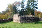
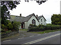
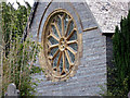
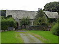
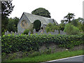
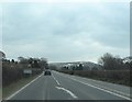
Nearby Images from Geograph Britain and Ireland:
©2018(licence)
©2018(licence)
©2018(licence)
©2018(licence)
©2013(licence)
The above images may not be of the site on this page, they are loaded from Geograph.
Please Submit an Image of this site or go out and take one for us!
Click here to see more info for this site
Nearby sites
Key: Red: member's photo, Blue: 3rd party photo, Yellow: other image, Green: no photo - please go there and take one, Grey: site destroyed
Download sites to:
KML (Google Earth)
GPX (GPS waypoints)
CSV (Garmin/Navman)
CSV (Excel)
To unlock full downloads you need to sign up as a Contributory Member. Otherwise downloads are limited to 50 sites.
Turn off the page maps and other distractions
Nearby sites listing. In the following links * = Image available
1.5km W 265° Maen Llwyd (Machynlleth)* Standing Stone (Menhir) (SH7529600819)
1.7km W 280° Gallt y Gog Hill Fort Hillfort (SH7519301248)
1.9km W 274° Pistyll Gwn Medicinal Well (Machynlleth)* Holy Well or Sacred Spring (SH7495101112)
2.0km WNW 303° Ffridd Round Barrows Round Barrow(s) (SH7514002080)
5.9km E 92° Maen Llwyd (Rhosdyrnog)* Standing Stone (Menhir) (SH8277400577)
6.1km E 93° Carreg Noddfa Standing Stone (Menhir) (SH829005)
6.8km SW 229° Brwyno-Canol* Stone Row / Alignment (SN71569666)
7.1km ENE 70° Maen Llwyd (Commins Coch)* Standing Stone (Menhir) (SH8359303171)
8.4km NNW 341° Maes-y-Bwlch 2* Standing Stone (Menhir) (SH7421408929)
8.6km NNW 340° Maes-y-Bwlch standing stone* Standing Stone (Menhir) (SH7409309085)
10.3km SSE 159° Foel Uchaf* Cairn (SN8027891195)
10.4km SSE 165° Carn Gwilym Cairns* Cairn (SN7923290838)
10.6km W 264° Eglwys Gwyddelod* Stone Circle (SH66260016)
11.1km S 175° Banc Llechwedd Mawr, Cairn 2* Cairn (SN7755389883)
11.1km WNW 294° Mynydd Pentre* Polissoir (SH6677705648)
11.1km S 175° Banc Llechwedd Mawr, Cairn I* Cairn (SN7754389845)
11.4km SW 222° Carn Wen (Tre-Taliesin) Cairn (SN689927)
11.5km SSE 153° Carn Fawr* Cairn (SN8181090530)
11.6km S 172° Afon Hyddgen* Stone Row / Alignment (SN78088943)
11.8km WSW 258° Llyn Barfog Stone Standing Stone (Menhir) (SN6521298686)
11.8km SSW 213° Moel y Llyn Stone Circle* Stone Circle (SN7010091160)
11.8km WSW 255° Carn March Arthur Stone* Standing Stone (Menhir) (SN6526298167)
11.8km WSW 258° Llyn Barfog Cairn* Cairn (SN65159868)
12.0km SSE 154° Blaen Hafren, Cairn III* Artificial Mound (SN8187390064)
12.0km SSE 150° Carn Fach Bugeilyn* Cairn (SN8263190380)
View more nearby sites and additional images


 We would like to know more about this location. Please feel free to add a brief description and any relevant information in your own language.
 Wir möchten mehr über diese Stätte erfahren. Bitte zögern Sie nicht, eine kurze Beschreibung und relevante Informationen in Deutsch hinzuzufügen.
 Nous aimerions en savoir encore un peu sur les lieux. S'il vous plaît n'hesitez pas à ajouter une courte description et tous les renseignements pertinents dans votre propre langue.
 Quisieramos informarnos un poco más de las lugares. No dude en añadir una breve descripción y otros datos relevantes en su propio idioma.