<< Our Photo Pages >> Acharn Burn - Cairn in Scotland in Perth and Kinross
Submitted by postman on Monday, 12 August 2013 Page Views: 3580
Neolithic and Bronze AgeSite Name: Acharn BurnCountry: Scotland County: Perth and Kinross Type: Cairn
Nearest Town: Aberfeldy Nearest Village: Acharn
Map Ref: NN76074294
Latitude: 56.562014N Longitude: 4.018153W
Condition:
| 5 | Perfect |
| 4 | Almost Perfect |
| 3 | Reasonable but with some damage |
| 2 | Ruined but still recognisable as an ancient site |
| 1 | Pretty much destroyed, possibly visible as crop marks |
| 0 | No data. |
| -1 | Completely destroyed |
| 5 | Superb |
| 4 | Good |
| 3 | Ordinary |
| 2 | Not Good |
| 1 | Awful |
| 0 | No data. |
| 5 | Can be driven to, probably with disabled access |
| 4 | Short walk on a footpath |
| 3 | Requiring a bit more of a walk |
| 2 | A long walk |
| 1 | In the middle of nowhere, a nightmare to find |
| 0 | No data. |
| 5 | co-ordinates taken by GPS or official recorded co-ordinates |
| 4 | co-ordinates scaled from a detailed map |
| 3 | co-ordinates scaled from a bad map |
| 2 | co-ordinates of the nearest village |
| 1 | co-ordinates of the nearest town |
| 0 | no data |
Internal Links:
External Links:
I have visited· I would like to visit
SumDoood would like to visit
Uralsdaughter visited on 21st Aug 2018 - their rating: Cond: 4 Amb: 5 Access: 3
")
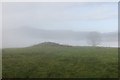
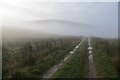
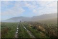
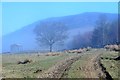
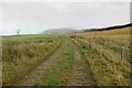
The walk up to this cairn is quite possibly the best walk to a cairn there is, parking at the bottom of the hill in Acharn then following the river up as it shutes, falls and crashes its way down. The big water fall is simply gorgeous, heavy tree cover and this big show off of a waterfall really does it's best to keep one away from the stone circle on the hill above. But the stones are calling me away and I must leave this idyllic place. When a farm track crosses the river follow it left then up the hill and there we have it. One of the best sited cairns in all of Pagan-dom, perched on a high shelf with good views of Loch Tay and some pretty big mountains, including Ben Lawers. But, still not much time to linger.
A very good place to sit and rest while en route to Greenland stone circle.
You may be viewing yesterday's version of this page. To see the most up to date information please register for a free account.
")
")
Do not use the above information on other web sites or publications without permission of the contributor.
Nearby Images from Geograph Britain and Ireland:
©2014(licence)
©2014(licence)
©2015(licence)
©2016(licence)
©2014(licence)
The above images may not be of the site on this page, they are loaded from Geograph.
Please Submit an Image of this site or go out and take one for us!
Click here to see more info for this site
Nearby sites
Key: Red: member's photo, Blue: 3rd party photo, Yellow: other image, Green: no photo - please go there and take one, Grey: site destroyed
Download sites to:
KML (Google Earth)
GPX (GPS waypoints)
CSV (Garmin/Navman)
CSV (Excel)
To unlock full downloads you need to sign up as a Contributory Member. Otherwise downloads are limited to 50 sites.
Turn off the page maps and other distractions
Nearby sites listing. In the following links * = Image available
330m E 94° Queen's Wood (Acharn) Rock Art (NN76404291)
842m ESE 120° Acharn Falls* Stone Circle (NN7678742495)
1.4km ENE 58° Balmacnaughton* Rock Art (NN7729043649)
2.2km NNE 25° Scottish Crannog Centre* Museum (NN7704444910)
2.5km NNE 28° Spar Island* Crannog (NN773451)
3.7km NE 53° Tombuie Cottage* Rock Art (NN791451)
4.0km WNW 288° Oakbank Crannog* Crannog (NN723443)
4.3km NNW 337° Fortingall S* Stone Circle (NN7454746927)
4.3km WNW 298° Cromrar 2* Rock Art (NN72344507)
4.3km WNW 302° Cromrar 1* Rock Art (NN72474531)
4.3km NNW 337° Fortingall SW* Stone Circle (NN7451446960)
4.3km NNW 338° Fortingall NE* Stone Circle (NN7453546977)
4.4km WNW 296° Fearnan Rock Art (NN72184497)
4.4km WNW 296° Cromrar 3 Rock Art (NN72184500)
4.5km NNW 332° Clach a' Phlaigh* Standing Stone (Menhir) (NN74064693)
4.5km NNW 334° Fortingall church crosses* Ancient Cross (NN74204702)
4.5km NW 318° Bridge of Lyon Standing Stones* Standing Stones (NN73144641)
4.6km WNW 292° Clach-na-Cruich (Fearnan) Rock Art (NN7186844743)
4.6km NW 320° Lyon Bridge Cairn* Cairn (NN73174657)
4.7km NNE 33° Comrie Bridge Stone Circle (NN787468)
4.7km NNW 329° Fortingall Modern Stone Circle* Modern Stone Circle etc (NN73754703)
4.8km NW 318° Bridge of Lyon long cairn* Long Barrow (NN72964655)
4.9km NNE 29° An Tobar* Holy Well or Sacred Spring (NN786472)
4.9km NE 39° Taymouth (1)* Standing Stones (NN793467)
5.7km NE 39° Croft Moraig Carving 1 Rock Art (NN7974647251)
View more nearby sites and additional images


 We would like to know more about this location. Please feel free to add a brief description and any relevant information in your own language.
 Wir möchten mehr über diese Stätte erfahren. Bitte zögern Sie nicht, eine kurze Beschreibung und relevante Informationen in Deutsch hinzuzufügen.
 Nous aimerions en savoir encore un peu sur les lieux. S'il vous plaît n'hesitez pas à ajouter une courte description et tous les renseignements pertinents dans votre propre langue.
 Quisieramos informarnos un poco más de las lugares. No dude en añadir una breve descripción y otros datos relevantes en su propio idioma.