


<< Our Photo Pages >> Caer Bach Hut Circle - Ancient Village or Settlement in Wales in Conwy
Submitted by coldrum on Wednesday, 27 January 2010 Page Views: 5376
Multi-periodSite Name: Caer Bach Hut CircleCountry: Wales County: Conwy Type: Ancient Village or Settlement
Map Ref: SH74367293
Latitude: 53.238487N Longitude: 3.884028W
Condition:
| 5 | Perfect |
| 4 | Almost Perfect |
| 3 | Reasonable but with some damage |
| 2 | Ruined but still recognisable as an ancient site |
| 1 | Pretty much destroyed, possibly visible as crop marks |
| 0 | No data. |
| -1 | Completely destroyed |
| 5 | Superb |
| 4 | Good |
| 3 | Ordinary |
| 2 | Not Good |
| 1 | Awful |
| 0 | No data. |
| 5 | Can be driven to, probably with disabled access |
| 4 | Short walk on a footpath |
| 3 | Requiring a bit more of a walk |
| 2 | A long walk |
| 1 | In the middle of nowhere, a nightmare to find |
| 0 | No data. |
| 5 | co-ordinates taken by GPS or official recorded co-ordinates |
| 4 | co-ordinates scaled from a detailed map |
| 3 | co-ordinates scaled from a bad map |
| 2 | co-ordinates of the nearest village |
| 1 | co-ordinates of the nearest town |
| 0 | no data |
Be the first person to rate this site - see the 'Contribute!' box in the right hand menu.
Internal Links:
External Links:
")
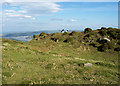
"A round hut, 30 yards SW of Caer Bach fort, is 24ft in diameter. The hut is cut into the slope on the NE and terraced out on the SW. The wall is now a low turfed bank 5ft wide. The entrance was on the SE."
Source: Coflein.
You may be viewing yesterday's version of this page. To see the most up to date information please register for a free account.
Do not use the above information on other web sites or publications without permission of the contributor.
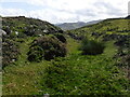
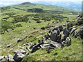
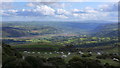
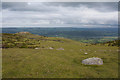
Nearby Images from Geograph Britain and Ireland:
©2020(licence)
©2009(licence)
©2014(licence)
©2011(licence)
©2006(licence)
The above images may not be of the site on this page, they are loaded from Geograph.
Please Submit an Image of this site or go out and take one for us!
Click here to see more info for this site
Nearby sites
Key: Red: member's photo, Blue: 3rd party photo, Yellow: other image, Green: no photo - please go there and take one, Grey: site destroyed
Download sites to:
KML (Google Earth)
GPX (GPS waypoints)
CSV (Garmin/Navman)
CSV (Excel)
To unlock full downloads you need to sign up as a Contributory Member. Otherwise downloads are limited to 50 sites.
Turn off the page maps and other distractions
Nearby sites listing. In the following links * = Image available
81m NNE 28° Caer Bach* Hillfort (SH744730)
96m S 176° Siambr Gladdu Caer Bach* Chambered Tomb (SH7436572834)
210m N 358° Caer Bach Cairn* Cairn (SH74367314)
335m S 189° Ddwyffrwd Cairns* Barrow Cemetery (SH743726)
526m S 187° Rhiw Hut Circle Ancient Village or Settlement (SH74287241)
630m S 181° Ffrith y Ddwyffrwd* Cairn (SH74337230)
787m NW 323° Maen Penddu* Standing Stone (Menhir) (SH73907357)
793m S 184° Pen y ffridd Farm Hut Circles* Ancient Village or Settlement (SH74297214)
839m NW 320° Cefn Maen Amor* Stone Circle (SH73847359)
1.0km NE 44° Ffynnon Gelynin Hut Circle Ancient Village or Settlement (SH75117366)
1.1km SSW 191° Caerhun Chambered Tomb* Chambered Tomb (SH74127189)
1.1km NE 43° St Celynin's Well* Holy Well or Sacred Spring (SH75127369)
1.1km S 188° Caerhun Stones* Standing Stones (SH74177182)
1.2km S 174° Caerhun Stone E Standing Stone (Menhir) (SH7444571763)
1.2km SSW 193° Maen y bardd* Burial Chamber or Dolmen (SH74067178)
1.3km SSW 198° Ffon-y-Cawr* Standing Stone (Menhir) (SH73917166)
1.4km SSW 210° Rowen Cross Incised Stone* Early Christian Sculptured Stone (SH736717)
1.5km NE 45° Cerrig-Y-Ddinas* Hillfort (SH75427395)
1.5km SSW 213° Rowen Hut Circles* Ancient Village or Settlement (SH735717)
1.5km NE 38° Southern Hut Group Ancient Village or Settlement (SH75347413)
1.6km NE 36° Northern Hut Group* Ancient Village or Settlement (SH75337418)
1.7km SW 219° Cae Coch* Standing Stone (Menhir) (SH73287166)
2.0km N 356° Waen Gyrach* Ring Cairn (SH74277493)
2.1km N 10° Maen Hir (Conwy)* Standing Stone (Menhir) (SH74787496)
2.2km N 2° Tydden-Grasod* Cist (SH74487508)
View more nearby sites and additional images


 We would like to know more about this location. Please feel free to add a brief description and any relevant information in your own language.
 Wir möchten mehr über diese Stätte erfahren. Bitte zögern Sie nicht, eine kurze Beschreibung und relevante Informationen in Deutsch hinzuzufügen.
 Nous aimerions en savoir encore un peu sur les lieux. S'il vous plaît n'hesitez pas à ajouter une courte description et tous les renseignements pertinents dans votre propre langue.
 Quisieramos informarnos un poco más de las lugares. No dude en añadir una breve descripción y otros datos relevantes en su propio idioma.