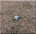
<< Our Photo Pages >> Disgwylfa Fach Stone 3 - Standing Stone (Menhir) in Wales in Ceredigion
Submitted by Geraint1 on Tuesday, 07 May 2024 Page Views: 138
Neolithic and Bronze AgeSite Name: Disgwylfa Fach Stone 3Country: Wales County: Ceredigion Type: Standing Stone (Menhir)
Nearest Town: Aberystwyth Nearest Village: Ponterwyd
Map Ref: SN7311183649
Latitude: 52.436041N Longitude: 3.867978W
Condition:
| 5 | Perfect |
| 4 | Almost Perfect |
| 3 | Reasonable but with some damage |
| 2 | Ruined but still recognisable as an ancient site |
| 1 | Pretty much destroyed, possibly visible as crop marks |
| 0 | No data. |
| -1 | Completely destroyed |
| 5 | Superb |
| 4 | Good |
| 3 | Ordinary |
| 2 | Not Good |
| 1 | Awful |
| 0 | No data. |
| 5 | Can be driven to, probably with disabled access |
| 4 | Short walk on a footpath |
| 3 | Requiring a bit more of a walk |
| 2 | A long walk |
| 1 | In the middle of nowhere, a nightmare to find |
| 0 | No data. |
| 5 | co-ordinates taken by GPS or official recorded co-ordinates |
| 4 | co-ordinates scaled from a detailed map |
| 3 | co-ordinates scaled from a bad map |
| 2 | co-ordinates of the nearest village |
| 1 | co-ordinates of the nearest town |
| 0 | no data |
Internal Links:
External Links:
")
Taking into account these 3 recumbent menhir have fallen - either via natural forces, deliberately by those who erected them (or their descendants), or vandalism, these may not be in their original positions so a more accurate alignment may once have been.
There are several other broken and recumbent menhir noted on Coflein in this area.
You may be viewing yesterday's version of this page. To see the most up to date information please register for a free account.
Do not use the above information on other web sites or publications without permission of the contributor.
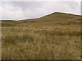
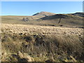
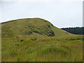
Nearby Images from Geograph Britain and Ireland:
©2018(licence)
©2010(licence)

©2024(licence)
©2013(licence)
©2008(licence)
The above images may not be of the site on this page, they are loaded from Geograph.
Please Submit an Image of this site or go out and take one for us!
Click here to see more info for this site
Nearby sites
Key: Red: member's photo, Blue: 3rd party photo, Yellow: other image, Green: no photo - please go there and take one, Grey: site destroyed
Download sites to:
KML (Google Earth)
GPX (GPS waypoints)
CSV (Garmin/Navman)
CSV (Excel)
To unlock full downloads you need to sign up as a Contributory Member. Otherwise downloads are limited to 50 sites.
Turn off the page maps and other distractions
Nearby sites listing. In the following links * = Image available
5m SW 232° Disgwylfa Fach Stone I* Standing Stones (SN7310783646)
21m NNE 15° Disgwylfa Fach Stone 2* Standing Stone (Menhir) (SN7311783669)
51m SSW 204° Glandwr Standing Stone* Standing Stone (Menhir) (SN7308983603)
53m SSW 202° Disgwylfa Fach Stone Row* Stone Row / Alignment (SN73098360)
62m W 259° Disgwylfa Fach Menhir 4* Standing Stone (Menhir) (SN7305083639)
93m WSW 237° Disgwylfa Fach Cairn* Cairn (SN7303283600)
138m NNW 327° Disgwylfa Fach Menhir 5* Standing Stone (Menhir) (SN7303983767)
205m NNE 14° Syfydrin Menhir* Standing Stone (Menhir) (SN7316583847)
321m NNW 338° Gwenffrwd-Uchaf Cairns Cairn (SN73008395)
327m W 260° Esgair Gorlan Chambered Tomb* Chambered Tomb (SN7278683603)
346m SSE 167° Nant Geifaes Cairn (SN73188331)
447m W 261° Esgair Gorlan Menhir Standing Stone (Menhir) (SN7266683594)
540m W 266° Castell Coch Stone* Standing Stone (Menhir) (SN72578363)
871m WSW 248° Buwch a'r Llo* Standing Stones (SN72298335)
937m S 171° Gorlan Cairn Cairn (SN73248272)
941m S 174° Esgair Gorlan Cairn I Cairn (SN73188271)
989m WSW 250° Maen Tarw* Standing Stone (Menhir) (SN7217183332)
1.1km SW 225° Esgair Gorlan Stone Standing Stone (Menhir) (SN72348292)
1.1km SSW 193° Esgair Gorlan Cairn II Cairn (SN72858261)
1.3km NNE 28° Disgwylfa Fawr Round Barrow* Round Barrow(s) (SN73738474)
1.3km ESE 105° Dinas Hillfort (Ceredigion)* Hillfort (SN7433083300)
2.1km E 95° Garn Lwyd Standing Stone* Standing Stone (Menhir) (SN752834)
2.2km E 81° Hirnant* Stone Circle (SN7532683939)
2.4km WSW 244° Carn Dolgau Cairn (SN70978266)
2.6km ENE 66° Lle'r Neuaddau* Stone Circle (SN75548465)
View more nearby sites and additional images


 We would like to know more about this location. Please feel free to add a brief description and any relevant information in your own language.
 Wir möchten mehr über diese Stätte erfahren. Bitte zögern Sie nicht, eine kurze Beschreibung und relevante Informationen in Deutsch hinzuzufügen.
 Nous aimerions en savoir encore un peu sur les lieux. S'il vous plaît n'hesitez pas à ajouter une courte description et tous les renseignements pertinents dans votre propre langue.
 Quisieramos informarnos un poco más de las lugares. No dude en añadir una breve descripción y otros datos relevantes en su propio idioma.