<< Text Pages >> Esgair Gorlan Cairn II - Cairn in Wales in Ceredigion
Submitted by coldrum on Sunday, 12 July 2009 Page Views: 3163
Neolithic and Bronze AgeSite Name: Esgair Gorlan Cairn IICountry: Wales County: Ceredigion Type: Cairn
Map Ref: SN72858261
Latitude: 52.426645N Longitude: 3.87142W
Condition:
| 5 | Perfect |
| 4 | Almost Perfect |
| 3 | Reasonable but with some damage |
| 2 | Ruined but still recognisable as an ancient site |
| 1 | Pretty much destroyed, possibly visible as crop marks |
| 0 | No data. |
| -1 | Completely destroyed |
| 5 | Superb |
| 4 | Good |
| 3 | Ordinary |
| 2 | Not Good |
| 1 | Awful |
| 0 | No data. |
| 5 | Can be driven to, probably with disabled access |
| 4 | Short walk on a footpath |
| 3 | Requiring a bit more of a walk |
| 2 | A long walk |
| 1 | In the middle of nowhere, a nightmare to find |
| 0 | No data. |
| 5 | co-ordinates taken by GPS or official recorded co-ordinates |
| 4 | co-ordinates scaled from a detailed map |
| 3 | co-ordinates scaled from a bad map |
| 2 | co-ordinates of the nearest village |
| 1 | co-ordinates of the nearest town |
| 0 | no data |
Be the first person to rate this site - see the 'Contribute!' box in the right hand menu.
Internal Links:
External Links:
Cairn in Ceredigion
Remnants of cairn surmounting top of hill. Cairn is c. 7m x 6m oval x c.0.60m high.
Coflein record:
https://www.coflein.gov.uk/en/site/282778
You may be viewing yesterday's version of this page. To see the most up to date information please register for a free account.
Do not use the above information on other web sites or publications without permission of the contributor.
Nearby Images from Geograph Britain and Ireland:
©2010(licence)
©2010(licence)

©2024(licence)
©2008(licence)
©2008(licence)
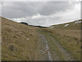
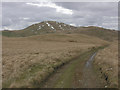
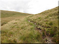
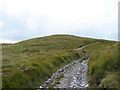
The above images may not be of the site on this page, they are loaded from Geograph.
Please Submit an Image of this site or go out and take one for us!
Click here to see more info for this site
Nearby sites
Key: Red: member's photo, Blue: 3rd party photo, Yellow: other image, Green: no photo - please go there and take one, Grey: site destroyed
Download sites to:
KML (Google Earth)
GPX (GPS waypoints)
CSV (Garmin/Navman)
CSV (Excel)
To unlock full downloads you need to sign up as a Contributory Member. Otherwise downloads are limited to 50 sites.
Turn off the page maps and other distractions
Nearby sites listing. In the following links * = Image available
344m ENE 72° Esgair Gorlan Cairn I Cairn (SN73188271)
404m ENE 73° Gorlan Cairn Cairn (SN73248272)
595m WNW 300° Esgair Gorlan Stone Standing Stone (Menhir) (SN72348292)
773m NNE 24° Nant Geifaes Cairn (SN73188331)
927m NW 321° Buwch a'r Llo* Standing Stones (SN72298335)
989m NW 315° Maen Tarw* Standing Stone (Menhir) (SN7217183332)
995m N 355° Esgair Gorlan Chambered Tomb* Chambered Tomb (SN7278683603)
1.0km NNW 348° Esgair Gorlan Menhir Standing Stone (Menhir) (SN7266683594)
1.0km N 9° Disgwylfa Fach Cairn* Cairn (SN7303283600)
1.0km NNE 12° Disgwylfa Fach Stone Row* Stone Row / Alignment (SN73098360)
1.0km NNE 12° Glandwr Standing Stone* Standing Stone (Menhir) (SN7308983603)
1.0km N 9° Disgwylfa Fach Menhir 4* Standing Stone (Menhir) (SN7305083639)
1.1km NNW 343° Castell Coch Stone* Standing Stone (Menhir) (SN72578363)
1.1km NNE 12° Disgwylfa Fach Stone I* Standing Stones (SN7310783646)
1.1km NNE 13° Disgwylfa Fach Stone 3* Standing Stone (Menhir) (SN7311183649)
1.1km NNE 13° Disgwylfa Fach Stone 2* Standing Stone (Menhir) (SN7311783669)
1.2km N 8° Disgwylfa Fach Menhir 5* Standing Stone (Menhir) (SN7303983767)
1.3km NNE 13° Syfydrin Menhir* Standing Stone (Menhir) (SN7316583847)
1.3km N 5° Gwenffrwd-Uchaf Cairns Cairn (SN73008395)
1.6km ENE 63° Dinas Hillfort (Ceredigion)* Hillfort (SN7433083300)
1.9km W 270° Carn Dolgau Cairn (SN70978266)
2.1km WSW 242° Esgair Nantyrarian Hillfort (SN710817)
2.3km NNE 21° Disgwylfa Fawr Round Barrow* Round Barrow(s) (SN73738474)
2.5km ENE 70° Garn Lwyd Standing Stone* Standing Stone (Menhir) (SN752834)
2.6km WNW 289° Garrig Hir* Standing Stone (Menhir) (SN70378351)
View more nearby sites and additional images


 We would like to know more about this location. Please feel free to add a brief description and any relevant information in your own language.
 Wir möchten mehr über diese Stätte erfahren. Bitte zögern Sie nicht, eine kurze Beschreibung und relevante Informationen in Deutsch hinzuzufügen.
 Nous aimerions en savoir encore un peu sur les lieux. S'il vous plaît n'hesitez pas à ajouter une courte description et tous les renseignements pertinents dans votre propre langue.
 Quisieramos informarnos un poco más de las lugares. No dude en añadir una breve descripción y otros datos relevantes en su propio idioma.