<< Text Pages >> Clach-na-Cruich (Fearnan) - Rock Art in Scotland in Perth and Kinross
Submitted by Anne T on Wednesday, 31 May 2017 Page Views: 1510
Rock ArtSite Name: Clach-na-Cruich (Fearnan) Alternative Name: Clach-na-Gruich (Fearnan); St. Ciaran's Seat (Fearnan); Measles Stone (Fearnan)Country: Scotland County: Perth and Kinross Type: Rock Art
Nearest Town: Fearnan
Map Ref: NN7186844743
Latitude: 56.577073N Longitude: 4.087367W
Condition:
| 5 | Perfect |
| 4 | Almost Perfect |
| 3 | Reasonable but with some damage |
| 2 | Ruined but still recognisable as an ancient site |
| 1 | Pretty much destroyed, possibly visible as crop marks |
| 0 | No data. |
| -1 | Completely destroyed |
| 5 | Superb |
| 4 | Good |
| 3 | Ordinary |
| 2 | Not Good |
| 1 | Awful |
| 0 | No data. |
| 5 | Can be driven to, probably with disabled access |
| 4 | Short walk on a footpath |
| 3 | Requiring a bit more of a walk |
| 2 | A long walk |
| 1 | In the middle of nowhere, a nightmare to find |
| 0 | No data. |
| 5 | co-ordinates taken by GPS or official recorded co-ordinates |
| 4 | co-ordinates scaled from a detailed map |
| 3 | co-ordinates scaled from a bad map |
| 2 | co-ordinates of the nearest village |
| 1 | co-ordinates of the nearest town |
| 0 | no data |
Be the first person to rate this site - see the 'Contribute!' box in the right hand menu.
Internal Links:
External Links:
Rock Art in Perth and Kinross
This cup-marked rock features on both The Northern Antiquarian (TNA) - see their page for Clach-na-Cruich, Fearnan, Perthshire and Canmore ID 25037.
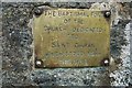
TNA give us directions to find the stone, together with a brief archaeology and history, local folklore and a drawing of the stone from 1884, which is described as a "great chair-shaped boulder with a great 'bowl' on it where the seating section is, and on its top and sides are a few cup-markings".
Canmore records: "is in the middle of a field immediately below Borland farmhouse. It has seven faint cup marks on its upper surface. Rainwater contained in a cavity was supposed to be a cure for measles ..... 'Clach-na-Cruich' or 'Stone of the Measles' (both names verified) is an earthfast boulder in an arable field and measures approximately 1.5m long, 0.8m wide, and 1.0m high. Its upper surface bears at least four shallow cup marks from 3cms to 6cms in diameter and 1cm to 2cms deep. Some of the marks illustrated by Macmillan are clearly due to weathering. The tradition concerning the stone survives locally."
Note: Have you visited this site? Do you have any photographs or further information you can add?
You may be viewing yesterday's version of this page. To see the most up to date information please register for a free account.
Do not use the above information on other web sites or publications without permission of the contributor.
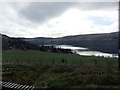
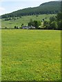
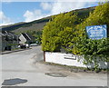
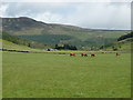
Nearby Images from Geograph Britain and Ireland:
©2012(licence)
©2006(licence)
©2011(licence)
©2011(licence)
©2007(licence)
The above images may not be of the site on this page, they are loaded from Geograph.
Please Submit an Image of this site or go out and take one for us!
Click here to see more info for this site
Nearby sites
Key: Red: member's photo, Blue: 3rd party photo, Yellow: other image, Green: no photo - please go there and take one, Grey: site destroyed
Download sites to:
KML (Google Earth)
GPX (GPS waypoints)
CSV (Garmin/Navman)
CSV (Excel)
To unlock full downloads you need to sign up as a Contributory Member. Otherwise downloads are limited to 50 sites.
Turn off the page maps and other distractions
Nearby sites listing. In the following links * = Image available
385m NE 52° Fearnan Rock Art (NN72184497)
403m NE 49° Cromrar 3 Rock Art (NN72184500)
573m NE 53° Cromrar 2* Rock Art (NN72344507)
617m SE 134° Oakbank Crannog* Crannog (NN723443)
825m NE 45° Cromrar 1* Rock Art (NN72474531)
2.1km NE 36° Bridge of Lyon Standing Stones* Standing Stones (NN73144641)
2.1km NNE 29° Bridge of Lyon long cairn* Long Barrow (NN72964655)
2.2km NNE 34° Lyon Bridge Cairn* Cairn (NN73174657)
3.0km NE 38° Fortingall Modern Stone Circle* Modern Stone Circle etc (NN73754703)
3.1km NE 43° Clach a' Phlaigh* Standing Stone (Menhir) (NN74064693)
3.1km NNW 344° Coille Dhubh Standing Stones (NN711478)
3.3km NE 44° Fortingall church crosses* Ancient Cross (NN74204702)
3.4km NE 48° Fortingall SW* Stone Circle (NN7451446960)
3.4km NE 49° Fortingall S* Stone Circle (NN7454746927)
3.5km NE 48° Fortingall NE* Stone Circle (NN7453546977)
3.5km SW 233° Allt Coire Phadairlidh 1* Rock Art (NN690427)
4.6km ESE 112° Acharn Burn* Cairn (NN76074294)
4.9km ESE 110° Queen's Wood (Acharn) Rock Art (NN76404291)
5.2km E 86° Scottish Crannog Centre* Museum (NN7704444910)
5.4km ESE 113° Acharn Falls* Stone Circle (NN7678742495)
5.4km E 84° Spar Island* Crannog (NN773451)
5.5km E 100° Balmacnaughton* Rock Art (NN7729043649)
5.9km SW 217° Machuinn* Stone Circle (NN6820140156)
6.1km WNW 296° Dericambus Standing Stone (Menhir) (NN66484757)
7.1km ENE 71° Comrie Bridge Stone Circle (NN787468)
View more nearby sites and additional images


 We would like to know more about this location. Please feel free to add a brief description and any relevant information in your own language.
 Wir möchten mehr über diese Stätte erfahren. Bitte zögern Sie nicht, eine kurze Beschreibung und relevante Informationen in Deutsch hinzuzufügen.
 Nous aimerions en savoir encore un peu sur les lieux. S'il vous plaît n'hesitez pas à ajouter une courte description et tous les renseignements pertinents dans votre propre langue.
 Quisieramos informarnos un poco más de las lugares. No dude en añadir una breve descripción y otros datos relevantes en su propio idioma.