<< Text Pages >> Carn Dolgau - Cairn in Wales in Ceredigion
Submitted by coldrum on Wednesday, 08 July 2009 Page Views: 2934
Neolithic and Bronze AgeSite Name: Carn DolgauCountry: Wales County: Ceredigion Type: Cairn
Map Ref: SN70978266
Latitude: 52.426653N Longitude: 3.899072W
Condition:
| 5 | Perfect |
| 4 | Almost Perfect |
| 3 | Reasonable but with some damage |
| 2 | Ruined but still recognisable as an ancient site |
| 1 | Pretty much destroyed, possibly visible as crop marks |
| 0 | No data. |
| -1 | Completely destroyed |
| 5 | Superb |
| 4 | Good |
| 3 | Ordinary |
| 2 | Not Good |
| 1 | Awful |
| 0 | No data. |
| 5 | Can be driven to, probably with disabled access |
| 4 | Short walk on a footpath |
| 3 | Requiring a bit more of a walk |
| 2 | A long walk |
| 1 | In the middle of nowhere, a nightmare to find |
| 0 | No data. |
| 5 | co-ordinates taken by GPS or official recorded co-ordinates |
| 4 | co-ordinates scaled from a detailed map |
| 3 | co-ordinates scaled from a bad map |
| 2 | co-ordinates of the nearest village |
| 1 | co-ordinates of the nearest town |
| 0 | no data |
Be the first person to rate this site - see the 'Contribute!' box in the right hand menu.
Internal Links:
External Links:
Cairn in Ceredigion
A round cairn, set on ground falling to to the SW, 15m in diameter, 0.8m high.
Coflein record:
https://www.coflein.gov.uk/en/site/303691
You may be viewing yesterday's version of this page. To see the most up to date information please register for a free account.
Do not use the above information on other web sites or publications without permission of the contributor.
Nearby Images from Geograph Britain and Ireland:
©2009(licence)
©2005(licence)
©2005(licence)
©2008(licence)
©2012(licence)
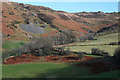
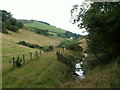
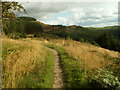
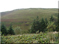
The above images may not be of the site on this page, they are loaded from Geograph.
Please Submit an Image of this site or go out and take one for us!
Click here to see more info for this site
Nearby sites
Key: Red: member's photo, Blue: 3rd party photo, Yellow: other image, Green: no photo - please go there and take one, Grey: site destroyed
Download sites to:
KML (Google Earth)
GPX (GPS waypoints)
CSV (Garmin/Navman)
CSV (Excel)
To unlock full downloads you need to sign up as a Contributory Member. Otherwise downloads are limited to 50 sites.
Turn off the page maps and other distractions
Nearby sites listing. In the following links * = Image available
960m S 177° Esgair Nantyrarian Hillfort (SN710817)
1.0km NW 323° Garrig Hir* Standing Stone (Menhir) (SN70378351)
1.4km ENE 59° Maen Tarw* Standing Stone (Menhir) (SN7217183332)
1.4km ENE 78° Esgair Gorlan Stone Standing Stone (Menhir) (SN72348292)
1.5km ENE 61° Buwch a'r Llo* Standing Stones (SN72298335)
1.7km NW 325° Pen-Y-Bryn-Mawr Cairn (SN70018412)
1.9km ENE 57° Castell Coch Stone* Standing Stone (Menhir) (SN72578363)
1.9km E 90° Esgair Gorlan Cairn II Cairn (SN72858261)
1.9km ENE 60° Esgair Gorlan Menhir Standing Stone (Menhir) (SN7266683594)
2.0km ENE 61° Esgair Gorlan Chambered Tomb* Chambered Tomb (SN7278683603)
2.2km E 87° Esgair Gorlan Cairn I Cairn (SN73188271)
2.3km ENE 64° Disgwylfa Fach Cairn* Cairn (SN7303283600)
2.3km E 87° Gorlan Cairn Cairn (SN73248272)
2.3km ENE 63° Disgwylfa Fach Menhir 4* Standing Stone (Menhir) (SN7305083639)
2.3km ENE 72° Nant Geifaes Cairn (SN73188331)
2.3km ENE 65° Disgwylfa Fach Stone Row* Stone Row / Alignment (SN73098360)
2.3km ENE 64° Glandwr Standing Stone* Standing Stone (Menhir) (SN7308983603)
2.3km ENE 60° Disgwylfa Fach Menhir 5* Standing Stone (Menhir) (SN7303983767)
2.3km ENE 64° Disgwylfa Fach Stone I* Standing Stones (SN7310783646)
2.4km ENE 64° Disgwylfa Fach Stone 3* Standing Stone (Menhir) (SN7311183649)
2.4km ENE 63° Disgwylfa Fach Stone 2* Standing Stone (Menhir) (SN7311783669)
2.4km NE 56° Gwenffrwd-Uchaf Cairns Cairn (SN73008395)
2.5km ENE 60° Syfydrin Menhir* Standing Stone (Menhir) (SN7316583847)
2.6km WNW 291° Stones of the Lamb* Standing Stone (Menhir) (SN68568367)
2.8km NW 306° Garn Wen (NE) Cairn (SN68788436)
View more nearby sites and additional images


 We would like to know more about this location. Please feel free to add a brief description and any relevant information in your own language.
 Wir möchten mehr über diese Stätte erfahren. Bitte zögern Sie nicht, eine kurze Beschreibung und relevante Informationen in Deutsch hinzuzufügen.
 Nous aimerions en savoir encore un peu sur les lieux. S'il vous plaît n'hesitez pas à ajouter une courte description et tous les renseignements pertinents dans votre propre langue.
 Quisieramos informarnos un poco más de las lugares. No dude en añadir una breve descripción y otros datos relevantes en su propio idioma.