<< Text Pages >> St Fillan's Chair (Dundurn) - Natural Stone / Erratic / Other Natural Feature in Scotland in Perth and Kinross
Submitted by Anne T on Monday, 08 January 2018 Page Views: 1835
Natural PlacesSite Name: St Fillan''s Chair (Dundurn) Alternative Name: Dundurn; Fillan's Chair; St Fillan's BedCountry: Scotland County: Perth and Kinross Type: Natural Stone / Erratic / Other Natural Feature
Nearest Town: Comrie Nearest Village: Dundurn
Map Ref: NN70812325
Latitude: 56.383820N Longitude: 4.093919W
Condition:
| 5 | Perfect |
| 4 | Almost Perfect |
| 3 | Reasonable but with some damage |
| 2 | Ruined but still recognisable as an ancient site |
| 1 | Pretty much destroyed, possibly visible as crop marks |
| 0 | No data. |
| -1 | Completely destroyed |
| 5 | Superb |
| 4 | Good |
| 3 | Ordinary |
| 2 | Not Good |
| 1 | Awful |
| 0 | No data. |
| 5 | Can be driven to, probably with disabled access |
| 4 | Short walk on a footpath |
| 3 | Requiring a bit more of a walk |
| 2 | A long walk |
| 1 | In the middle of nowhere, a nightmare to find |
| 0 | No data. |
| 5 | co-ordinates taken by GPS or official recorded co-ordinates |
| 4 | co-ordinates scaled from a detailed map |
| 3 | co-ordinates scaled from a bad map |
| 2 | co-ordinates of the nearest village |
| 1 | co-ordinates of the nearest town |
| 0 | no data |
Be the first person to rate this site - see the 'Contribute!' box in the right hand menu.
Internal Links:
External Links:
Natural Stone / Erratic / Other Natural Feature in Perth and Kinross
This legendary rock is featured on The Northern Antiquarian (TNA) - see their entry for St. Fillan’s Chair, Dundurn, Comrie, Perthshire which gives directions for finding this site, together with photographs, a brief archaeology & history and local folklore.
The site is also recorded as Canmore ID 24876, an extract from which reads: "The spring of St Fillan, at the W end of Strathearne is at the foot of a rock, a quarter of a mile south of Dun-Fhaolain (St Fillan's Hill). It is still visited by invalids especially on 1st May and the 1st August. A white stone is thrown on the saint's cairn and rags are left. A rock on the summit of the hill formed a chair for saint. At the foot of the hill there is a basin made by the saint, on the top of a large stone."
Note: Have you visited this site? Do you have any photographs or information to add?
You may be viewing yesterday's version of this page. To see the most up to date information please register for a free account.
Do not use the above information on other web sites or publications without permission of the contributor.
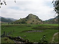
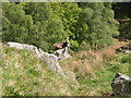
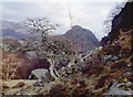
Nearby Images from Geograph Britain and Ireland:
©2009(licence)

©2008(licence)

©2014(licence)
©2009(licence)
©2015(licence)
The above images may not be of the site on this page, they are loaded from Geograph.
Please Submit an Image of this site or go out and take one for us!
Click here to see more info for this site
Nearby sites
Key: Red: member's photo, Blue: 3rd party photo, Yellow: other image, Green: no photo - please go there and take one, Grey: site destroyed
Download sites to:
KML (Google Earth)
GPX (GPS waypoints)
CSV (Garmin/Navman)
CSV (Excel)
To unlock full downloads you need to sign up as a Contributory Member. Otherwise downloads are limited to 50 sites.
Turn off the page maps and other distractions
Nearby sites listing. In the following links * = Image available
22m NNW 332° St Fillan's Well (Comrie) Holy Well or Sacred Spring (NN70802327)
538m NW 306° St Fillan's Chapel (Comrie)* Ancient Cross (NN7038323579)
1.0km NNW 331° Little Port* Standing Stone (Menhir) (NN70342415)
1.4km E 90° Kindrochat Chambered Cairn (NN722232)
1.5km E 98° Loch Earn Chambered Cairn (NN723230)
3.2km E 93° Cluan-Glasdale Stone Circle (NN7423)
4.7km E 98° Tullybannocher* Stone Circle (NN75482247)
5.8km ESE 107° Craggish (Comrie) Standing Stones (NN763214)
6.0km ESE 109° Comrie Cursus Cursus (NN76422112)
6.0km ESE 113° Craggish Stone Row / Alignment (NN763207)
6.3km E 100° Tom na Chessaig Stone Circle (NN770220)
6.8km E 96° Coney Hill (Comrie)* Misc. Earthwork (NN77552238)
7.0km ESE 112° Comrie Cursus Cursus (NN77252048)
7.1km ESE 110° West Cowden* Stone Row / Alignment (NN7744520645)
7.1km ESE 111° Comrie Cursus Cursus (NN77422047)
7.5km ESE 104° Dalginross* Stone Circle (NN7802521264)
7.8km ENE 74° Balmuick* Stone Circle (NN78362513)
8.7km ESE 113° Auchingarrich Farm Standing Stone (Menhir) (NN78731958)
9.3km E 92° Lawers* Standing Stone (Menhir) (NN80102267)
9.5km SE 125° Giant's Knowe (Culloch) Cairn (NN78481762)
10.0km ESE 121° Craigneich Farm* Standing Stone (Menhir) (NN7922617871)
10.3km SE 125° Dunruchan C (Muthill)* Standing Stone (Menhir) (NN7910817137)
10.4km E 89° Clathick House Standing Stone (Menhir) (NN81212315)
10.4km SE 126° Dunruchan D (Muthill)* Standing Stone (Menhir) (NN7904416881)
10.4km SE 126° Dunruchan E (Muthill)* Standing Stone (Menhir) (NN7899716819)
View more nearby sites and additional images


 We would like to know more about this location. Please feel free to add a brief description and any relevant information in your own language.
 Wir möchten mehr über diese Stätte erfahren. Bitte zögern Sie nicht, eine kurze Beschreibung und relevante Informationen in Deutsch hinzuzufügen.
 Nous aimerions en savoir encore un peu sur les lieux. S'il vous plaît n'hesitez pas à ajouter une courte description et tous les renseignements pertinents dans votre propre langue.
 Quisieramos informarnos un poco más de las lugares. No dude en añadir una breve descripción y otros datos relevantes en su propio idioma.