
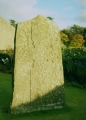

<< Our Photo Pages >> Bryndyfan Standing Stone - Standing Stone (Menhir) in Wales in Carmarthenshire
Submitted by geoffstickland on Thursday, 03 June 2021 Page Views: 871
Neolithic and Bronze AgeSite Name: Bryndyfan Standing StoneCountry: Wales
NOTE: This site is 2.7 km away from the location you searched for.
County: Carmarthenshire Type: Standing Stone (Menhir)
Nearest Town: Llandovery Nearest Village: Llansadwrn
Map Ref: SN6886732240
Latitude: 51.973112N Longitude: 3.910447W
Condition:
| 5 | Perfect |
| 4 | Almost Perfect |
| 3 | Reasonable but with some damage |
| 2 | Ruined but still recognisable as an ancient site |
| 1 | Pretty much destroyed, possibly visible as crop marks |
| 0 | No data. |
| -1 | Completely destroyed |
| 5 | Superb |
| 4 | Good |
| 3 | Ordinary |
| 2 | Not Good |
| 1 | Awful |
| 0 | No data. |
| 5 | Can be driven to, probably with disabled access |
| 4 | Short walk on a footpath |
| 3 | Requiring a bit more of a walk |
| 2 | A long walk |
| 1 | In the middle of nowhere, a nightmare to find |
| 0 | No data. |
| 5 | co-ordinates taken by GPS or official recorded co-ordinates |
| 4 | co-ordinates scaled from a detailed map |
| 3 | co-ordinates scaled from a bad map |
| 2 | co-ordinates of the nearest village |
| 1 | co-ordinates of the nearest town |
| 0 | no data |
Internal Links:
External Links:
I have visited· I would like to visit
geoffstickland has visited here
")
You may be viewing yesterday's version of this page. To see the most up to date information please register for a free account.
Do not use the above information on other web sites or publications without permission of the contributor.
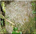
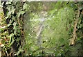
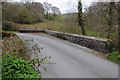
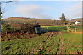
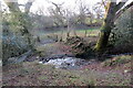
Nearby Images from Geograph Britain and Ireland:
©2016(licence)
©2016(licence)
©2013(licence)
©2021(licence)
©2021(licence)
The above images may not be of the site on this page, they are loaded from Geograph.
Please Submit an Image of this site or go out and take one for us!
Click here to see more info for this site
Nearby sites
Key: Red: member's photo, Blue: 3rd party photo, Yellow: other image, Green: no photo - please go there and take one, Grey: site destroyed
Download sites to:
KML (Google Earth)
GPX (GPS waypoints)
CSV (Garmin/Navman)
CSV (Excel)
To unlock full downloads you need to sign up as a Contributory Member. Otherwise downloads are limited to 50 sites.
Turn off the page maps and other distractions
Nearby sites listing. In the following links * = Image available
1.9km ESE 116° Cwmbran Camp* Hillfort (SN70593135)
3.0km SSE 166° Careg Fawr* Standing Stone (Menhir) (SN69492933)
6.0km NNE 25° Berrisbrook Standing Stones* Standing Stone (Menhir) (SN71603761)
6.2km ESE 109° Cilgwyn* Standing Stone (Menhir) (SN7470330061)
6.3km S 173° Llangaddock* Standing Stone (Menhir) (SN6943825985)
6.4km SSE 148° Tir Mawr Defended Enclosure* Hillfort (SN72102676)
6.5km SE 129° Mandinam Hill Fort and Earth Works* Hillfort (SN73822808)
7.2km ESE 104° Llwynmeredydd Defended Enclosure* Hillfort (SN75853037)
7.5km NNE 15° Nant-Iwrch Cairn* Ring Cairn (SN71043946)
7.7km SSW 201° Capel Isaf Holy Well Holy Well or Sacred Spring (SN659251)
7.8km S 186° Llwyndu Camp* Hillfort (SN67902447)
7.9km S 188° Sythfaen Llwyn Du* Standing Stone (Menhir) (SN67562443)
7.9km S 177° Carn Goch (Carmarthenshire)* Hillfort (SN69122432)
8.0km S 181° Gaer Fach, Y Garn Goch* Hillfort (SN6854624271)
8.0km S 174° Carn Goch Cairn* Cairn (SN6942924253)
8.1km ESE 105° Monksfield Tumuli* Cairn (SN76633000)
8.1km S 180° Carreg Canol* Modern Stone Circle etc (SN68632417)
8.4km NNW 341° Dolaucothi* Ancient Mine, Quarry or other Industry (SN66384025)
8.4km E 99° Ffynnon y Wern* Holy Well or Sacred Spring (SN7714130653)
8.5km NNW 341° Carreg Pumsaint* Standing Stone (Menhir) (SN66334035)
8.5km NE 51° Troed y Rhiw (Cilycwm)* Misc. Earthwork (SN75643746)
8.6km ENE 69° Llandovery Roman Fort - Alabum* Hillfort (SN76973514)
8.6km E 94° Pen Hill Defended Enclosure* Hillfort (SN77483139)
8.7km NE 50° Pen Y Gaer (Cilycwm)* Hillfort (SN75683773)
9.3km S 172° Trichrug* Cairn (SN69962298)
View more nearby sites and additional images


 We would like to know more about this location. Please feel free to add a brief description and any relevant information in your own language.
 Wir möchten mehr über diese Stätte erfahren. Bitte zögern Sie nicht, eine kurze Beschreibung und relevante Informationen in Deutsch hinzuzufügen.
 Nous aimerions en savoir encore un peu sur les lieux. S'il vous plaît n'hesitez pas à ajouter une courte description et tous les renseignements pertinents dans votre propre langue.
 Quisieramos informarnos un poco más de las lugares. No dude en añadir una breve descripción y otros datos relevantes en su propio idioma.