<< Our Photo Pages >> Allt Coire Phadairlidh 1 - Rock Art in Scotland in Perth and Kinross
Submitted by Andy B on Friday, 17 August 2007 Page Views: 8284
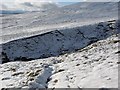
Rock ArtSite Name: Allt Coire Phadairlidh 1 Alternative Name: Allt Coire Phadairlidh 2, Ben LawersCountry: Scotland County: Perth and Kinross Type: Rock Art
Nearest Town: Killin
Map Ref: NN690427
Latitude: 56.557939N Longitude: 4.132984W
Condition:
| 5 | Perfect |
| 4 | Almost Perfect |
| 3 | Reasonable but with some damage |
| 2 | Ruined but still recognisable as an ancient site |
| 1 | Pretty much destroyed, possibly visible as crop marks |
| 0 | No data. |
| -1 | Completely destroyed |
| 5 | Superb |
| 4 | Good |
| 3 | Ordinary |
| 2 | Not Good |
| 1 | Awful |
| 0 | No data. |
| 5 | Can be driven to, probably with disabled access |
| 4 | Short walk on a footpath |
| 3 | Requiring a bit more of a walk |
| 2 | A long walk |
| 1 | In the middle of nowhere, a nightmare to find |
| 0 | No data. |
| 5 | co-ordinates taken by GPS or official recorded co-ordinates |
| 4 | co-ordinates scaled from a detailed map |
| 3 | co-ordinates scaled from a bad map |
| 2 | co-ordinates of the nearest village |
| 1 | co-ordinates of the nearest town |
| 0 | no data |
Be the first person to rate this site - see the 'Contribute!' box in the right hand menu.
Internal Links:
External Links:
I have visited· I would like to visit
rockartuk has visited here
")
A team working on National Trust for Scotland (NTS) land as part of the Ben Lawers Historic Landscape Project found the previously undiscovered ‘cup-and-ring’ style markings on a hillside overlooking Loch Tay and Kenmore. The carvings could date back to Neolithic times and be up to 5,000 years old.
Cup-and-ring rock art features abstract symbols of circles and cups, chipped out of the stone some time between 3,000-1,500 BC, from the late Neolithic period to the early Bronze Age. Other examples have been found at locations in upland Britain and across Atlantic Europe, from Portugal to Orkney.
“It is likely that these specialised symbols had different meanings depending on their context of use, much like the Christian cross,” explained Derek Alexander, NTS West Region Archaeologist.
“Some are used in ceremonial monuments, others are on public display in open landscapes like Ben Lawers, while some are included in individual burial cists [stone caskets].”
The archaeological team, led by Professor Richard Bradley from Reading University and Aaron Watson, decided to excavate one of the terraces along the hillside where the carvings were found.
“The team have been excavating small trenches around the bedrock outcrops to try and find any artefactual evidence that might be contemporary with the carving and use of the rock art sites,” said Derek.
“Already quantities of flaked and worked quartz have been recovered,” he added. “More surprising, however, was the discovery of two flakes of Arran pitchstone. This is a volcanic glass that is only found on the Isle of Arran in the Firth of Clyde and must have been brought to the site at Ben Lawers.”
It is hoped that these discoveries will lead to a much better understanding of Scotland’s prehistoric past, said archaeologist Aaron Watson, who has investigated several cup-and-ring sites, including one at Kilmartin Glen in Argyll.
“What is important about our current work is trying to move beyond simply studying the individual motifs to finding evidence for the people who made, used and understood these sites.”
Source: 24 Hour Museum and more on the overall project at the Ben Lawers Historic Landscape Project.
Note: Perthshire Rock Art sheds light on Scotland's prehistoric past
You may be viewing yesterday's version of this page. To see the most up to date information please register for a free account.
")
Do not use the above information on other web sites or publications without permission of the contributor.
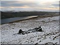
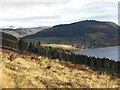
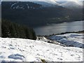
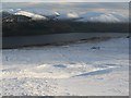
Nearby Images from Geograph Britain and Ireland:
©2006(licence)
©2006(licence)
©2006(licence)
©2006(licence)
©2006(licence)
The above images may not be of the site on this page, they are loaded from Geograph.
Please Submit an Image of this site or go out and take one for us!
Click here to see more info for this site
Nearby sites
Key: Red: member's photo, Blue: 3rd party photo, Yellow: other image, Green: no photo - please go there and take one, Grey: site destroyed
Download sites to:
KML (Google Earth)
GPX (GPS waypoints)
CSV (Garmin/Navman)
CSV (Excel)
To unlock full downloads you need to sign up as a Contributory Member. Otherwise downloads are limited to 50 sites.
Turn off the page maps and other distractions
Nearby sites listing. In the following links * = Image available
2.7km SSW 196° Machuinn* Stone Circle (NN6820140156)
3.5km NE 53° Clach-na-Cruich (Fearnan) Rock Art (NN7186844743)
3.7km ENE 62° Oakbank Crannog* Crannog (NN723443)
3.8km SSW 209° Easter Croftintygan Farm Standing Stone (Menhir) (NN6706839421)
3.9km NE 53° Fearnan Rock Art (NN72184497)
3.9km NE 52° Cromrar 3 Rock Art (NN72184500)
4.1km NE 53° Cromrar 2* Rock Art (NN72344507)
4.3km NE 51° Cromrar 1* Rock Art (NN72474531)
4.3km SSW 201° Balnasuim* Rock Art (NN6733438677)
4.8km SW 228° Allt a' Choire Chireinich 4 Rock Art (NN6530639560)
4.9km SW 228° Allt a' Choire Chireinich 3 Rock Art (NN6524939579)
4.9km SW 228° Allt a' Choire Chireinich 2 Rock Art (NN6521839525)
5.1km SW 228° Alt a' Choire Chireinich 1 Rock Art (NN6509639442)
5.5km NNW 331° Dericambus Standing Stone (Menhir) (NN66484757)
5.5km NNE 21° Coille Dhubh Standing Stones (NN711478)
5.5km NE 44° Bridge of Lyon long cairn* Long Barrow (NN72964655)
5.5km NE 46° Bridge of Lyon Standing Stones* Standing Stones (NN73144641)
5.7km NE 45° Lyon Bridge Cairn* Cairn (NN73174657)
5.8km SW 224° Tombreck (08) Rock Art (NN6479538648)
5.9km SW 220° Tombreck (07) Rock Art (NN6502238285)
6.1km WSW 236° Beinn Ghlas Rock Art (NN6382839501)
6.1km SW 222° Tombreck (01) Rock Art (NN6479838284)
6.3km SW 220° Carie (Kenmore) Sculptured Stone (NN6477238018)
6.4km NE 46° Fortingall Modern Stone Circle* Modern Stone Circle etc (NN73754703)
6.5km SW 216° Tombreck (10) Ring Cairn (NN6504237559)
View more nearby sites and additional images


 We would like to know more about this location. Please feel free to add a brief description and any relevant information in your own language.
 Wir möchten mehr über diese Stätte erfahren. Bitte zögern Sie nicht, eine kurze Beschreibung und relevante Informationen in Deutsch hinzuzufügen.
 Nous aimerions en savoir encore un peu sur les lieux. S'il vous plaît n'hesitez pas à ajouter une courte description et tous les renseignements pertinents dans votre propre langue.
 Quisieramos informarnos un poco más de las lugares. No dude en añadir una breve descripción y otros datos relevantes en su propio idioma.