<< Text Pages >> Newmore Wood - Rock Art in Scotland in Highlands
Submitted by SolarMegalith on Tuesday, 18 December 2012 Page Views: 2210
Rock ArtSite Name: Newmore WoodCountry: Scotland County: Highlands Type: Rock Art
Map Ref: NH68327366
Latitude: 57.733314N Longitude: 4.213161W
Condition:
| 5 | Perfect |
| 4 | Almost Perfect |
| 3 | Reasonable but with some damage |
| 2 | Ruined but still recognisable as an ancient site |
| 1 | Pretty much destroyed, possibly visible as crop marks |
| 0 | No data. |
| -1 | Completely destroyed |
| 5 | Superb |
| 4 | Good |
| 3 | Ordinary |
| 2 | Not Good |
| 1 | Awful |
| 0 | No data. |
| 5 | Can be driven to, probably with disabled access |
| 4 | Short walk on a footpath |
| 3 | Requiring a bit more of a walk |
| 2 | A long walk |
| 1 | In the middle of nowhere, a nightmare to find |
| 0 | No data. |
| 5 | co-ordinates taken by GPS or official recorded co-ordinates |
| 4 | co-ordinates scaled from a detailed map |
| 3 | co-ordinates scaled from a bad map |
| 2 | co-ordinates of the nearest village |
| 1 | co-ordinates of the nearest town |
| 0 | no data |
Internal Links:
External Links:
Rock Art in Highlands
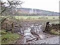
A moved stone with a cup-mark and remains of a ring around it.
Read More at Canmore.
You may be viewing yesterday's version of this page. To see the most up to date information please register for a free account.
Do not use the above information on other web sites or publications without permission of the contributor.
Nearby Images from Geograph Britain and Ireland:
©2022(licence)
©2008(licence)
©2019(licence)
©2010(licence)
©2022(licence)
The above images may not be of the site on this page, they are loaded from Geograph.
Please Submit an Image of this site or go out and take one for us!
Click here to see more info for this site
Nearby sites
Key: Red: member's photo, Blue: 3rd party photo, Yellow: other image, Green: no photo - please go there and take one, Grey: site destroyed
Download sites to:
KML (Google Earth)
GPX (GPS waypoints)
CSV (Garmin/Navman)
CSV (Excel)
To unlock full downloads you need to sign up as a Contributory Member. Otherwise downloads are limited to 50 sites.
Turn off the page maps and other distractions
Nearby sites listing. In the following links * = Image available
2.1km NE 43° King's Head Cairn Chambered Cairn (NH69777513)
2.4km NE 41° Kinrive West Chambered Cairn (NH69937538)
3.0km W 277° Stittenham Cairn 2 Cairn (NH65367413)
3.1km WSW 240° Cnoc Navie Chambered Cairn (NH656722)
3.2km SW 219° Nonakiln Class I Pictish Symbol Stone (NH66217124)
3.4km W 279° The Ardross Wolf Class I Pictish Stone* Class I Pictish Symbol Stone (NH650743)
3.5km W 279° Stittenham Cairn 1 Chambered Tomb (NH649743)
3.6km W 276° Dalnavie Class I Pictish Symbol Stone (NH64737414)
3.7km SW 222° Mill craig Chambered Tomb (NH658710)
4.0km NE 50° Scotsburn House Dun* Stone Fort or Dun (NH71487616)
4.1km NE 50° Scotsburn House Chambered Cairn Chambered Cairn (NH71537618)
4.5km SSW 200° Carn Liath, Alness* Cairn (NH66626952)
4.6km S 181° Rosskeen* Class I Pictish Symbol Stone (NH6809969024)
4.8km NE 49° Scotsburn Wood West Chambered Tomb (NH721767)
4.9km W 277° Carn Nam Fiann Chambered Cairn (NH63517441)
5.3km NE 52° Scotsburn Wood East Chambered Tomb (NH726768)
5.5km WNW 292° Baldoon Chambered Cairn (NH63317591)
6.9km W 277° Carn Na Feinne Chambered Cairn (NH615747)
7.6km NE 35° Morangie Forest Chambered Cairn (NH729798)
7.7km NE 54° Wester Lamington* Cairn (NH747780)
10.0km W 270° Boath Short Chambered Cairn (NH58337395)
10.2km W 269° Boath Long Cairn Chambered Cairn (NH581738)
10.2km W 267° Balnagrotchen Chambered Cairn (NH581735)
10.7km NNE 23° Red Burn Chambered Cairn (NH72788341)
11.0km NNE 26° Edderton Hill Cairn (NH734834)
View more nearby sites and additional images


 We would like to know more about this location. Please feel free to add a brief description and any relevant information in your own language.
 Wir möchten mehr über diese Stätte erfahren. Bitte zögern Sie nicht, eine kurze Beschreibung und relevante Informationen in Deutsch hinzuzufügen.
 Nous aimerions en savoir encore un peu sur les lieux. S'il vous plaît n'hesitez pas à ajouter une courte description et tous les renseignements pertinents dans votre propre langue.
 Quisieramos informarnos un poco más de las lugares. No dude en añadir una breve descripción y otros datos relevantes en su propio idioma.