<< Text Pages >> Knockshinnie - Stone Circle in Scotland in Dumfries and Galloway
Submitted by Tom_Bullock on Saturday, 02 November 2002 Page Views: 7404
Neolithic and Bronze AgeSite Name: KnockshinnieCountry: Scotland County: Dumfries and Galloway Type: Stone Circle
Map Ref: NX681450 Landranger Map Number: 83
Latitude: 54.782514N Longitude: 4.052482W
Condition:
| 5 | Perfect |
| 4 | Almost Perfect |
| 3 | Reasonable but with some damage |
| 2 | Ruined but still recognisable as an ancient site |
| 1 | Pretty much destroyed, possibly visible as crop marks |
| 0 | No data. |
| -1 | Completely destroyed |
| 5 | Superb |
| 4 | Good |
| 3 | Ordinary |
| 2 | Not Good |
| 1 | Awful |
| 0 | No data. |
| 5 | Can be driven to, probably with disabled access |
| 4 | Short walk on a footpath |
| 3 | Requiring a bit more of a walk |
| 2 | A long walk |
| 1 | In the middle of nowhere, a nightmare to find |
| 0 | No data. |
| 5 | co-ordinates taken by GPS or official recorded co-ordinates |
| 4 | co-ordinates scaled from a detailed map |
| 3 | co-ordinates scaled from a bad map |
| 2 | co-ordinates of the nearest village |
| 1 | co-ordinates of the nearest town |
| 0 | no data |
Internal Links:
External Links:
Stone Circle (?) in Dumfries & Galloway
Stone Circle listed in big Burl book. However Canmore says: Two heaps of field clearance in a small quarry on the SW flank of Knockshinnie. Source
You may be viewing yesterday's version of this page. To see the most up to date information please register for a free account.
Do not use the above information on other web sites or publications without permission of the contributor.
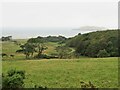
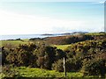
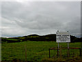
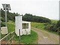
Nearby Images from Geograph Britain and Ireland:
©2022(licence)
©2010(licence)
©2010(licence)
©2022(licence)
©2008(licence)
The above images may not be of the site on this page, they are loaded from Geograph.
Please Submit an Image of this site or go out and take one for us!
Click here to see more info for this site
Nearby sites
Key: Red: member's photo, Blue: 3rd party photo, Yellow: other image, Green: no photo - please go there and take one, Grey: site destroyed
Download sites to:
KML (Google Earth)
GPX (GPS waypoints)
CSV (Garmin/Navman)
CSV (Excel)
To unlock full downloads you need to sign up as a Contributory Member. Otherwise downloads are limited to 50 sites.
Turn off the page maps and other distractions
Nearby sites listing. In the following links * = Image available
284m NW 319° Torrs 3* Rock Art (NX67924522)
710m E 101° Craikness Hill 1* Rock Art (NX6879644847)
861m N 355° Torrs 2* Rock Art (NX68054586)
1.0km ESE 105° Little Balmae Stone Circle (NX691447)
1.1km NE 39° Drummore Hillfort* Hillfort (NX688458)
1.1km NE 36° Drummore Castle* Stone Circle (NX688459)
1.1km NE 36° Drummore* Stone Circle (NX688459)
2.0km NE 35° Blackhill Cottage* Rock Art (NX69334663)
2.2km ESE 121° St Margaret's Well (Kirkcudbright) Holy Well or Sacred Spring (NX69994378)
2.6km NE 35° Townhead* Rock Art (NX69644705)
2.6km NNE 15° Grange 3 (Dumfries and Galloway)* Rock Art (NX6883947526)
4.0km NNW 347° Monk's Well (Kirkcudbright) Holy Well or Sacred Spring (NX6730048892)
4.1km W 276° Brighouse* Standing Stone (Menhir) (NX64024555)
4.2km WNW 300° Clauchandolly 8* Rock Art (NX64474722)
4.3km WNW 298° Clauchandolly 6 Rock Art (NX64384711)
4.4km WNW 297° Clauchandolly 1* Rock Art (NX64244714)
4.7km NE 41° Galtway Hill Cairn (NX71294845)
4.8km NNE 34° High Banks Farm* Rock Art (NX70914895)
4.9km NNE 26° High Banks Southern Cairn* Cairn (NX70394934)
5.0km NNE 26° High Banks Northern Cairn* Cairn (NX70454947)
5.1km N 360° Butter Well (Kirkcudbright) Holy Well or Sacred Spring (NX6821250148)
5.8km N 4° Kirkcudbright Standing Stones* Standing Stones (NX6870450736)
5.9km N 1° Stewartry Museum* Museum (NX68335086)
5.9km N 358° Mercat Cross (Kirkcudbright)* Ancient Cross (NX6807650896)
5.9km NE 47° Castlecreavie Dun* Stone Fort or Dun (NX72544894)
View more nearby sites and additional images


 We would like to know more about this location. Please feel free to add a brief description and any relevant information in your own language.
 Wir möchten mehr über diese Stätte erfahren. Bitte zögern Sie nicht, eine kurze Beschreibung und relevante Informationen in Deutsch hinzuzufügen.
 Nous aimerions en savoir encore un peu sur les lieux. S'il vous plaît n'hesitez pas à ajouter une courte description et tous les renseignements pertinents dans votre propre langue.
 Quisieramos informarnos un poco más de las lugares. No dude en añadir una breve descripción y otros datos relevantes en su propio idioma.