<< Our Photo Pages >> Machuinn - Stone Circle in Scotland in Perth and Kinross
Submitted by Nick on Tuesday, 04 November 2003 Page Views: 11160
Neolithic and Bronze AgeSite Name: Machuinn Alternative Name: Lawer's MillCountry: Scotland County: Perth and Kinross Type: Stone Circle
Nearest Town: Pitlochry Nearest Village: Fearnan
Map Ref: NN6820140156 Landranger Map Number: 51
Latitude: 56.534877N Longitude: 4.144681W
Condition:
| 5 | Perfect |
| 4 | Almost Perfect |
| 3 | Reasonable but with some damage |
| 2 | Ruined but still recognisable as an ancient site |
| 1 | Pretty much destroyed, possibly visible as crop marks |
| 0 | No data. |
| -1 | Completely destroyed |
| 5 | Superb |
| 4 | Good |
| 3 | Ordinary |
| 2 | Not Good |
| 1 | Awful |
| 0 | No data. |
| 5 | Can be driven to, probably with disabled access |
| 4 | Short walk on a footpath |
| 3 | Requiring a bit more of a walk |
| 2 | A long walk |
| 1 | In the middle of nowhere, a nightmare to find |
| 0 | No data. |
| 5 | co-ordinates taken by GPS or official recorded co-ordinates |
| 4 | co-ordinates scaled from a detailed map |
| 3 | co-ordinates scaled from a bad map |
| 2 | co-ordinates of the nearest village |
| 1 | co-ordinates of the nearest town |
| 0 | no data |
Internal Links:
External Links:
I have visited· I would like to visit
Uralsdaughter visited on 18th Aug 2018 - their rating: Cond: 4 Amb: 4 Access: 4

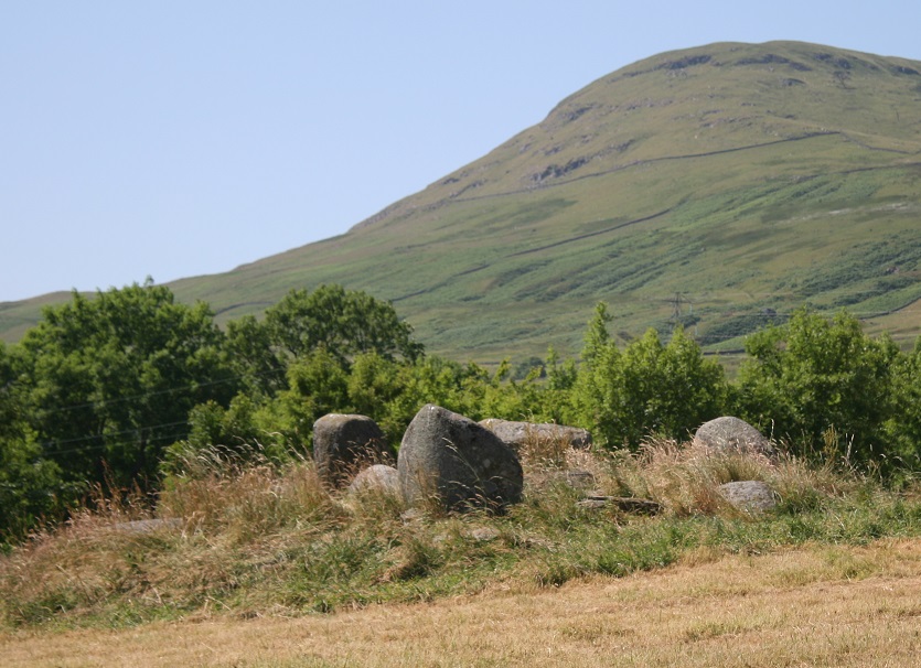
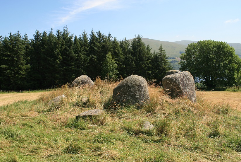
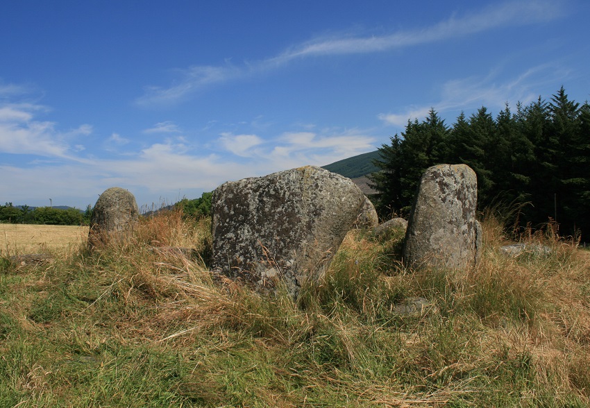
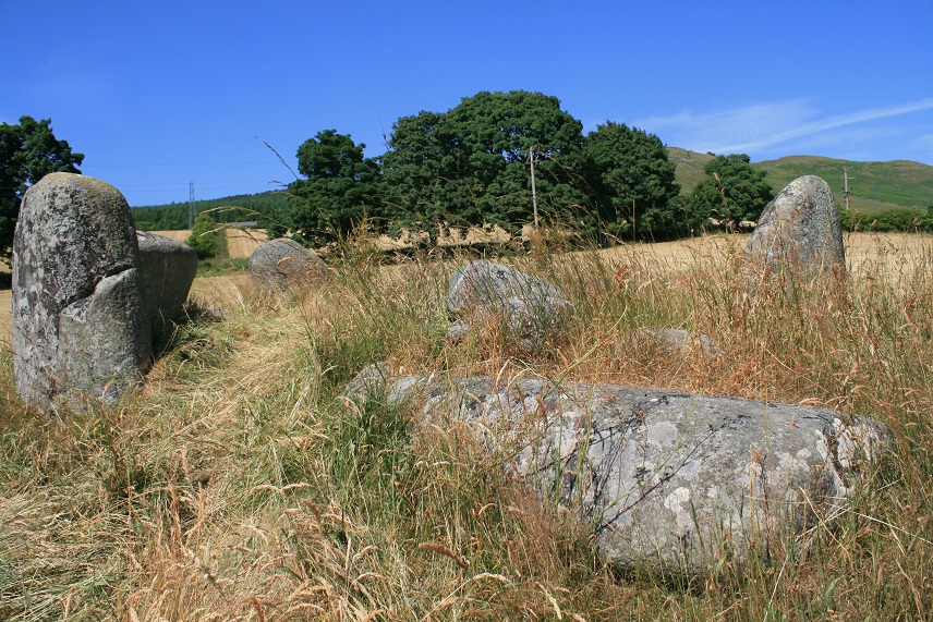
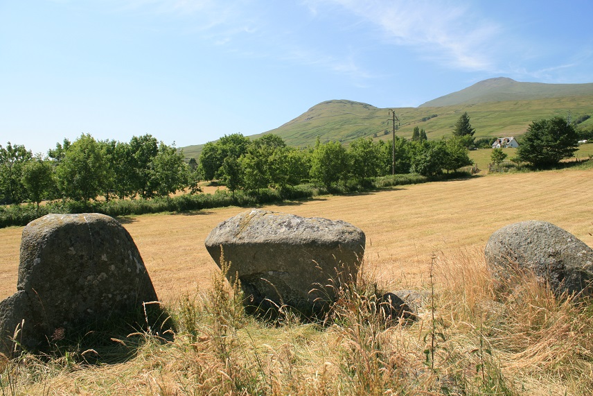
The circle looking south west. The only decent parking space is at the horn carver's shop at Lawers, but there's a very unfriendly notice saying it's £5 to park there if you're not visiting the shop... Welcome to Perthshire - not! There is a farm gate further up the road if you want to take the risk. This is not a typical Perthshire circle, it has more of an Aberdeen feel to it. Somewhat disrupted, and with some field clearance boulders in the centre, it has the remains of a kerb round about, and sits on a slight platform. Perched high above the loch, the views are absolutely breathtaking. A definite must-see on a sunny day!
For more information on this site, see Canmore ID 24537, an extract of which reads: "This stone circle stands on a low rise in improved pasture. It appears to have been constructed on top of an earlier cairn, which measures 7.3m from E to W by 7m transversely and 0.65m in height, and whose surface is partly obscured by dumps of recent field-cleared stones. The circle measures 6.2m from NE to SW by 5.8m overall, and probably comprised seven large erratic boulders set on edge around the cairn's flat top. Four stones remain standing and three have fallen; two additional stones, much smaller than the others though also earthfast, and which lie between the orthostats in the NW and NE arcs, may be no more than field clearance. The stones appear to be graded in height, from 1.4m in the SW arc to 1m on the NE, and all present their broader and more regular faces outwards. One stone is noteworthy for having a broad band of quartz, and two stones are decorated with cupmarks. One of the cup marked stones, in the NW arc, has two shallow cups on its external face, each measuring 30mm in diameter, and another on its internal face, measuring 50mm in diameter; the other, in the SW arc, has one faint cup, measuring 45mm in diameter, and two possible cups, all on its internal face."
The Northern Antiquarian (TNA) also features a page for this site - see their entry for Machuim, Lawers, Loch Tay, Perthshire, which gives directions for finding this stone circle together with a brief archaeology & history, a photograph and a plan of the circle.
You may be viewing yesterday's version of this page. To see the most up to date information please register for a free account.
Do not use the above information on other web sites or publications without permission of the contributor.
Nearby Images from Geograph Britain and Ireland:

©2014(licence)

©2011(licence)

©2013(licence)

©2010(licence)

©2024(licence)
The above images may not be of the site on this page, they are loaded from Geograph.
Please Submit an Image of this site or go out and take one for us!
Click here to see more info for this site
Nearby sites
Key: Red: member's photo, Blue: 3rd party photo, Yellow: other image, Green: no photo - please go there and take one, Grey: site destroyed
Download sites to:
KML (Google Earth)
GPX (GPS waypoints)
CSV (Garmin/Navman)
CSV (Excel)
To unlock full downloads you need to sign up as a Contributory Member. Otherwise downloads are limited to 50 sites.
Turn off the page maps and other distractions
Nearby sites listing. In the following links * = Image available
1.3km SW 235° Easter Croftintygan Farm Standing Stone (Menhir) (NN6706839421)
1.7km SSW 209° Balnasuim* Rock Art (NN6733438677)
2.7km NNE 16° Allt Coire Phadairlidh 1* Rock Art (NN690427)
2.9km WSW 257° Allt a' Choire Chireinich 4 Rock Art (NN6530639560)
3.0km WSW 257° Allt a' Choire Chireinich 3 Rock Art (NN6524939579)
3.0km WSW 256° Allt a' Choire Chireinich 2 Rock Art (NN6521839525)
3.2km WSW 255° Alt a' Choire Chireinich 1 Rock Art (NN6509639442)
3.7km WSW 238° Tombreck (07) Rock Art (NN6502238285)
3.7km WSW 244° Tombreck (08) Rock Art (NN6479538648)
3.9km WSW 239° Tombreck (01) Rock Art (NN6479838284)
4.0km SW 236° Carie (Kenmore) Sculptured Stone (NN6477238018)
4.1km SW 229° Tombreck (10) Ring Cairn (NN6504237559)
4.4km W 260° Beinn Ghlas Rock Art (NN6382839501)
4.5km SSW 193° Dull Farm Stone Marker Stone (NN6704235826)
5.8km NE 43° Oakbank Crannog* Crannog (NN723443)
5.9km NE 37° Clach-na-Cruich (Fearnan) Rock Art (NN7186844743)
6.2km NE 38° Fearnan Rock Art (NN72184497)
6.3km NE 38° Cromrar 3 Rock Art (NN72184500)
6.4km NE 38° Cromrar 2* Rock Art (NN72344507)
6.7km NE 38° Cromrar 1* Rock Art (NN72474531)
7.6km NNW 345° Dericambus Standing Stone (Menhir) (NN66484757)
8.0km NE 36° Bridge of Lyon Standing Stones* Standing Stones (NN73144641)
8.0km NE 35° Bridge of Lyon long cairn* Long Barrow (NN72964655)
8.1km NE 36° Lyon Bridge Cairn* Cairn (NN73174657)
8.2km NNE 19° Coille Dhubh Standing Stones (NN711478)
View more nearby sites and additional images


 We would like to know more about this location. Please feel free to add a brief description and any relevant information in your own language.
 Wir möchten mehr über diese Stätte erfahren. Bitte zögern Sie nicht, eine kurze Beschreibung und relevante Informationen in Deutsch hinzuzufügen.
 Nous aimerions en savoir encore un peu sur les lieux. S'il vous plaît n'hesitez pas à ajouter une courte description et tous les renseignements pertinents dans votre propre langue.
 Quisieramos informarnos un poco más de las lugares. No dude en añadir una breve descripción y otros datos relevantes en su propio idioma.