<< Our Photo Pages >> Torrs 3 - Rock Art in Scotland in Dumfries and Galloway
Submitted by SolarMegalith on Wednesday, 16 September 2015 Page Views: 2034
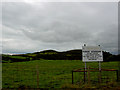
Rock ArtSite Name: Torrs 3Country: Scotland
NOTE: This site is 0.2 km away from the location you searched for.
County: Dumfries and Galloway Type: Rock Art
Nearest Town: Kircudbright Nearest Village: Balmae
Map Ref: NX67924522
Latitude: 54.784442N Longitude: 4.055379W
Condition:
| 5 | Perfect |
| 4 | Almost Perfect |
| 3 | Reasonable but with some damage |
| 2 | Ruined but still recognisable as an ancient site |
| 1 | Pretty much destroyed, possibly visible as crop marks |
| 0 | No data. |
| -1 | Completely destroyed |
| 5 | Superb |
| 4 | Good |
| 3 | Ordinary |
| 2 | Not Good |
| 1 | Awful |
| 0 | No data. |
| 5 | Can be driven to, probably with disabled access |
| 4 | Short walk on a footpath |
| 3 | Requiring a bit more of a walk |
| 2 | A long walk |
| 1 | In the middle of nowhere, a nightmare to find |
| 0 | No data. |
| 5 | co-ordinates taken by GPS or official recorded co-ordinates |
| 4 | co-ordinates scaled from a detailed map |
| 3 | co-ordinates scaled from a bad map |
| 2 | co-ordinates of the nearest village |
| 1 | co-ordinates of the nearest town |
| 0 | no data |
Internal Links:
External Links:
I have visited· I would like to visit
SolarMegalith visited on 23rd Jun 2015 - their rating: Cond: 3 Amb: 4 Access: 4
")
An outcrop decorated with cup-and-ring mark with two rings, cup with single ring and about 60 cup-marks. The panel is located just east of the footpath.
For more information on this prehistoric cup and ring marked rock see Canmore ID 63902 which adds that in 1971 the southernmost part of the rock was covered by gorse. By 1993 this had been removed and more of the outcrop ridge had been exposed. They found "about 58 extra single cups, one cup with tail, two cups with one (incomplete) ring, one cup with two rings, the very faint remains of a set of four or five rings (no central cup?) with a number of the single cups superimposed."
You may be viewing yesterday's version of this page. To see the most up to date information please register for a free account.
")
")
Do not use the above information on other web sites or publications without permission of the contributor.
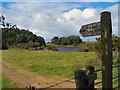
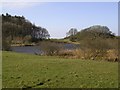
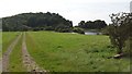
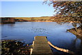
Nearby Images from Geograph Britain and Ireland:
©2010(licence)
©2008(licence)
©2017(licence)
©2010(licence)
©2010(licence)
The above images may not be of the site on this page, they are loaded from Geograph.
Please Submit an Image of this site or go out and take one for us!
Click here to see more info for this site
Nearby sites
Key: Red: member's photo, Blue: 3rd party photo, Yellow: other image, Green: no photo - please go there and take one, Grey: site destroyed
Download sites to:
KML (Google Earth)
GPX (GPS waypoints)
CSV (Garmin/Navman)
CSV (Excel)
To unlock full downloads you need to sign up as a Contributory Member. Otherwise downloads are limited to 50 sites.
Turn off the page maps and other distractions
Nearby sites listing. In the following links * = Image available
284m SE 139° Knockshinnie Stone Circle (NX681450)
652m N 10° Torrs 2* Rock Art (NX68054586)
949m ESE 111° Craikness Hill 1* Rock Art (NX6879644847)
1.1km NE 55° Drummore Hillfort* Hillfort (NX688458)
1.1km NE 51° Drummore Castle* Stone Circle (NX688459)
1.1km NE 51° Drummore* Stone Circle (NX688459)
1.3km ESE 112° Little Balmae Stone Circle (NX691447)
2.0km NE 43° Blackhill Cottage* Rock Art (NX69334663)
2.5km NNE 20° Grange 3 (Dumfries and Galloway)* Rock Art (NX6883947526)
2.5km NE 41° Townhead* Rock Art (NX69644705)
2.5km ESE 123° St Margaret's Well (Kirkcudbright) Holy Well or Sacred Spring (NX69994378)
3.7km N 349° Monk's Well (Kirkcudbright) Holy Well or Sacred Spring (NX6730048892)
3.9km W 273° Brighouse* Standing Stone (Menhir) (NX64024555)
4.0km WNW 298° Clauchandolly 8* Rock Art (NX64474722)
4.0km WNW 296° Clauchandolly 6 Rock Art (NX64384711)
4.1km WNW 296° Clauchandolly 1* Rock Art (NX64244714)
4.7km NE 44° Galtway Hill Cairn (NX71294845)
4.8km NE 37° High Banks Farm* Rock Art (NX70914895)
4.8km NNE 29° High Banks Southern Cairn* Cairn (NX70394934)
4.9km N 2° Butter Well (Kirkcudbright) Holy Well or Sacred Spring (NX6821250148)
4.9km NNE 29° High Banks Northern Cairn* Cairn (NX70454947)
5.6km N 6° Kirkcudbright Standing Stones* Standing Stones (NX6870450736)
5.6km N 2° Stewartry Museum* Museum (NX68335086)
5.7km N 360° Mercat Cross (Kirkcudbright)* Ancient Cross (NX6807650896)
5.8km N 3° Soaperie Gardens Well (Kirkcudbright)* Holy Well or Sacred Spring (NX6843251039)
View more nearby sites and additional images


 We would like to know more about this location. Please feel free to add a brief description and any relevant information in your own language.
 Wir möchten mehr über diese Stätte erfahren. Bitte zögern Sie nicht, eine kurze Beschreibung und relevante Informationen in Deutsch hinzuzufügen.
 Nous aimerions en savoir encore un peu sur les lieux. S'il vous plaît n'hesitez pas à ajouter une courte description et tous les renseignements pertinents dans votre propre langue.
 Quisieramos informarnos un poco más de las lugares. No dude en añadir una breve descripción y otros datos relevantes en su propio idioma.