<< Our Photo Pages >> Ingle Stone (Ingleston) - Natural Stone / Erratic / Other Natural Feature in Scotland in Dumfries and Galloway
Submitted by markj99 on Tuesday, 18 June 2019 Page Views: 1213
Natural PlacesSite Name: Ingle Stone (Ingleston)Country: Scotland County: Dumfries and Galloway Type: Natural Stone / Erratic / Other Natural Feature
Nearest Town: Kirkcudbright Nearest Village: Twynholm
Map Ref: NX6597753324
Latitude: 54.856704N Longitude: 4.089326W
Condition:
| 5 | Perfect |
| 4 | Almost Perfect |
| 3 | Reasonable but with some damage |
| 2 | Ruined but still recognisable as an ancient site |
| 1 | Pretty much destroyed, possibly visible as crop marks |
| 0 | No data. |
| -1 | Completely destroyed |
| 5 | Superb |
| 4 | Good |
| 3 | Ordinary |
| 2 | Not Good |
| 1 | Awful |
| 0 | No data. |
| 5 | Can be driven to, probably with disabled access |
| 4 | Short walk on a footpath |
| 3 | Requiring a bit more of a walk |
| 2 | A long walk |
| 1 | In the middle of nowhere, a nightmare to find |
| 0 | No data. |
| 5 | co-ordinates taken by GPS or official recorded co-ordinates |
| 4 | co-ordinates scaled from a detailed map |
| 3 | co-ordinates scaled from a bad map |
| 2 | co-ordinates of the nearest village |
| 1 | co-ordinates of the nearest town |
| 0 | no data |
Internal Links:
External Links:
I have visited· I would like to visit
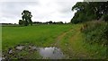
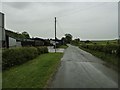
markj99 visited on 17th Jan 2019 - their rating: Cond: 5 Amb: 5 Access: 3 I approached the Ingle Stone from the north because there is no room to park on the minor road running south from Twynholm past Ingleston farm. I parked up at a farm track road end at NX 65830 54067. I followed the track south (past Arden Fort). I headed SSE towards NX 65971 53318 using my GPS to zoom into my target.
 (PID:198730)")
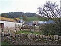
I found this stone by sight as I was travelling S out of Twynholm. On passing Ingleston farm I noticed a large stone on the right side at the top of a hill.
I couldn't find any online references to this stone but found it marked on my OS landranger map.
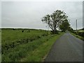
The Ingle Stone is a massive erratic measuring around 10x10x8 feet. There is a small moss-covered stone resting on top of the Ingle Stone. It is no wonder that the Ingle Stone has not been moved and has given the farm it's name due to its prominence in the landscape.
You may be viewing yesterday's version of this page. To see the most up to date information please register for a free account.
 (PID:198731)")
 (PID:198729)")
Do not use the above information on other web sites or publications without permission of the contributor.
Nearby Images from Geograph Britain and Ireland:
©2017(licence)
©2014(licence)
©2010(licence)
©2010(licence)
©2014(licence)
The above images may not be of the site on this page, they are loaded from Geograph.
Please Submit an Image of this site or go out and take one for us!
Click here to see more info for this site
Nearby sites
Key: Red: member's photo, Blue: 3rd party photo, Yellow: other image, Green: no photo - please go there and take one, Grey: site destroyed
Download sites to:
KML (Google Earth)
GPX (GPS waypoints)
CSV (Garmin/Navman)
CSV (Excel)
To unlock full downloads you need to sign up as a Contributory Member. Otherwise downloads are limited to 50 sites.
Turn off the page maps and other distractions
Nearby sites listing. In the following links * = Image available
634m NNW 349° Arden Fort* Hillfort (NX65875395)
1.1km N 1° The Doon (Twynholm)* Hillfort (NX66035438)
3.2km SE 138° Mercat Cross (Kirkcudbright)* Ancient Cross (NX6807650896)
3.3km SE 131° Soaperie Gardens Well (Kirkcudbright)* Holy Well or Sacred Spring (NX6843251039)
3.4km SE 135° Stewartry Museum* Museum (NX68335086)
3.6km E 88° Carse Moat* Hillfort (NX69555336)
3.7km NNE 14° Fairies Well (Tongland) Holy Well or Sacred Spring (NX6695556911)
3.8km SE 132° Kirkcudbright Standing Stones* Standing Stones (NX6870450736)
3.9km SE 143° Butter Well (Kirkcudbright) Holy Well or Sacred Spring (NX6821250148)
4.6km SSE 162° Monk's Well (Kirkcudbright) Holy Well or Sacred Spring (NX6730048892)
4.8km NE 53° Park Of Tongland Stones* Standing Stones (NX69965609)
4.9km E 98° Culdoach* Rock Art (NX70835250)
5.2km NE 43° Holy Well (Parton) Holy Well or Sacred Spring (NX696570)
5.7km NE 50° Park of Tongland Marked Stone Rock Art (NX70475685)
5.9km SE 129° High Banks Northern Cairn* Cairn (NX70454947)
5.9km SE 130° High Banks Southern Cairn* Cairn (NX70394934)
6.3km SSW 192° Clauchandolly 8* Rock Art (NX64474722)
6.4km SSW 193° Clauchandolly 6 Rock Art (NX64384711)
6.4km SSW 194° Clauchandolly 1* Rock Art (NX64244714)
6.5km SSE 152° Grange 3 (Dumfries and Galloway)* Rock Art (NX6883947526)
6.6km SE 130° High Banks Farm* Rock Art (NX70914895)
7.0km NE 56° St Ringan's Well (Kelton) Holy Well or Sacred Spring (NX71905713)
7.1km ESE 117° Bombie 1 Rock Art (NX72294994)
7.2km SE 131° Galtway Hill Cairn (NX71294845)
7.3km SSE 148° Townhead* Rock Art (NX69644705)
View more nearby sites and additional images


 We would like to know more about this location. Please feel free to add a brief description and any relevant information in your own language.
 Wir möchten mehr über diese Stätte erfahren. Bitte zögern Sie nicht, eine kurze Beschreibung und relevante Informationen in Deutsch hinzuzufügen.
 Nous aimerions en savoir encore un peu sur les lieux. S'il vous plaît n'hesitez pas à ajouter une courte description et tous les renseignements pertinents dans votre propre langue.
 Quisieramos informarnos un poco más de las lugares. No dude en añadir una breve descripción y otros datos relevantes en su propio idioma.