<< Our Photo Pages >> Auchenlaich Cairn - Chambered Cairn in Scotland in Stirling
Submitted by rogerkread on Friday, 16 October 2015 Page Views: 4437
Neolithic and Bronze AgeSite Name: Auchenlaich CairnCountry: Scotland
NOTE: This site is 0.2 km away from the location you searched for.
County: Stirling Type: Chambered Cairn
Nearest Town: Callendar
Map Ref: NN64980715
Latitude: 56.237649N Longitude: 4.180011W
Condition:
| 5 | Perfect |
| 4 | Almost Perfect |
| 3 | Reasonable but with some damage |
| 2 | Ruined but still recognisable as an ancient site |
| 1 | Pretty much destroyed, possibly visible as crop marks |
| 0 | No data. |
| -1 | Completely destroyed |
| 5 | Superb |
| 4 | Good |
| 3 | Ordinary |
| 2 | Not Good |
| 1 | Awful |
| 0 | No data. |
| 5 | Can be driven to, probably with disabled access |
| 4 | Short walk on a footpath |
| 3 | Requiring a bit more of a walk |
| 2 | A long walk |
| 1 | In the middle of nowhere, a nightmare to find |
| 0 | No data. |
| 5 | co-ordinates taken by GPS or official recorded co-ordinates |
| 4 | co-ordinates scaled from a detailed map |
| 3 | co-ordinates scaled from a bad map |
| 2 | co-ordinates of the nearest village |
| 1 | co-ordinates of the nearest town |
| 0 | no data |
Internal Links:
External Links:
I have visited· I would like to visit
SumDoood would like to visit
")
An extraordinary cairn, 342m long, by far the longest chambered cairn in Britain. It is so long it is difficult to appreciate its true size, and a farm track bisects it. Apparently 'aerial views can be seen on the Canmore website'. It is thought to be a contemporary of a nearby homestead at Claish, 1.5km to the west, which was a relatively huge and complex timber structure and which has been dated to be around 6000 years old. The chambered cairn is most easily visited through the Keltie Caravan Site, which is signposted just E of Callander.
For more information see Canmore ID 24362 which describes the cairn as running from NN 6498 0715 to NN 6493 0747. This entry contains aerial photographs and a series of archaeological notes from 1968 to 1997. A field visit took place in March 1991 and an extract from this report reads: "The much-disturbed remains of this unusual monument are situated in improved pasture on a gravel terrace 110m E of Auchenlaich farmsteading and 50m N of the River Keltie. It comprises a long stony mound, aligned NNW-SSE, with, incorporated at its SSE end, what is probably a trapezoidal chambered cairn. For such a large monument, the long mound forms a relatively inconspicuous feature in the landscape, and its low-lying position may have been deliberately chosen in order to reduce its visibility from the surrounding ground. The best view of the site is gained from the hill immediately to the NW, which is crowned by the remains of a fort. The mound measures 322m in length and tapers in width from 15m at the SSE end to 11m at the NNW, one possible kerbstone having been identified. Stone-robbing and field clearance have obscured the original profile of the mound which, apart from the chambered cairn at the SSE end, now stands to no more than 0.5m in height above the former ground level. The centre of the mound has been plundered for stone, presumably to build the surrounding field-walls, and dumping of field-gathered stones has, in places, added a raised rim along the perimeter."
You may be viewing yesterday's version of this page. To see the most up to date information please register for a free account.
")
")
")
Do not use the above information on other web sites or publications without permission of the contributor.
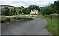
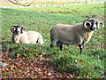
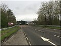
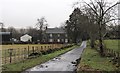
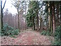
Nearby Images from Geograph Britain and Ireland:
©2019(licence)
©2012(licence)
©2023(licence)
©2019(licence)
©2013(licence)
The above images may not be of the site on this page, they are loaded from Geograph.
Please Submit an Image of this site or go out and take one for us!
Click here to see more info for this site
Nearby sites
Key: Red: member's photo, Blue: 3rd party photo, Yellow: other image, Green: no photo - please go there and take one, Grey: site destroyed
Download sites to:
KML (Google Earth)
GPX (GPS waypoints)
CSV (Garmin/Navman)
CSV (Excel)
To unlock full downloads you need to sign up as a Contributory Member. Otherwise downloads are limited to 50 sites.
Turn off the page maps and other distractions
Nearby sites listing. In the following links * = Image available
1.6km S 175° St Mary's Well (Callender)* Holy Well or Sacred Spring (NN65070556)
1.7km SSE 157° Ballochallan* Modern Stone Circle etc (NN65580559)
2.4km S 169° Wester Torrie Stone Circle (NN65340480)
2.6km N 359° West Bracklinn* Chambered Cairn (NN6501809794)
2.9km NNW 329° Druim Mor (Callander)* Standing Stone (Menhir) (NN6354209721)
3.1km E 100° Ballachraggan Chambered Cairn (NN68050650)
4.6km W 277° Samson Stone (Callendar) Ancient Village or Settlement (NN6039807821)
6.9km SSW 203° The Ruskie Stane* Modern Stone Circle etc (NN6203800912)
9.0km SE 129° Tulloch Knowe (Doune)s Cairn (NN7178201194)
9.1km SW 226° Lake of Menteith Crannogs* Crannog (NN5821901097)
9.1km E 98° The Judge's Cairn (Dunblane) Cairn (NN7394405618)
9.2km WSW 240° Upper Glenny* Rock Art (NN56880277)
9.2km ESE 123° Trysting Stone* Standing Stone (Menhir) (NN72550185)
9.8km SSE 154° Craighead Cairn* Cairn (NS69039822)
9.8km WSW 239° Nether Glenny (42) Rock Art (NN56430229)
9.9km WSW 238° Nether Glenny (35) Rock Art (NN5642502099)
9.9km WSW 237° Nether Glenny (02) Cairn (NN56440202)
10.0km WSW 237° Nether Glenny Cairn* Cairn (NN56460192)
10.1km SSE 151° Coldoch Broch* Broch or Nuraghe (NS6963998128)
10.2km WSW 238° Nether Glenny (28) Rock Art (NN56190197)
10.3km WSW 237° Nether Glenny Rock Art* Rock Art (NN56140179)
10.4km WSW 237° Mask Stone (Port of Menteith) Rock Art (NN5610701712)
10.4km WSW 237° Ballochraggan 12 Rock Art (NN5610601711)
10.5km SW 236° Ballochraggan 5 Rock Art (NN5604401549)
10.9km SW 234° Ballochraggan 1 Rock Art (NN5590001005)
View more nearby sites and additional images


 We would like to know more about this location. Please feel free to add a brief description and any relevant information in your own language.
 Wir möchten mehr über diese Stätte erfahren. Bitte zögern Sie nicht, eine kurze Beschreibung und relevante Informationen in Deutsch hinzuzufügen.
 Nous aimerions en savoir encore un peu sur les lieux. S'il vous plaît n'hesitez pas à ajouter une courte description et tous les renseignements pertinents dans votre propre langue.
 Quisieramos informarnos un poco más de las lugares. No dude en añadir una breve descripción y otros datos relevantes en su propio idioma.