<< Our Photo Pages >> Ty n-yr-eithin - Cairn in Wales in Ceredigion
Submitted by caradoc68 on Wednesday, 11 July 2018 Page Views: 1236
Neolithic and Bronze AgeSite Name: Ty n-yr-eithin Alternative Name: House in the gorseCountry: Wales
NOTE: This site is 1.9 km away from the location you searched for.
County: Ceredigion Type: Cairn
Nearest Town: Lledrod
Map Ref: SN630685
Latitude: 52.297491N Longitude: 4.010425W
Condition:
| 5 | Perfect |
| 4 | Almost Perfect |
| 3 | Reasonable but with some damage |
| 2 | Ruined but still recognisable as an ancient site |
| 1 | Pretty much destroyed, possibly visible as crop marks |
| 0 | No data. |
| -1 | Completely destroyed |
| 5 | Superb |
| 4 | Good |
| 3 | Ordinary |
| 2 | Not Good |
| 1 | Awful |
| 0 | No data. |
| 5 | Can be driven to, probably with disabled access |
| 4 | Short walk on a footpath |
| 3 | Requiring a bit more of a walk |
| 2 | A long walk |
| 1 | In the middle of nowhere, a nightmare to find |
| 0 | No data. |
| 5 | co-ordinates taken by GPS or official recorded co-ordinates |
| 4 | co-ordinates scaled from a detailed map |
| 3 | co-ordinates scaled from a bad map |
| 2 | co-ordinates of the nearest village |
| 1 | co-ordinates of the nearest town |
| 0 | no data |
Internal Links:
External Links:
")
The monument comprises the remains of a turf-covered round cairn, probably dating to the Bronze Age (c. 2300 - 800 BC). It is located centrally in an enclosed field of pasture on a gentle S-facing slope overlooking the Camddwr. The cairn is circular in shape on plan and measures c. 14m in diameter. It is flat-topped and a maximum of 0.6m in height. There is a shallow depression at the centre of the mound.
The monument is of national importance for its potential to enhance our knowledge of prehistoric burial and ritual practices. The feature is an important relic of a prehistoric funerary and ritual landscape and retains significant archaeological potential. There is a strong probability of the presence of both intact burial or ritual deposits, together with environmental and structural evidence.
The scheduled area comprises the remains described and an area around within which related evidence may be expected to survive. The scheduled area is circular in shape on plan and measures 18m in diameter.
Source: Cadw
You may be viewing yesterday's version of this page. To see the most up to date information please register for a free account.
")
")
Do not use the above information on other web sites or publications without permission of the contributor.
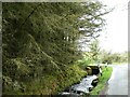
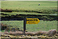
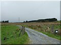
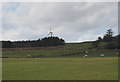
Nearby Images from Geograph Britain and Ireland:
©2023(licence)
©2010(licence)
©2023(licence)
©2010(licence)
©2010(licence)
The above images may not be of the site on this page, they are loaded from Geograph.
Please Submit an Image of this site or go out and take one for us!
Click here to see more info for this site
Nearby sites
Key: Red: member's photo, Blue: 3rd party photo, Yellow: other image, Green: no photo - please go there and take one, Grey: site destroyed
Download sites to:
KML (Google Earth)
GPX (GPS waypoints)
CSV (Garmin/Navman)
CSV (Excel)
To unlock full downloads you need to sign up as a Contributory Member. Otherwise downloads are limited to 50 sites.
Turn off the page maps and other distractions
Nearby sites listing. In the following links * = Image available
3.8km NNE 27° Gaer Fawr (Lledrod)* Hillfort (SN648718)
3.8km WNW 300° The Dominicus Stone Early Christian Sculptured Stone (SN597705)
4.6km ESE 107° St Ffraid's Well* Holy Well or Sacred Spring (SN67436705)
5.6km ENE 78° Llanwnnws Inscribed Stone Early Christian Sculptured Stone (SN68516950)
5.8km SSE 154° Castell Flemish* Hillfort (SN6538863195)
6.0km N 358° Llanilar Hillfort (SN62997454)
6.2km N 358° Pen-Y-Castell Enclosure Ancient Village or Settlement (SN62997468)
7.2km ENE 79° Garreg Lwyd Ancient Village or Settlement (SN70106972)
7.2km W 281° Gaer (Gilfachafael)* Ancient Village or Settlement (SN55907005)
7.3km ENE 73° Nant Byr Isaf Cairn (SN70037044)
7.3km NNW 343° Castell Pantmawr Hillfort (SN611756)
7.7km S 171° Pen-Y-Gaer (Llangeitho) Hillfort (SN63996083)
7.8km W 276° Gaer Penrhôs* Ancient Village or Settlement (SN5520569555)
7.9km E 86° Pen y Ffrwd* Hillfort (SN709688)
7.9km NE 44° Coed Ty'n y Cwm* Hillfort (SN687740)
8.8km ENE 76° Banc-Y-Geufron* Cairn (SN71637033)
8.8km W 274° Y Foel Promontory Fort * Promontory Fort / Cliff Castle (SN5418069310)
9.1km W 271° Castell Bach (Llanrhystud)* Hillfort (SN5388068870)
9.1km WNW 302° Pen Glog* Cairn (SN554736)
9.2km W 272° Pentre-isaf Misc. Earthwork (SN5377069010)
9.2km W 269° Castell Mawr (Llanrhystud) Hillfort (SN5373068660)
9.5km WSW 246° Llech Gron* Standing Stone (Menhir) (SN5424664851)
9.7km W 276° Pengarreg Defended Enclosure Hillfort (SN5333069710)
9.9km SSE 148° Tregaron Gorsedd Circle* Modern Stone Circle etc (SN6807860037)
9.9km ENE 65° Castle Grogwynion* Hillfort (SN72107249)
View more nearby sites and additional images


 We would like to know more about this location. Please feel free to add a brief description and any relevant information in your own language.
 Wir möchten mehr über diese Stätte erfahren. Bitte zögern Sie nicht, eine kurze Beschreibung und relevante Informationen in Deutsch hinzuzufügen.
 Nous aimerions en savoir encore un peu sur les lieux. S'il vous plaît n'hesitez pas à ajouter une courte description et tous les renseignements pertinents dans votre propre langue.
 Quisieramos informarnos un poco más de las lugares. No dude en añadir una breve descripción y otros datos relevantes en su propio idioma.