<< Text Pages >> Old Warren Hill - Hillfort in Wales in Ceredigion
Submitted by vicky on Tuesday, 23 March 2004 Page Views: 15561
Iron Age and Later PrehistorySite Name: Old Warren HillCountry: Wales
NOTE: This site is 0.2 km away from the location you searched for.
County: Ceredigion Type: Hillfort
Nearest Town: Aberystwyth Nearest Village: Nanteos
Map Ref: SN615789 Landranger Map Number: 135
Latitude: 52.390554N Longitude: 4.036697W
Condition:
| 5 | Perfect |
| 4 | Almost Perfect |
| 3 | Reasonable but with some damage |
| 2 | Ruined but still recognisable as an ancient site |
| 1 | Pretty much destroyed, possibly visible as crop marks |
| 0 | No data. |
| -1 | Completely destroyed |
| 5 | Superb |
| 4 | Good |
| 3 | Ordinary |
| 2 | Not Good |
| 1 | Awful |
| 0 | No data. |
| 5 | Can be driven to, probably with disabled access |
| 4 | Short walk on a footpath |
| 3 | Requiring a bit more of a walk |
| 2 | A long walk |
| 1 | In the middle of nowhere, a nightmare to find |
| 0 | No data. |
| 5 | co-ordinates taken by GPS or official recorded co-ordinates |
| 4 | co-ordinates scaled from a detailed map |
| 3 | co-ordinates scaled from a bad map |
| 2 | co-ordinates of the nearest village |
| 1 | co-ordinates of the nearest town |
| 0 | no data |
Internal Links:
External Links:
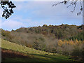
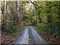
Promontary Fort in Ceredigion. This is the largest single-ditched hillfort in Wales. Now covered in trees, but accessed via a public footpath in the care of the Dyfed Wildlife Trust.
Have you visited this site? Please add a comment below.
Note: Planning Application for Paintballing is turned down.
You may be viewing yesterday's version of this page. To see the most up to date information please register for a free account.
")
Do not use the above information on other web sites or publications without permission of the contributor.
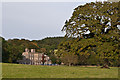
Nearby Images from Geograph Britain and Ireland:
©2010(licence)
©2020(licence)
©2006(licence)
©2010(licence)
©2012(licence)
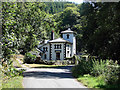
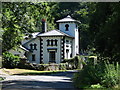
The above images may not be of the site on this page, they are loaded from Geograph.
Please Submit an Image of this site or go out and take one for us!
Click here to see more info for this site
Nearby sites
Key: Red: member's photo, Blue: 3rd party photo, Yellow: other image, Green: no photo - please go there and take one, Grey: site destroyed
Download sites to:
KML (Google Earth)
GPX (GPS waypoints)
CSV (Garmin/Navman)
CSV (Excel)
To unlock full downloads you need to sign up as a Contributory Member. Otherwise downloads are limited to 50 sites.
Turn off the page maps and other distractions
Nearby sites listing. In the following links * = Image available
2.5km NW 322° Y Garreg Fawr* Chambered Tomb (SN59998093)
2.6km NW 321° Llanbadarn Fawr Celtic Crosses* Ancient Cross (SN59918101)
3.0km W 270° Castell Tan Y Bwlch Castle* Promontory Fort / Cliff Castle (SN5851079000)
3.1km NW 318° Ffynnon Badarn* Holy Well or Sacred Spring (SN5951181263)
3.3km S 185° Castell Pantmawr Hillfort (SN611756)
3.3km WNW 291° Pen Dinas (Aberystwyth)* Hillfort (SN5842080211)
4.3km NW 311° Ceredigion Museum* Museum (SN583818)
4.4km NW 305° Aberystwyth Gorsedd Circle* Modern Stone Circle etc (SN5794681533)
4.5km SSE 159° Pen-Y-Castell Enclosure Ancient Village or Settlement (SN62997468)
4.6km SSE 160° Llanilar Hillfort (SN62997454)
4.7km NNE 12° Plas Gogerddan Barrow* Round Barrow(s) (SN62658348)
4.7km NNE 12° Plas Gogerddan* Stone Row / Alignment (SN626835)
4.9km N 8° Gorgerddan Round Barrow(s) (SN62328373)
5.0km N 9° Gorgerddan Enclosure Ancient Village or Settlement (SN62418387)
5.5km N 6° Bow Street* Ancient Village or Settlement (SN6223584325)
5.8km NNE 16° Hen Gaer Hillfort (SN633844)
5.8km NNE 26° Penrhyncoch War Memorial Standing Stone (Menhir) (SN6422984058)
6.3km NNE 34° Bryntirion Well* Holy Well or Sacred Spring (SN65158407)
6.7km NNE 23° Cwrt Enclosure Ancient Village or Settlement (SN64348503)
7.0km N 2° Ruel Uchaf Ancient Village or Settlement (SN620859)
7.6km NE 56° Darren Camp Cairn I Cairn (SN6789382997)
7.6km NE 56° Darren Camp Cairn II Cairn (SN6789183010)
7.6km NE 56° Darren Camp* Hillfort (SN67908302)
7.8km SSE 154° Gaer Fawr (Lledrod)* Hillfort (SN648718)
8.0km NE 54° Cwm-Y-Darren and Twyll-Y-Mwyn Copper Mines Ancient Mine, Quarry or other Industry (SN68148335)
View more nearby sites and additional images


 We would like to know more about this location. Please feel free to add a brief description and any relevant information in your own language.
 Wir möchten mehr über diese Stätte erfahren. Bitte zögern Sie nicht, eine kurze Beschreibung und relevante Informationen in Deutsch hinzuzufügen.
 Nous aimerions en savoir encore un peu sur les lieux. S'il vous plaît n'hesitez pas à ajouter une courte description et tous les renseignements pertinents dans votre propre langue.
 Quisieramos informarnos un poco más de las lugares. No dude en añadir una breve descripción y otros datos relevantes en su propio idioma.