


<< Our Photo Pages >> Hatherleigh St. John's Well - Holy Well or Sacred Spring in England in Devon
Submitted by HOLYWELL on Thursday, 03 April 2008 Page Views: 10795
Springs and Holy WellsSite Name: Hatherleigh St. John's WellCountry: England
NOTE: This site is 4.0 km away from the location you searched for.
County: Devon Type: Holy Well or Sacred Spring
Nearest Village: Hatherleigh
Map Ref: SS5523104363
Latitude: 50.820663N Longitude: 4.056614W
Condition:
| 5 | Perfect |
| 4 | Almost Perfect |
| 3 | Reasonable but with some damage |
| 2 | Ruined but still recognisable as an ancient site |
| 1 | Pretty much destroyed, possibly visible as crop marks |
| 0 | No data. |
| -1 | Completely destroyed |
| 5 | Superb |
| 4 | Good |
| 3 | Ordinary |
| 2 | Not Good |
| 1 | Awful |
| 0 | No data. |
| 5 | Can be driven to, probably with disabled access |
| 4 | Short walk on a footpath |
| 3 | Requiring a bit more of a walk |
| 2 | A long walk |
| 1 | In the middle of nowhere, a nightmare to find |
| 0 | No data. |
| 5 | co-ordinates taken by GPS or official recorded co-ordinates |
| 4 | co-ordinates scaled from a detailed map |
| 3 | co-ordinates scaled from a bad map |
| 2 | co-ordinates of the nearest village |
| 1 | co-ordinates of the nearest town |
| 0 | no data |
Internal Links:
External Links:
")
You may be viewing yesterday's version of this page. To see the most up to date information please register for a free account.
")
")
")
")
Do not use the above information on other web sites or publications without permission of the contributor.
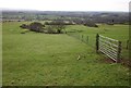
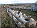
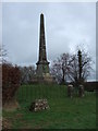
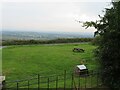
Nearby Images from Geograph Britain and Ireland:
©2012(licence)
©2009(licence)
©2011(licence)
©2020(licence)
©2012(licence)
The above images may not be of the site on this page, they are loaded from Geograph.
Please Submit an Image of this site or go out and take one for us!
Click here to see more info for this site
Nearby sites
Key: Red: member's photo, Blue: 3rd party photo, Yellow: other image, Green: no photo - please go there and take one, Grey: site destroyed
Download sites to:
KML (Google Earth)
GPX (GPS waypoints)
CSV (Garmin/Navman)
CSV (Excel)
To unlock full downloads you need to sign up as a Contributory Member. Otherwise downloads are limited to 50 sites.
Turn off the page maps and other distractions
Nearby sites listing. In the following links * = Image available
3.4km WNW 294° Hatherleigh St. Mary's Well Holy Well or Sacred Spring (SS5213105847)
7.1km NNW 329° Heathmoor Barrow* Barrow Cemetery (SS517105)
10.0km ESE 104° North Tawton A Cursus Cursus (SS649017)
10.9km SW 228° Three Barrows, Patchacott* Barrow Cemetery (SX4693097301)
11.3km SSE 158° Fitz's Well* Holy Well or Sacred Spring (SX5919093783)
11.4km WSW 248° Halwill Great Barrows* Barrow Cemetery (SS4449200306)
11.5km SSE 152° East Hill Promontory Fort* Promontory Fort / Cliff Castle (SX604941)
12.3km WNW 292° Devil's Stone, Shebbear* Standing Stone (Menhir) (SS43880925)
12.4km SE 139° Belstone Boundary Marker* Marker Stone (SX6314994770)
12.6km N 2° Combe Wood Hillfort (SS561169)
12.7km SSE 147° Belstone Ring Cross* Ancient Cross (SX6192793500)
12.8km SSE 147° Holy Well (Belstone)* Holy Well or Sacred Spring (SX6202393468)
12.8km NNW 345° Castle Hill (Woolleigh Bridge) Ancient Village or Settlement (SS5225916849)
12.9km SSE 150° Watchet Hill Cairn* Cairn (SX6147293042)
13.0km W 274° Holemoor Well* Holy Well or Sacred Spring (SS423057)
13.0km SSE 151° Nine Stones (Belstone)* Stone Circle (SX6123192844)
13.0km SSE 169° Black Down West Cairn (SX57469153)
13.3km S 172° Longstone Hill cairn* Cairn (SX56709113)
13.4km SE 138° Sticklepath Boundary Marker* Marker Stone (SX6388694135)
13.4km WSW 247° Halwill Village Cross* Ancient Cross (SX4275199393)
13.4km SE 138° Lady Well (Sticklepath)* Holy Well or Sacred Spring (SX6390494124)
13.4km WSW 247° Halwill Churchyard Cross* Ancient Cross (SX4272799412)
13.5km SE 138° Sticklepath Methodist Chapel Cross* Ancient Cross (SX6404694079)
13.6km S 172° Longstone Hill stone* Standing Stone (Menhir) (SX56729089)
13.6km SSE 154° Belstone Common Cairns* Cairn (SX6077491956)
View more nearby sites and additional images


 We would like to know more about this location. Please feel free to add a brief description and any relevant information in your own language.
 Wir möchten mehr über diese Stätte erfahren. Bitte zögern Sie nicht, eine kurze Beschreibung und relevante Informationen in Deutsch hinzuzufügen.
 Nous aimerions en savoir encore un peu sur les lieux. S'il vous plaît n'hesitez pas à ajouter une courte description et tous les renseignements pertinents dans votre propre langue.
 Quisieramos informarnos un poco más de las lugares. No dude en añadir una breve descripción y otros datos relevantes en su propio idioma.