<< Our Photo Pages >> Castell Tan Y Bwlch Castle - Promontory Fort / Cliff Castle in Wales in Ceredigion
Submitted by Hayden on Monday, 27 December 2021 Page Views: 1409
Iron Age and Later PrehistorySite Name: Castell Tan Y Bwlch CastleCountry: Wales
NOTE: This site is 1.3 km away from the location you searched for.
County: Ceredigion Type: Promontory Fort / Cliff Castle
Nearest Town: Aberystwyth Nearest Village: Rhydyfelin
Map Ref: SN5851079000
Latitude: 52.390687N Longitude: 4.080647W
Condition:
| 5 | Perfect |
| 4 | Almost Perfect |
| 3 | Reasonable but with some damage |
| 2 | Ruined but still recognisable as an ancient site |
| 1 | Pretty much destroyed, possibly visible as crop marks |
| 0 | No data. |
| -1 | Completely destroyed |
| 5 | Superb |
| 4 | Good |
| 3 | Ordinary |
| 2 | Not Good |
| 1 | Awful |
| 0 | No data. |
| 5 | Can be driven to, probably with disabled access |
| 4 | Short walk on a footpath |
| 3 | Requiring a bit more of a walk |
| 2 | A long walk |
| 1 | In the middle of nowhere, a nightmare to find |
| 0 | No data. |
| 5 | co-ordinates taken by GPS or official recorded co-ordinates |
| 4 | co-ordinates scaled from a detailed map |
| 3 | co-ordinates scaled from a bad map |
| 2 | co-ordinates of the nearest village |
| 1 | co-ordinates of the nearest town |
| 0 | no data |
Internal Links:
External Links:
")
The original castle at Aberystwyth was built in 1110 by the Earl of Clare and occupied by the Normans until 1136. The Welsh controlled it from 1136 to 1143. The site comprises a large oval ringwork castle on the back of a ridge, with a bailey 120ft long running along the ridge and protected by a scarp up to 13ft high; the ringwork measures 90ft by 70ft. The site was excavated in 1956-7, revealing that the castle was extensively damaged circa 1143 or later and that another period of occupation commenced about 1200AD, when the ruins were levelled and the gateway strengthened. The castle is some 350m north of St Hychan's Church (NPRN 96043) and the two may have been contemporary.
Source: Coflein
You may be viewing yesterday's version of this page. To see the most up to date information please register for a free account.
Do not use the above information on other web sites or publications without permission of the contributor.
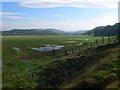
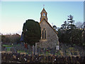
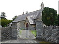
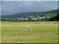
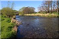
Nearby Images from Geograph Britain and Ireland:
©2010(licence)
©2011(licence)
©2011(licence)
©2008(licence)
©2014(licence)
The above images may not be of the site on this page, they are loaded from Geograph.
Please Submit an Image of this site or go out and take one for us!
Click here to see more info for this site
Nearby sites
Key: Red: member's photo, Blue: 3rd party photo, Yellow: other image, Green: no photo - please go there and take one, Grey: site destroyed
Download sites to:
KML (Google Earth)
GPX (GPS waypoints)
CSV (Garmin/Navman)
CSV (Excel)
To unlock full downloads you need to sign up as a Contributory Member. Otherwise downloads are limited to 50 sites.
Turn off the page maps and other distractions
Nearby sites listing. In the following links * = Image available
1.2km N 354° Pen Dinas (Aberystwyth)* Hillfort (SN5842080211)
2.4km NE 36° Y Garreg Fawr* Chambered Tomb (SN59998093)
2.4km NNE 33° Llanbadarn Fawr Celtic Crosses* Ancient Cross (SN59918101)
2.5km NNE 22° Ffynnon Badarn* Holy Well or Sacred Spring (SN5951181263)
2.6km NNW 346° Aberystwyth Gorsedd Circle* Modern Stone Circle etc (SN5794681533)
2.8km N 354° Ceredigion Museum* Museum (SN583818)
3.0km E 90° Old Warren Hill Hillfort (SN615789)
4.3km SE 141° Castell Pantmawr Hillfort (SN611756)
6.1km NE 37° Gorgerddan Round Barrow(s) (SN62328373)
6.1km NE 41° Plas Gogerddan* Stone Row / Alignment (SN626835)
6.1km NE 41° Plas Gogerddan Barrow* Round Barrow(s) (SN62658348)
6.2km SE 132° Pen-Y-Castell Enclosure Ancient Village or Settlement (SN62997468)
6.2km SSW 208° Pen Glog* Cairn (SN554736)
6.2km NE 37° Gorgerddan Enclosure Ancient Village or Settlement (SN62418387)
6.3km SE 133° Llanilar Hillfort (SN62997454)
6.5km NNE 33° Bow Street* Ancient Village or Settlement (SN6223584325)
7.2km NE 40° Hen Gaer Hillfort (SN633844)
7.6km NE 47° Penrhyncoch War Memorial Standing Stone (Menhir) (SN6422984058)
7.7km NNE 25° Ruel Uchaf Ancient Village or Settlement (SN620859)
7.8km N 5° Cerig Y Gath Burial Chamber or Dolmen (SN59378678)
8.3km NE 51° Bryntirion Well* Holy Well or Sacred Spring (SN65158407)
8.4km NE 42° Cwrt Enclosure Ancient Village or Settlement (SN64348503)
8.6km S 170° The Dominicus Stone Early Christian Sculptured Stone (SN597705)
8.7km NNE 24° St Michael's Church Well Holy Well or Sacred Spring (SN62328687)
9.3km SSW 195° Gaer (Gilfachafael)* Ancient Village or Settlement (SN55907005)
View more nearby sites and additional images


 We would like to know more about this location. Please feel free to add a brief description and any relevant information in your own language.
 Wir möchten mehr über diese Stätte erfahren. Bitte zögern Sie nicht, eine kurze Beschreibung und relevante Informationen in Deutsch hinzuzufügen.
 Nous aimerions en savoir encore un peu sur les lieux. S'il vous plaît n'hesitez pas à ajouter une courte description et tous les renseignements pertinents dans votre propre langue.
 Quisieramos informarnos un poco más de las lugares. No dude en añadir una breve descripción y otros datos relevantes en su propio idioma.