<< Our Photo Pages >> Edinchip - Chambered Cairn in Scotland in Perth and Kinross
Submitted by fijow21 on Tuesday, 09 November 2021 Page Views: 908
Neolithic and Bronze AgeSite Name: EdinchipCountry: Scotland County: Perth and Kinross Type: Chambered Cairn
Map Ref: NN57502185
Latitude: 56.367426N Longitude: 4.308535W
Condition:
| 5 | Perfect |
| 4 | Almost Perfect |
| 3 | Reasonable but with some damage |
| 2 | Ruined but still recognisable as an ancient site |
| 1 | Pretty much destroyed, possibly visible as crop marks |
| 0 | No data. |
| -1 | Completely destroyed |
| 5 | Superb |
| 4 | Good |
| 3 | Ordinary |
| 2 | Not Good |
| 1 | Awful |
| 0 | No data. |
| 5 | Can be driven to, probably with disabled access |
| 4 | Short walk on a footpath |
| 3 | Requiring a bit more of a walk |
| 2 | A long walk |
| 1 | In the middle of nowhere, a nightmare to find |
| 0 | No data. |
| 5 | co-ordinates taken by GPS or official recorded co-ordinates |
| 4 | co-ordinates scaled from a detailed map |
| 3 | co-ordinates scaled from a bad map |
| 2 | co-ordinates of the nearest village |
| 1 | co-ordinates of the nearest town |
| 0 | no data |
Be the first person to rate this site - see the 'Contribute!' box in the right hand menu.
Internal Links:
External Links:
I have visited· I would like to visit
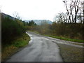
crediblywitless visited on 13th Nov 2021 - their rating: Cond: 3 Amb: 5 Access: 3 You can either park at Kingshouse ("Mhor 84") and then go under the A84 and walk north up the Rob Roy Way and then "Old Military Road for about 1km each - this second half can be pretty muddy with pop-up burns; or you can carry on a little further on the Rob Roy Way and walk up "Dismantled Railway". This second route is better walking, but when you get level with the cairn there's farm-related stuff about and there may be a locked gate to climb over.
")
The cairn is 56m in overall length, exaggerated by some spreading of the cairn material which is lightly grassed-over; some white quartz stones show here and there. It is oriented ENE-WSW, each end being about 2m high and spread to 16m wide, while about midway, quarrying has reduced its height to about 1m and 13m in width. Later structures (enclosures and walls of a farmstead) have been built onto the cairn mutilating it considerably; the SW end particularly shows no cairn features, but a large boulder measuring 2.1 x 1.2m may have been utilised as a kerb stone. There is another large boulder on the S side near the NE end.
More at Canmore
You may be viewing yesterday's version of this page. To see the most up to date information please register for a free account.
")
Do not use the above information on other web sites or publications without permission of the contributor.
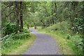
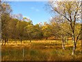
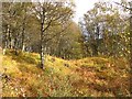
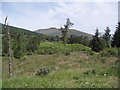
Nearby Images from Geograph Britain and Ireland:
©2015(licence)
©2011(licence)
©2011(licence)
©2006(licence)
©2011(licence)
The above images may not be of the site on this page, they are loaded from Geograph.
Please Submit an Image of this site or go out and take one for us!
Click here to see more info for this site
Nearby sites
Key: Red: member's photo, Blue: 3rd party photo, Yellow: other image, Green: no photo - please go there and take one, Grey: site destroyed
Download sites to:
KML (Google Earth)
GPX (GPS waypoints)
CSV (Garmin/Navman)
CSV (Excel)
To unlock full downloads you need to sign up as a Contributory Member. Otherwise downloads are limited to 50 sites.
Turn off the page maps and other distractions
Nearby sites listing. In the following links * = Image available
1.7km NE 44° Craggan* Rock Art (NN58752307)
2.1km SSW 212° Balquhidder* Modern Stone Circle etc (NN563201)
3.1km WSW 250° Wester Auchleskine (Balquidder) Rock Art (NN5458420876)
3.1km WSW 249° Clach nan Sul (Balquhidder)* Rock Art (NN54562084)
3.4km WSW 252° Basan an Sagairt* Rock Art (NN54192089)
3.6km WSW 251° Puidrac Standing Stone* Standing Stone (Menhir) (NN54062079)
3.8km WSW 251° Clachan Aoraidh* Stone Circle (NN5388920759)
8.3km WSW 251° Bealach Driseach* Modern Stone Circle etc (NN49511940)
8.4km NNW 342° Mid Lix (Killin) Rock Art (NN55132987)
9.8km N 350° Acharn Standing Stone* Standing Stone (Menhir) (NN56143160)
10.7km N 357° Innis Bhuidhe* Stone Fort or Dun (NN57223255)
10.9km N 359° Kinnell* Stone Circle (NN5770032803)
11.2km N 356° Fingal's Stone* Standing Stone (Menhir) (NN5712933021)
12.1km N 11° Firbush Point (Killin) Hillfort (NN602337)
12.9km N 4° Tir Artair Standing Stone (Killin) Standing Stone (Menhir) (NN5887034720)
13.0km E 80° St Fillan's Chapel (Comrie)* Ancient Cross (NN7038323579)
13.0km ENE 78° Little Port* Standing Stone (Menhir) (NN70342415)
13.0km N 5° Tir Artair 1 (Killin) Rock Art (NN5906334807)
13.1km NNE 20° Creag Ard* Rock Art (NN6250433969)
13.1km NNW 343° Murlaganmore (Killin) Rock Art (NN54023455)
13.2km NNW 342° Murlaganmore 2 (Killin) Rock Art (NN53953455)
13.3km E 82° St Fillan's Well (Comrie) Holy Well or Sacred Spring (NN70802327)
13.3km E 82° St Fillan's Chair (Dundurn) Natural Stone / Erratic / Other Natural Feature (NN70812325)
13.3km NNW 344° Murlaganmore Footprint (Killin) Sculptured Stone (NN54323483)
13.5km SSE 152° Druim Mor (Callander)* Standing Stone (Menhir) (NN6354209721)
View more nearby sites and additional images


 We would like to know more about this location. Please feel free to add a brief description and any relevant information in your own language.
 Wir möchten mehr über diese Stätte erfahren. Bitte zögern Sie nicht, eine kurze Beschreibung und relevante Informationen in Deutsch hinzuzufügen.
 Nous aimerions en savoir encore un peu sur les lieux. S'il vous plaît n'hesitez pas à ajouter une courte description et tous les renseignements pertinents dans votre propre langue.
 Quisieramos informarnos un poco más de las lugares. No dude en añadir una breve descripción y otros datos relevantes en su propio idioma.