<< Text Pages >> Cwm Mawr - Stone Circle in Wales in Gwynedd
Submitted by TimPrevett on Tuesday, 24 September 2002 Page Views: 11555
Neolithic and Bronze AgeSite Name: Cwm MawrCountry: Wales County: Gwynedd Type: Stone Circle
Map Ref: SH553414 Landranger Map Number: 124
Latitude: 52.950410N Longitude: 4.155205W
Condition:
| 5 | Perfect |
| 4 | Almost Perfect |
| 3 | Reasonable but with some damage |
| 2 | Ruined but still recognisable as an ancient site |
| 1 | Pretty much destroyed, possibly visible as crop marks |
| 0 | No data. |
| -1 | Completely destroyed |
| 5 | Superb |
| 4 | Good |
| 3 | Ordinary |
| 2 | Not Good |
| 1 | Awful |
| 0 | No data. |
| 5 | Can be driven to, probably with disabled access |
| 4 | Short walk on a footpath |
| 3 | Requiring a bit more of a walk |
| 2 | A long walk |
| 1 | In the middle of nowhere, a nightmare to find |
| 0 | No data. |
| 5 | co-ordinates taken by GPS or official recorded co-ordinates |
| 4 | co-ordinates scaled from a detailed map |
| 3 | co-ordinates scaled from a bad map |
| 2 | co-ordinates of the nearest village |
| 1 | co-ordinates of the nearest town |
| 0 | no data |
Internal Links:
External Links:
Stone Circle in Gwynedd
According to Burl this circle, located a mile from the one at Cefn Coch, was blown up some time ago!
You may be viewing yesterday's version of this page. To see the most up to date information please register for a free account.
")
Do not use the above information on other web sites or publications without permission of the contributor.
Nearby Images from Geograph Britain and Ireland:
©2011(licence)
©2006(licence)
©2006(licence)
©2005(licence)
©2011(licence)
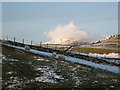
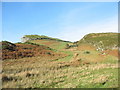
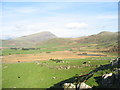
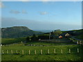
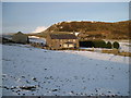
The above images may not be of the site on this page, they are loaded from Geograph.
Please Submit an Image of this site or go out and take one for us!
Click here to see more info for this site
Nearby sites
Key: Red: member's photo, Blue: 3rd party photo, Yellow: other image, Green: no photo - please go there and take one, Grey: site destroyed
Download sites to:
KML (Google Earth)
GPX (GPS waypoints)
CSV (Garmin/Navman)
CSV (Excel)
To unlock full downloads you need to sign up as a Contributory Member. Otherwise downloads are limited to 50 sites.
Turn off the page maps and other distractions
Nearby sites listing. In the following links * = Image available
402m W 261° Cwm Mawr Hut Group Ancient Village or Settlement (SH54904135)
411m WSW 254° Hut Group West of Cwm Mawr Ancient Village or Settlement (SH549413)
582m WSW 237° Cairns east of Graig Y Gesail* Cairn (SH548411)
606m W 259° Hut Circle near Graig Y Gesail* Ancient Village or Settlement (SH547413)
632m SSW 197° Hut circles west of Allt Wen* Ancient Village or Settlement (SH551408)
800m N 360° Cerrig Cae-glan-yr-afon* Marker Stone (SH55324220)
1.0km NNW 340° Cae Glan Yr Afon Stone Feature* Modern Stone Circle etc (SH5498142368)
1.4km NNW 337° Cefn Coch (Gwynedd)* Stone Circle (SH548427)
1.4km NNW 342° Meini Herion Stone* Standing Stone (Menhir) (SH54914276)
1.5km ENE 76° Hendre Seler Hut Circle* Ancient Village or Settlement (SH5680041730)
1.6km E 98° Fach Goch* Standing Stone (Menhir) (SH56844115)
1.7km NE 45° Llyn Du Hut Circle 2* Ancient Village or Settlement (SH5657342584)
1.7km NE 45° Llyn Du Hut Circle 1* Ancient Village or Settlement (SH5656842599)
1.8km NE 40° Cae'r Eithin Tew Hut Circle* Ancient Village or Settlement (SH5649042750)
2.0km NNE 20° Ynys-Wen Settlement* Ancient Village or Settlement (SH56054327)
2.0km NE 45° Pant Engan Hut Circle* Ancient Village or Settlement (SH5677642807)
2.1km NNE 27° Beudy Caeau Gwynion Stones* Standing Stones (SH5630043208)
2.2km SE 142° Porthmadog Eisteddfod Stone Circle* Modern Stone Circle etc (SH56583966)
2.3km S 181° Hut Circle North of Moel Y Gest* Ancient Village or Settlement (SH552391)
2.4km NNE 30° Ynys Wen Hut Circle 2* Ancient Village or Settlement (SH5655243395)
2.4km NNE 31° Ynys Wen Hut Circle 1* Ancient Village or Settlement (SH5656243391)
2.4km NNE 28° Ynys Wen Hut Circle 3* Ancient Village or Settlement (SH5650543497)
2.5km S 187° Moel Y Gest Hillfort* Hillfort (SH549389)
2.7km S 191° Hut Circle West of Moel Y Gest Ancient Village or Settlement (SH547388)
2.8km NNE 26° Ynys Wen Hut Circle 5* Ancient Village or Settlement (SH5664043895)
View more nearby sites and additional images


 We would like to know more about this location. Please feel free to add a brief description and any relevant information in your own language.
 Wir möchten mehr über diese Stätte erfahren. Bitte zögern Sie nicht, eine kurze Beschreibung und relevante Informationen in Deutsch hinzuzufügen.
 Nous aimerions en savoir encore un peu sur les lieux. S'il vous plaît n'hesitez pas à ajouter une courte description et tous les renseignements pertinents dans votre propre langue.
 Quisieramos informarnos un poco más de las lugares. No dude en añadir una breve descripción y otros datos relevantes en su propio idioma.