<< Our Photo Pages >> Gaer Penrhôs - Ancient Village or Settlement in Wales in Ceredigion
Submitted by Hayden on Saturday, 25 December 2021 Page Views: 1365
Medieval (High and Late)Site Name: Gaer Penrhôs Alternative Name: Caer PenrhosCountry: Wales County: Ceredigion Type: Ancient Village or Settlement
Nearest Town: Aberaeron Nearest Village: Llanrhystud
Map Ref: SN5520569555
Latitude: 52.304969N Longitude: 4.125103W
Condition:
| 5 | Perfect |
| 4 | Almost Perfect |
| 3 | Reasonable but with some damage |
| 2 | Ruined but still recognisable as an ancient site |
| 1 | Pretty much destroyed, possibly visible as crop marks |
| 0 | No data. |
| -1 | Completely destroyed |
| 5 | Superb |
| 4 | Good |
| 3 | Ordinary |
| 2 | Not Good |
| 1 | Awful |
| 0 | No data. |
| 5 | Can be driven to, probably with disabled access |
| 4 | Short walk on a footpath |
| 3 | Requiring a bit more of a walk |
| 2 | A long walk |
| 1 | In the middle of nowhere, a nightmare to find |
| 0 | No data. |
| 5 | co-ordinates taken by GPS or official recorded co-ordinates |
| 4 | co-ordinates scaled from a detailed map |
| 3 | co-ordinates scaled from a bad map |
| 2 | co-ordinates of the nearest village |
| 1 | co-ordinates of the nearest town |
| 0 | no data |
Internal Links:
External Links:
I have visited· I would like to visit
Hayden visited on 16th Apr 2021 - their rating: Cond: 2 Amb: 4 Access: 3
")
According to the Royal Commission on the Ancient and Historical Monuments of Wales, a ring motte was first erected by Richard de la Mare in around 1110; just six years later it was captured by Gruffydd ap Rhys, and destroyed by Cadwaladr ap Gruffydd in 1136, who built a new castle on basically the same site in 1149. In 1150, a dispute between Cadwaladr's brother Owain Gwynedd and his nephew Hywel ab Owain Gwynedd, Owain's son, erupted and Hywel seized Gaer Penrhôs for himself. Hywel was only able to retain control of the castle for a year, losing it to Rhys ap Gruffydd and his brothers. The castle hadn't seen the last of Hywel, however; he returned some months later, where he slaughtered the castle's garrison and destroyed its timber defenses.
In 1158 what appears to be a new structure was captured by Normans, but that was likely burned to the ground again when Rhys returned later to scourge every English-controlled castle in Ceredigion.
This site is certainly one of the most impressive of the area. Its size and history are both a thing to behold.
You may be viewing yesterday's version of this page. To see the most up to date information please register for a free account.
")
")
Do not use the above information on other web sites or publications without permission of the contributor.
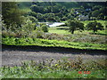
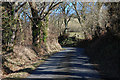
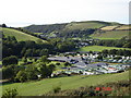
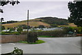
Nearby Images from Geograph Britain and Ireland:
©2008(licence)
©2010(licence)
©2007(licence)

©2010(licence)
©2014(licence)
The above images may not be of the site on this page, they are loaded from Geograph.
Please Submit an Image of this site or go out and take one for us!
Click here to see more info for this site
Nearby sites
Key: Red: member's photo, Blue: 3rd party photo, Yellow: other image, Green: no photo - please go there and take one, Grey: site destroyed
Download sites to:
KML (Google Earth)
GPX (GPS waypoints)
CSV (Garmin/Navman)
CSV (Excel)
To unlock full downloads you need to sign up as a Contributory Member. Otherwise downloads are limited to 50 sites.
Turn off the page maps and other distractions
Nearby sites listing. In the following links * = Image available
851m NE 53° Gaer (Gilfachafael)* Ancient Village or Settlement (SN55907005)
1.1km WSW 255° Y Foel Promontory Fort * Promontory Fort / Cliff Castle (SN5418069310)
1.5km WSW 241° Castell Bach (Llanrhystud)* Hillfort (SN5388068870)
1.5km WSW 247° Pentre-isaf Misc. Earthwork (SN5377069010)
1.7km WSW 237° Castell Mawr (Llanrhystud) Hillfort (SN5373068660)
1.9km W 273° Pengarreg Defended Enclosure Hillfort (SN5333069710)
4.0km N 1° Pen Glog* Cairn (SN554736)
4.6km ENE 76° The Dominicus Stone Early Christian Sculptured Stone (SN597705)
4.8km S 190° Llech Gron* Standing Stone (Menhir) (SN5424664851)
5.7km SW 233° Llanon Defended Enclosure* Ancient Village or Settlement (SN5051066250)
7.8km E 96° Ty n-yr-eithin* Cairn (SN630685)
8.4km NE 43° Castell Pantmawr Hillfort (SN611756)
9.2km SW 217° Castell Dinerth* Promontory Fort / Cliff Castle (SN4949062370)
9.2km NE 56° Llanilar Hillfort (SN62997454)
9.3km NE 55° Pen-Y-Castell Enclosure Ancient Village or Settlement (SN62997468)
9.7km S 184° Trichrug cairns* Round Cairn (SN542599)
9.8km SW 229° St David's Church Hillfort* Hillfort (SN4761063370)
9.8km ENE 75° Gaer Fawr (Lledrod)* Hillfort (SN648718)
10.0km NNE 18° Castell Tan Y Bwlch Castle* Promontory Fort / Cliff Castle (SN5851079000)
10.9km S 191° Castell Perthi-mawr* Hillfort (SN528589)
11.1km NNE 15° Pen Dinas (Aberystwyth)* Hillfort (SN5842080211)
11.3km NNE 32° Old Warren Hill Hillfort (SN615789)
11.3km SW 230° Tyn-y-coed the Second Well* Holy Well or Sacred Spring (SN4626462558)
11.3km SW 230° Tyn-y-coed Well* Holy Well or Sacred Spring (SN4626062559)
11.5km SSE 166° Pen-Y-Gaer (Nantcwnlle)* Hillfort (SN57735833)
View more nearby sites and additional images


 We would like to know more about this location. Please feel free to add a brief description and any relevant information in your own language.
 Wir möchten mehr über diese Stätte erfahren. Bitte zögern Sie nicht, eine kurze Beschreibung und relevante Informationen in Deutsch hinzuzufügen.
 Nous aimerions en savoir encore un peu sur les lieux. S'il vous plaît n'hesitez pas à ajouter une courte description et tous les renseignements pertinents dans votre propre langue.
 Quisieramos informarnos un poco más de las lugares. No dude en añadir una breve descripción y otros datos relevantes en su propio idioma.