<< Our Photo Pages >> Cairnharrow Cup & Ring Marked Stone - Rock Art in Scotland in Dumfries and Galloway
Submitted by markj99 on Tuesday, 13 November 2018 Page Views: 1997
Rock ArtSite Name: Cairnharrow Cup & Ring Marked StoneCountry: Scotland County: Dumfries and Galloway Type: Rock Art
Nearest Town: Gatehouse of Fleet Nearest Village: Anwoth
Map Ref: NX54005684
Latitude: 54.884923N Longitude: 4.277526W
Condition:
| 5 | Perfect |
| 4 | Almost Perfect |
| 3 | Reasonable but with some damage |
| 2 | Ruined but still recognisable as an ancient site |
| 1 | Pretty much destroyed, possibly visible as crop marks |
| 0 | No data. |
| -1 | Completely destroyed |
| 5 | Superb |
| 4 | Good |
| 3 | Ordinary |
| 2 | Not Good |
| 1 | Awful |
| 0 | No data. |
| 5 | Can be driven to, probably with disabled access |
| 4 | Short walk on a footpath |
| 3 | Requiring a bit more of a walk |
| 2 | A long walk |
| 1 | In the middle of nowhere, a nightmare to find |
| 0 | No data. |
| 5 | co-ordinates taken by GPS or official recorded co-ordinates |
| 4 | co-ordinates scaled from a detailed map |
| 3 | co-ordinates scaled from a bad map |
| 2 | co-ordinates of the nearest village |
| 1 | co-ordinates of the nearest town |
| 0 | no data |
Internal Links:
External Links:
")
This stone is listed as Canmore ID 63668.
It is a moss covered stone with a large worn ring mark and several cup marks visible in its current state. Canmore lists more ring marks but I didn't remove the moss to look for them.
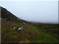
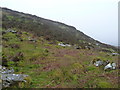
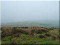
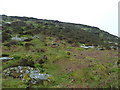
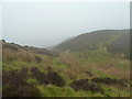
Access to the site is by climbing up the slope of Cairnharrow for about 0.5 mile across rough ground or by a longer detour from Cambret Hill.
You may be viewing yesterday's version of this page. To see the most up to date information please register for a free account.
")
")
Do not use the above information on other web sites or publications without permission of the contributor.
Nearby Images from Geograph Britain and Ireland:
©2011(licence)
©2011(licence)
©2011(licence)
©2011(licence)
©2011(licence)
The above images may not be of the site on this page, they are loaded from Geograph.
Please Submit an Image of this site or go out and take one for us!
Click here to see more info for this site
Nearby sites
Key: Red: member's photo, Blue: 3rd party photo, Yellow: other image, Green: no photo - please go there and take one, Grey: site destroyed
Download sites to:
KML (Google Earth)
GPX (GPS waypoints)
CSV (Garmin/Navman)
CSV (Excel)
To unlock full downloads you need to sign up as a Contributory Member. Otherwise downloads are limited to 50 sites.
Turn off the page maps and other distractions
Nearby sites listing. In the following links * = Image available
996m SW 220° Cairnharrow Summit* Cairn (NX53335610)
1.1km WNW 283° Cauldside Burn Stone Circle* Stone Circle (NX52955711)
1.1km WNW 284° Caulside Burn Cairn South* Cairn (NX52945714)
1.2km WNW 287° Caulside Burn Stone Setting Stone Row / Alignment (NX52915722)
1.2km WNW 289° Caulside Burn Cairn North* Cairn (NX52905725)
1.3km WNW 293° Penny Stone (Cambret Moor)* Rock Art (NX52855738)
1.3km WNW 295° Cambret Moor Cairn* Cairn (NX52815744)
2.2km ESE 110° Lady's Well (Anwoth) Holy Well or Sacred Spring (NX5608356025)
2.4km WSW 248° Claughreid* Stone Circle (NX5177356005)
2.5km SE 125° Mill Knock Standing Stones* Standing Stones (NX5597855343)
2.6km SE 125° Lagganmullan 3* Rock Art (NX56125528)
2.7km SE 127° Lagganmullan 4* Rock Art (NX56095516)
2.8km SW 227° Cairnholy 6* Rock Art (NX51855496)
3.0km NW 304° Glenquicken Stone* Standing Stone (Menhir) (NX51575858)
3.0km SW 226° Cairnholy 7* Rock Art (NX51765484)
3.0km SE 124° Lagganmullan 9* Rock Art (NX56465504)
3.1km SE 124° Lagganmullan 8* Rock Art (NX56475503)
3.1km SE 127° Stone Triangle (Lagganmullan)* Modern Stone Circle etc (NX5641154896)
3.1km SW 228° Cairnholy 5* Rock Art (NX51615480)
3.2km SW 216° Cairnholy 3* Rock Art (NX52005428)
3.3km SW 226° Cairnholy 14* Rock Art (NX5155554633)
3.3km SW 226° Cairnholy 11* Rock Art (NX5155154631)
3.3km SW 226° Cairnholy 4* Rock Art (NX51555463)
3.3km SW 226° Cairnholy 12* Rock Art (NX5155054630)
3.3km WNW 292° Glenquicken Circle* Stone Circle (NX50965821)
View more nearby sites and additional images


 We would like to know more about this location. Please feel free to add a brief description and any relevant information in your own language.
 Wir möchten mehr über diese Stätte erfahren. Bitte zögern Sie nicht, eine kurze Beschreibung und relevante Informationen in Deutsch hinzuzufügen.
 Nous aimerions en savoir encore un peu sur les lieux. S'il vous plaît n'hesitez pas à ajouter une courte description et tous les renseignements pertinents dans votre propre langue.
 Quisieramos informarnos un poco más de las lugares. No dude en añadir una breve descripción y otros datos relevantes en su propio idioma.