<< Text Pages >> Castle Spynie - Broch or Nuraghe in Scotland in Highlands
Submitted by SolarMegalith on Sunday, 27 March 2011 Page Views: 6055
Iron Age and Later PrehistorySite Name: Castle Spynie Alternative Name: LeanachCountry: Scotland
NOTE: This site is 0.239 km away from the location you searched for.
County: Highlands Type: Broch or Nuraghe
Nearest Town: Inverness
Map Ref: NH54144204
Latitude: 57.445166N Longitude: 4.432048W
Condition:
| 5 | Perfect |
| 4 | Almost Perfect |
| 3 | Reasonable but with some damage |
| 2 | Ruined but still recognisable as an ancient site |
| 1 | Pretty much destroyed, possibly visible as crop marks |
| 0 | No data. |
| -1 | Completely destroyed |
| 5 | Superb |
| 4 | Good |
| 3 | Ordinary |
| 2 | Not Good |
| 1 | Awful |
| 0 | No data. |
| 5 | Can be driven to, probably with disabled access |
| 4 | Short walk on a footpath |
| 3 | Requiring a bit more of a walk |
| 2 | A long walk |
| 1 | In the middle of nowhere, a nightmare to find |
| 0 | No data. |
| 5 | co-ordinates taken by GPS or official recorded co-ordinates |
| 4 | co-ordinates scaled from a detailed map |
| 3 | co-ordinates scaled from a bad map |
| 2 | co-ordinates of the nearest village |
| 1 | co-ordinates of the nearest town |
| 0 | no data |
Internal Links:
External Links:
Broch in Highlands
Remains of a broch of 19 m diameter located on a broch on a rocky knoll. It has been also interpreted as a dun.
Read More at ScotlandsPlaces.
You may be viewing yesterday's version of this page. To see the most up to date information please register for a free account.
Do not use the above information on other web sites or publications without permission of the contributor.
Nearby Images from Geograph Britain and Ireland:
©2012(licence)
©2011(licence)
©2020(licence)
©2020(licence)
©2022(licence)
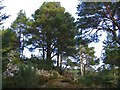
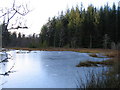
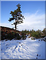
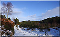
The above images may not be of the site on this page, they are loaded from Geograph.
Please Submit an Image of this site or go out and take one for us!
Click here to see more info for this site
Nearby sites
Key: Red: member's photo, Blue: 3rd party photo, Yellow: other image, Green: no photo - please go there and take one, Grey: site destroyed
Download sites to:
KML (Google Earth)
GPX (GPS waypoints)
CSV (Garmin/Navman)
CSV (Excel)
To unlock full downloads you need to sign up as a Contributory Member. Otherwise downloads are limited to 50 sites.
Turn off the page maps and other distractions
Nearby sites listing. In the following links * = Image available
1.8km NNE 32° Balblair Class I Pictish Symbol Stone (NH55184357)
2.4km NE 45° Giant's Grave (Highlands) Chambered Cairn (NH55904369)
2.4km SW 225° Allt Eoghainn* Chambered Tomb (NH5236240392)
2.6km WSW 258° Belladrum South Chambered Tomb (NH5161041578)
2.6km WSW 249° Meg's Stone* Standing Stone (Menhir) (NH5164541196)
2.7km W 270° Belladrum Chambered Cairn* Chambered Cairn (NH5141742120)
4.2km W 260° Bruiach* Cairn (NH49984143)
4.5km W 266° Beaufort Cottages Cairn* Cairn (NH49654188)
4.6km WNW 300° Ballblair Wood Chambered Cairn (NH502445)
5.0km W 265° Culburnie* Stone Circle (NH491418)
5.4km WSW 240° Boblainy* Stone Circle (NH49343951)
6.2km NNW 348° Windhill* Standing Stones (NH531482)
7.7km N 4° Tarradale* Chambered Tomb (NH549497)
7.8km NNW 347° Muir of Ord Henge* Henge (NH527497)
8.1km E 79° Ladystone Farm* Stone Row / Alignment (NH62204330)
8.5km SE 135° Aldourie* Ring Cairn (NH59993587)
8.5km ESE 109° Kinchyle Of Dores* Stone Circle (NH62153898)
9.0km ENE 74° Leachkin* Chambered Cairn (NH62964416)
9.8km NW 320° Cnoc Udais Cairn* Cairn (NH48154984)
9.9km NNE 15° Kilcoy South* Chambered Tomb (NH570515)
9.9km N 357° Balvaird Chambered Cairn (NH53945193)
10.1km NNE 14° Kilcoy North Chambered Tomb (NH570517)
10.3km ENE 70° Craig Phadraig* Vitrified Fort (NH640452)
10.3km E 97° Torbreck* Stone Circle (NH64384039)
10.4km N 0° Muir of Conan Chambered Cairn (NH546524)
View more nearby sites and additional images


 We would like to know more about this location. Please feel free to add a brief description and any relevant information in your own language.
 Wir möchten mehr über diese Stätte erfahren. Bitte zögern Sie nicht, eine kurze Beschreibung und relevante Informationen in Deutsch hinzuzufügen.
 Nous aimerions en savoir encore un peu sur les lieux. S'il vous plaît n'hesitez pas à ajouter une courte description et tous les renseignements pertinents dans votre propre langue.
 Quisieramos informarnos un poco más de las lugares. No dude en añadir una breve descripción y otros datos relevantes en su propio idioma.