<< Our Photo Pages >> Boblainy - Stone Circle in Scotland in Highlands
Submitted by enkidu41 on Tuesday, 09 July 2002 Page Views: 8746
Neolithic and Bronze AgeSite Name: BoblainyCountry: Scotland County: Highlands Type: Stone Circle
Map Ref: NH49343951 Landranger Map Number: 26
Latitude: 57.420894N Longitude: 4.510386W
Condition:
| 5 | Perfect |
| 4 | Almost Perfect |
| 3 | Reasonable but with some damage |
| 2 | Ruined but still recognisable as an ancient site |
| 1 | Pretty much destroyed, possibly visible as crop marks |
| 0 | No data. |
| -1 | Completely destroyed |
| 5 | Superb |
| 4 | Good |
| 3 | Ordinary |
| 2 | Not Good |
| 1 | Awful |
| 0 | No data. |
| 5 | Can be driven to, probably with disabled access |
| 4 | Short walk on a footpath |
| 3 | Requiring a bit more of a walk |
| 2 | A long walk |
| 1 | In the middle of nowhere, a nightmare to find |
| 0 | No data. |
| 5 | co-ordinates taken by GPS or official recorded co-ordinates |
| 4 | co-ordinates scaled from a detailed map |
| 3 | co-ordinates scaled from a bad map |
| 2 | co-ordinates of the nearest village |
| 1 | co-ordinates of the nearest town |
| 0 | no data |
Be the first person to rate this site - see the 'Contribute!' box in the right hand menu.
Internal Links:
External Links:
I have visited· I would like to visit
tom_bullock has visited here
")
You may be viewing yesterday's version of this page. To see the most up to date information please register for a free account.
Do not use the above information on other web sites or publications without permission of the contributor.
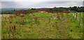
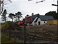
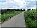
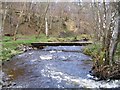
Nearby Images from Geograph Britain and Ireland:
©2012(licence)
©2008(licence)
©2021(licence)
©2012(licence)
©2022(licence)
The above images may not be of the site on this page, they are loaded from Geograph.
Please Submit an Image of this site or go out and take one for us!
Click here to see more info for this site
Nearby sites
Key: Red: member's photo, Blue: 3rd party photo, Yellow: other image, Green: no photo - please go there and take one, Grey: site destroyed
Download sites to:
KML (Google Earth)
GPX (GPS waypoints)
CSV (Garmin/Navman)
CSV (Excel)
To unlock full downloads you need to sign up as a Contributory Member. Otherwise downloads are limited to 50 sites.
Turn off the page maps and other distractions
Nearby sites listing. In the following links * = Image available
2.0km NNE 16° Bruiach* Cairn (NH49984143)
2.3km N 352° Culburnie* Stone Circle (NH491418)
2.8km NE 52° Meg's Stone* Standing Stone (Menhir) (NH5164541196)
3.1km NE 45° Belladrum South Chambered Tomb (NH5161041578)
3.1km ENE 72° Allt Eoghainn* Chambered Tomb (NH5236240392)
3.3km NE 36° Belladrum Chambered Cairn* Chambered Cairn (NH5141742120)
5.1km N 8° Ballblair Wood Chambered Cairn (NH502445)
5.4km ENE 60° Castle Spynie Broch or Nuraghe (NH54144204)
7.1km NE 53° Balblair Class I Pictish Symbol Stone (NH55184357)
7.8km NE 55° Giant's Grave (Highlands) Chambered Cairn (NH55904369)
8.0km S 177° Carn Daley* Clava Cairn (NH4945431458)
8.0km S 177° Clachmhor, Culnakirk* Rock Art (NH49443145)
9.5km NNE 21° Windhill* Standing Stones (NH531482)
9.7km W 269° Dun Coille Struy Broch or Nuraghe (NH39643976)
10.2km SSE 157° Holy Well (Drumnadrochit)* Holy Well or Sacred Spring (NH530300)
10.4km N 351° Cnoc Udais Cairn* Cairn (NH48154984)
10.7km NNE 16° Muir of Ord Henge* Henge (NH527497)
11.2km ESE 107° Aldourie* Ring Cairn (NH59993587)
11.6km NNE 26° Tarradale* Chambered Tomb (NH549497)
12.7km SW 226° Buntait Cup Marked Stone* Rock Art (NH39793102)
12.8km E 90° Kinchyle Of Dores* Stone Circle (NH62153898)
13.1km WSW 247° St Ignatius' Well* Holy Well or Sacred Spring (NH3709934761)
13.2km NNE 18° Balvaird Chambered Cairn (NH53945193)
13.4km ENE 71° Ladystone Farm* Stone Row / Alignment (NH62204330)
13.5km SW 229° Curadan's Well* Holy Well or Sacred Spring (NH38753102)
View more nearby sites and additional images


 We would like to know more about this location. Please feel free to add a brief description and any relevant information in your own language.
 Wir möchten mehr über diese Stätte erfahren. Bitte zögern Sie nicht, eine kurze Beschreibung und relevante Informationen in Deutsch hinzuzufügen.
 Nous aimerions en savoir encore un peu sur les lieux. S'il vous plaît n'hesitez pas à ajouter une courte description et tous les renseignements pertinents dans votre propre langue.
 Quisieramos informarnos un poco más de las lugares. No dude en añadir una breve descripción y otros datos relevantes en su propio idioma.