<< Text Pages >> Boulder near Creag Dhearg - Natural Stone / Erratic / Other Natural Feature in Scotland in Highlands
Submitted by coldrum on Sunday, 12 April 2009 Page Views: 6011
Natural PlacesSite Name: Boulder near Creag DheargCountry: Scotland
NOTE: This site is 7.7 km away from the location you searched for.
County: Highlands Type: Natural Stone / Erratic / Other Natural Feature
Nearest Town: Inverness Nearest Village: Invermoriston
Map Ref: NH456215
Latitude: 57.258022N Longitude: 4.561311W
Condition:
| 5 | Perfect |
| 4 | Almost Perfect |
| 3 | Reasonable but with some damage |
| 2 | Ruined but still recognisable as an ancient site |
| 1 | Pretty much destroyed, possibly visible as crop marks |
| 0 | No data. |
| -1 | Completely destroyed |
| 5 | Superb |
| 4 | Good |
| 3 | Ordinary |
| 2 | Not Good |
| 1 | Awful |
| 0 | No data. |
| 5 | Can be driven to, probably with disabled access |
| 4 | Short walk on a footpath |
| 3 | Requiring a bit more of a walk |
| 2 | A long walk |
| 1 | In the middle of nowhere, a nightmare to find |
| 0 | No data. |
| 5 | co-ordinates taken by GPS or official recorded co-ordinates |
| 4 | co-ordinates scaled from a detailed map |
| 3 | co-ordinates scaled from a bad map |
| 2 | co-ordinates of the nearest village |
| 1 | co-ordinates of the nearest town |
| 0 | no data |
Internal Links:
External Links:
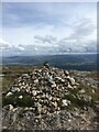
Natural Stone in the Highlands. Boulder could have been a calendar – 5000 years ago. An amateur archaeologist believes a giant boulder on a hill overlooking Loch Ness was used as a guide for crop sowing and harvesting by residents of in the Great Glen more than 5000 years ago.
John Forsyth, who lives in Lower Foyers and describes himself as a natural naturalist, is convinced the five-metre wide rock, which he can see on the horizon opposite his home, was intentionally placed there by early man.
The 76-year-old — who was voted a corresponding member of the Society of Antiquaries of Scotland for services to archaeology — believes the boulder was positioned and sculpted so people could use it as a marker against the sun to signal when their crops should be planted in spring and harvested in autumn.
He believes a community lived to the east of the boulder, which is between Creag Dhearg and Meall Fuar-Mhonaidh, and used the setting of the sun to establish the spring and autumn equinoxes — when day and night is roughly the same length.
As part of his research, Mr Forsyth used a global positioning system to locate another rock behind his home which lies directly east of the boulder and has the same latitude, suggesting an alignment which he thinks is deliberate.
The retired geography teacher spent the spring equinox — Friday 20th March — photographing the sun setting to ensure his calculations were accurate.
"It was very exciting but I was lucky because there are only two days in the year I could do it and luckily there wasn't a cloud in the sky," he said.
"I was waiting with bated breath and started getting very tense and uptight when the sun started coming down.
"When it started to disappear behind the hill it came right down perfectly on top of the boulder. I was delighted!"
Mr Forsyth takes a keen interest in archaeology and believes the boulder was last moved at around the same time as the Callanish Standing Stones on Lewis and the structures at Stonehenge were erected.
John Forsyth checks his findings ahead of the last week's spring equinox.
"I'm very confident it's from that time because the boulder is firmly embedded in peat and there is lichen on its surface," he said.
How the people of the time managed to put the boulder there is another question, admitted Mr Forsyth, who is confident of his findings, despite another school of thought that markers were also used by man in an attempt to find out more about the sun, moon and stars.
Highland Council archaeologist Kirsty Cameron was interested to learn of the theory.
"People who were living in that time had a very good use of astronomy," she said.
"We encourage people to contact us about sites of possible interest but establishing a time for this is hard to prove and because it's a stone, it can't be excavated. I would be keen to find out more about it."
Source, with photos: Inverness Courier.
You may be viewing yesterday's version of this page. To see the most up to date information please register for a free account.
Do not use the above information on other web sites or publications without permission of the contributor.
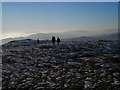
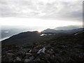
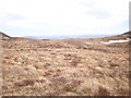
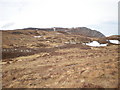
Nearby Images from Geograph Britain and Ireland:
©2009(licence)
©2008(licence)
©2010(licence)
©2010(licence)
©2021(licence)
The above images may not be of the site on this page, they are loaded from Geograph.
Please Submit an Image of this site or go out and take one for us!
Click here to see more info for this site
Nearby sites
Key: Red: member's photo, Blue: 3rd party photo, Yellow: other image, Green: no photo - please go there and take one, Grey: site destroyed
Download sites to:
KML (Google Earth)
GPX (GPS waypoints)
CSV (Garmin/Navman)
CSV (Excel)
To unlock full downloads you need to sign up as a Contributory Member. Otherwise downloads are limited to 50 sites.
Turn off the page maps and other distractions
Nearby sites listing. In the following links * = Image available
10.6km NNE 19° Clachmhor, Culnakirk* Rock Art (NH49443145)
10.7km NNE 19° Carn Daley* Clava Cairn (NH4945431458)
11.1km NNW 327° Buntait Cup Marked Stone* Rock Art (NH39793102)
11.2km NE 39° Holy Well (Drumnadrochit)* Holy Well or Sacred Spring (NH530300)
11.4km NW 318° Corrimony* Clava Cairn (NH38303029)
11.4km NW 319° Corrimony mound Artificial Mound (NH38383038)
11.7km NW 322° Curadan's Well* Holy Well or Sacred Spring (NH38753102)
11.8km NW 315° Mony's Stone* Standing Stone (Menhir) (NH3751530072)
13.3km SSW 210° Cherry Island* Crannog (NH385102)
15.7km NW 325° St Ignatius' Well* Holy Well or Sacred Spring (NH3709934761)
16.1km NW 304° Comar Wood* Stone Fort or Dun (NH3250931008)
18.4km N 10° Boblainy* Stone Circle (NH49343951)
19.2km NNW 340° Dun Coille Struy Broch or Nuraghe (NH39643976)
19.4km ENE 72° Dhuallow Clava Cairn (NH644267)
19.9km NE 54° West Town* Chambered Cairn (NH62173258)
20.0km NNE 18° Allt Eoghainn* Chambered Tomb (NH5236240392)
20.3km NE 43° Aldourie* Ring Cairn (NH59993587)
20.4km N 10° Bruiach* Cairn (NH49984143)
20.6km N 8° Culburnie* Stone Circle (NH491418)
20.6km NNE 15° Meg's Stone* Standing Stone (Menhir) (NH5164541196)
20.9km NNE 14° Belladrum South Chambered Tomb (NH5161041578)
21.4km NNE 14° Belladrum Chambered Cairn* Chambered Cairn (NH5141742120)
21.5km ENE 57° Eastertown Cairn* Cairn (NH64203245)
22.2km NNE 20° Castle Spynie Broch or Nuraghe (NH54144204)
23.4km N 9° Ballblair Wood Chambered Cairn (NH502445)
View more nearby sites and additional images


 We would like to know more about this location. Please feel free to add a brief description and any relevant information in your own language.
 Wir möchten mehr über diese Stätte erfahren. Bitte zögern Sie nicht, eine kurze Beschreibung und relevante Informationen in Deutsch hinzuzufügen.
 Nous aimerions en savoir encore un peu sur les lieux. S'il vous plaît n'hesitez pas à ajouter une courte description et tous les renseignements pertinents dans votre propre langue.
 Quisieramos informarnos un poco más de las lugares. No dude en añadir una breve descripción y otros datos relevantes en su propio idioma.