<< Our Photo Pages >> Llanfendigaid Stone - Standing Stone (Menhir) in Wales in Gwynedd
Submitted by DavidHoyle on Thursday, 16 February 2023 Page Views: 773
Neolithic and Bronze AgeSite Name: Llanfendigaid StoneCountry: Wales
NOTE: This site is 1.521 km away from the location you searched for.
County: Gwynedd Type: Standing Stone (Menhir)
Nearest Town: Tywyn Nearest Village: Bryncrug
Map Ref: SH5698705276
Latitude: 52.626350N Longitude: 4.114315W
Condition:
| 5 | Perfect |
| 4 | Almost Perfect |
| 3 | Reasonable but with some damage |
| 2 | Ruined but still recognisable as an ancient site |
| 1 | Pretty much destroyed, possibly visible as crop marks |
| 0 | No data. |
| -1 | Completely destroyed |
| 5 | Superb |
| 4 | Good |
| 3 | Ordinary |
| 2 | Not Good |
| 1 | Awful |
| 0 | No data. |
| 5 | Can be driven to, probably with disabled access |
| 4 | Short walk on a footpath |
| 3 | Requiring a bit more of a walk |
| 2 | A long walk |
| 1 | In the middle of nowhere, a nightmare to find |
| 0 | No data. |
| 5 | co-ordinates taken by GPS or official recorded co-ordinates |
| 4 | co-ordinates scaled from a detailed map |
| 3 | co-ordinates scaled from a bad map |
| 2 | co-ordinates of the nearest village |
| 1 | co-ordinates of the nearest town |
| 0 | no data |
Be the first person to rate this site - see the 'Contribute!' box in the right hand menu.
Internal Links:
External Links:
")
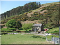
Stone near the corner of the wall from old OS map.
SH5698705276, 52.626352, -4.114322
You may be viewing yesterday's version of this page. To see the most up to date information please register for a free account.
")
")
")
Do not use the above information on other web sites or publications without permission of the contributor.
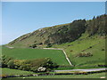
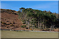
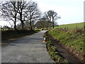
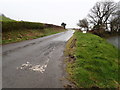
Nearby Images from Geograph Britain and Ireland:
©2012(licence)
©2010(licence)
©2014(licence)
©2019(licence)
©2012(licence)
The above images may not be of the site on this page, they are loaded from Geograph.
Please Submit an Image of this site or go out and take one for us!
Click here to see more info for this site
Nearby sites
Key: Red: member's photo, Blue: 3rd party photo, Yellow: other image, Green: no photo - please go there and take one, Grey: site destroyed
Download sites to:
KML (Google Earth)
GPX (GPS waypoints)
CSV (Garmin/Navman)
CSV (Excel)
To unlock full downloads you need to sign up as a Contributory Member. Otherwise downloads are limited to 50 sites.
Turn off the page maps and other distractions
Nearby sites listing. In the following links * = Image available
1.5km E 94° Fron Eunydd Carreg Wen* Standing Stone (Menhir) (SH5851605111)
1.8km ENE 74° Rhyd y Criw* Standing Stone (Menhir) (SH5868505721)
2.0km SSE 149° Fron Newydd Stone* Standing Stone (Menhir) (SH5797403504)
2.5km E 98° Waun Fach* Standing Stone (Menhir) (SH5944404873)
2.5km ESE 115° Gwyddfryniau* Standing Stones (SH5922204150)
2.6km ESE 112° Gwyddfryniau stone circle* Stone Circle (SH5933704229)
4.3km ENE 58° Hut Circles And Enclosure East of Cae'r Mynach* Ancient Village or Settlement (SH607074)
4.4km NE 56° Circular Enclosure West of Allt Lwyd* Ancient Village or Settlement (SH607076)
4.4km NNE 30° Castell y Gaer* Hillfort (SH593090)
4.4km E 80° Glanmachlas Standing Stones* Standing Stones (SH6132905937)
4.4km ENE 58° Cairn east of Cae'r Mynach* Cairn (SH608075)
4.6km SE 143° Croes Faen* Standing Stone (Menhir) (SH59690154)
4.7km SSE 156° St Cadfan (Tywyn)* Early Christian Sculptured Stone (SH58770094)
4.8km NE 55° Cairn West of Allt Lwyd* Cairn (SH610079)
5.1km ENE 60° Cairn and enclosure south of Allt Lwyd* Cairn (SH615077)
5.2km NE 51° Afon Gwril Cairn* Cairn (SH611084)
5.2km ENE 59° Allt Lwyd Cairn and Ritual Complex* Cairn (SH615078)
5.3km NE 53° Cairn South of Afon Gwril* Cairn (SH613083)
5.4km NE 51° Afon Gwril Hut Circle Settlement* Ancient Village or Settlement (SH613085)
5.5km ENE 76° Tyrgawen* Standing Stone (Menhir) (SH6238106444)
5.9km NNE 30° Gwastadgoed* Standing Stones (SH601103)
6.0km SSE 153° Esguan Stone* Standing Stone (Menhir) (SN5961499839)
6.3km NNE 32° Cefnfeusydd Farm Cairns* Cairn (SH605105)
6.3km ENE 57° Twll Y Darren Round Barrow(s) (SH624086)
7.3km NE 36° Morfa Stone* Standing Stone (Menhir) (SH6144811077)
View more nearby sites and additional images


 We would like to know more about this location. Please feel free to add a brief description and any relevant information in your own language.
 Wir möchten mehr über diese Stätte erfahren. Bitte zögern Sie nicht, eine kurze Beschreibung und relevante Informationen in Deutsch hinzuzufügen.
 Nous aimerions en savoir encore un peu sur les lieux. S'il vous plaît n'hesitez pas à ajouter une courte description et tous les renseignements pertinents dans votre propre langue.
 Quisieramos informarnos un poco más de las lugares. No dude en añadir una breve descripción y otros datos relevantes en su propio idioma.