 with our Megalithic Portal iPhone app")


<< Our Photo Pages >> Devil's Stone, Shebbear - Standing Stone (Menhir) in England in Devon
Submitted by thesabs on Friday, 29 September 2017 Page Views: 20176
Neolithic and Bronze AgeSite Name: Devil's Stone, Shebbear Alternative Name: Devil's Boulder, Devils StoneCountry: England
NOTE: This site is 2.2 km away from the location you searched for.
County: Devon Type: Standing Stone (Menhir)
Nearest Town: Holsworthy Nearest Village: Shebbear
Map Ref: SS43880925 Landranger Map Number: 190
Latitude: 50.861625N Longitude: 4.21972W
Condition:
| 5 | Perfect |
| 4 | Almost Perfect |
| 3 | Reasonable but with some damage |
| 2 | Ruined but still recognisable as an ancient site |
| 1 | Pretty much destroyed, possibly visible as crop marks |
| 0 | No data. |
| -1 | Completely destroyed |
| 5 | Superb |
| 4 | Good |
| 3 | Ordinary |
| 2 | Not Good |
| 1 | Awful |
| 0 | No data. |
| 5 | Can be driven to, probably with disabled access |
| 4 | Short walk on a footpath |
| 3 | Requiring a bit more of a walk |
| 2 | A long walk |
| 1 | In the middle of nowhere, a nightmare to find |
| 0 | No data. |
| 5 | co-ordinates taken by GPS or official recorded co-ordinates |
| 4 | co-ordinates scaled from a detailed map |
| 3 | co-ordinates scaled from a bad map |
| 2 | co-ordinates of the nearest village |
| 1 | co-ordinates of the nearest town |
| 0 | no data |
Internal Links:
External Links:
")
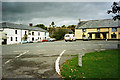
Map ref: SS 4409 Directions: The village can be reached from a series of minor roads off the A388, the A3072 or the A386 from Great Torrington.
Note: Time to turn the Shebbear Devil Stone again, November 5th if you'd like to watch world catastrophe be averted - also archive photos and video, details in the comments on our page
You may be viewing yesterday's version of this page. To see the most up to date information please register for a free account.
")
")
Do not use the above information on other web sites or publications without permission of the contributor.
coldrum has found this location on Google Street View:
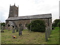
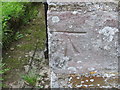
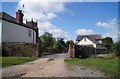
Nearby Images from Geograph Britain and Ireland:
©2011(licence)
©2013(licence)
©2013(licence)
©2014(licence)

©2025(licence)
The above images may not be of the site on this page, they are loaded from Geograph.
Please Submit an Image of this site or go out and take one for us!
Click here to see more info for this site
Nearby sites
Key: Red: member's photo, Blue: 3rd party photo, Yellow: other image, Green: no photo - please go there and take one, Grey: site destroyed
Download sites to:
KML (Google Earth)
GPX (GPS waypoints)
CSV (Garmin/Navman)
CSV (Excel)
To unlock full downloads you need to sign up as a Contributory Member. Otherwise downloads are limited to 50 sites.
Turn off the page maps and other distractions
Nearby sites listing. In the following links * = Image available
3.9km SSW 202° Holemoor Well* Holy Well or Sacred Spring (SS423057)
4.2km NW 314° St Petrock's Well Devon* Holy Well or Sacred Spring (SS4095912219)
7.9km E 79° Heathmoor Barrow* Barrow Cemetery (SS517105)
8.7km SW 223° Hollacombe Cross* Ancient Cross (SS3774603038)
8.7km N 351° Hembury Castle Fort (Tythecott) Hillfort (SS4272117905)
8.9km ESE 111° Hatherleigh St. Mary's Well Holy Well or Sacred Spring (SS5213105847)
9.0km S 174° Halwill Great Barrows* Barrow Cemetery (SS4449200306)
9.8km W 270° High Barrow* Round Barrow(s) (SS3410209563)
9.8km NW 324° Wrangworthy Cross* Barrow Cemetery (SS384174)
9.9km S 185° Halwill Churchyard Cross* Ancient Cross (SX4272799412)
9.9km S 185° Halwill Village Cross* Ancient Cross (SX4275199393)
10.8km WSW 238° Holsworthy St Peter’s Well Holy Well or Sacred Spring (SS345038)
11.3km NNE 22° Coverney Well* Holy Well or Sacred Spring (SS484196)
11.3km NE 46° Castle Hill (Woolleigh Bridge) Ancient Village or Settlement (SS5225916849)
11.4km SSW 206° Sandymoor Cross Tumuli* Barrow Cemetery (SX3849499147)
11.8km W 259° Ugworthy Beacon Barrows* Round Barrow(s) (SS3217607440)
12.3km WNW 291° St Peter's Well (Bradworthy)* Holy Well or Sacred Spring (SS325139)
12.3km SSE 164° Three Barrows, Patchacott* Barrow Cemetery (SX4693097301)
12.3km ESE 112° Hatherleigh St. John's Well* Holy Well or Sacred Spring (SS5523104363)
14.2km NNE 22° Berry Castle (Huntshaw Wood)* Hillfort (SS49502228)
14.4km NE 56° Combe Wood Hillfort (SS561169)
14.9km SW 231° Affaland Moor Bowl Barrow* Round Barrow(s) (SS3196200184)
15.9km NNW 336° Peppercombe Castle Hillfort (SS379240)
16.3km NNW 329° Buck's Mills Fort Promontory Fort / Cliff Castle (SS35892349)
17.4km W 279° Taylors Cross Tumuli* Round Barrow(s) (SS2669012535)
View more nearby sites and additional images


 We would like to know more about this location. Please feel free to add a brief description and any relevant information in your own language.
 Wir möchten mehr über diese Stätte erfahren. Bitte zögern Sie nicht, eine kurze Beschreibung und relevante Informationen in Deutsch hinzuzufügen.
 Nous aimerions en savoir encore un peu sur les lieux. S'il vous plaît n'hesitez pas à ajouter une courte description et tous les renseignements pertinents dans votre propre langue.
 Quisieramos informarnos un poco más de las lugares. No dude en añadir una breve descripción y otros datos relevantes en su propio idioma.