<< Our Photo Pages >> Kirroughtree House N - Cairn in Scotland in Dumfries and Galloway
Submitted by markj99 on Thursday, 25 April 2019 Page Views: 643
Neolithic and Bronze AgeSite Name: Kirroughtree House NCountry: Scotland County: Dumfries and Galloway Type: Cairn
Nearest Town: Newton Stewart Nearest Village: Creebridge
Map Ref: NX42676596
Latitude: 54.963364N Longitude: 4.458967W
Condition:
| 5 | Perfect |
| 4 | Almost Perfect |
| 3 | Reasonable but with some damage |
| 2 | Ruined but still recognisable as an ancient site |
| 1 | Pretty much destroyed, possibly visible as crop marks |
| 0 | No data. |
| -1 | Completely destroyed |
| 5 | Superb |
| 4 | Good |
| 3 | Ordinary |
| 2 | Not Good |
| 1 | Awful |
| 0 | No data. |
| 5 | Can be driven to, probably with disabled access |
| 4 | Short walk on a footpath |
| 3 | Requiring a bit more of a walk |
| 2 | A long walk |
| 1 | In the middle of nowhere, a nightmare to find |
| 0 | No data. |
| 5 | co-ordinates taken by GPS or official recorded co-ordinates |
| 4 | co-ordinates scaled from a detailed map |
| 3 | co-ordinates scaled from a bad map |
| 2 | co-ordinates of the nearest village |
| 1 | co-ordinates of the nearest town |
| 0 | no data |
Internal Links:
External Links:
")
Kirroughtree House N lies 250 yards N in a field. It look just like a natural grass mound until you are close enough to the slight hollow in the summit. It is a naked cairn that blends into the landscape
Canmore ID 63431 verifies its status as a cairn.
You may be viewing yesterday's version of this page. To see the most up to date information please register for a free account.
")
")
Do not use the above information on other web sites or publications without permission of the contributor.
Nearby Images from Geograph Britain and Ireland:
©2011(licence)
©2016(licence)
©2011(licence)
©2014(licence)
©2011(licence)
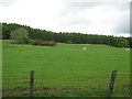
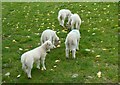
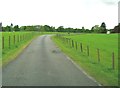
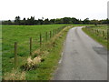
The above images may not be of the site on this page, they are loaded from Geograph.
Please Submit an Image of this site or go out and take one for us!
Click here to see more info for this site
Nearby sites
Key: Red: member's photo, Blue: 3rd party photo, Yellow: other image, Green: no photo - please go there and take one, Grey: site destroyed
Download sites to:
KML (Google Earth)
GPX (GPS waypoints)
CSV (Garmin/Navman)
CSV (Excel)
To unlock full downloads you need to sign up as a Contributory Member. Otherwise downloads are limited to 50 sites.
Turn off the page maps and other distractions
Nearby sites listing. In the following links * = Image available
191m NE 41° Parliament Knowe Fort Hillfort (NX428661)
283m S 170° Kirroughtree House E* Cairn (NX42716568)
316m SSW 196° Kirroughtree House W* Cairn (NX42576566)
526m NNE 14° Gout Well of Larg (Minnigaff) Holy Well or Sacred Spring (NX4281766466)
622m SSW 202° Low Lessons* Cairn (NX42426539)
693m SW 214° High Lessons* Cairn (NX42266540)
1.0km WSW 248° Creebridge Cairn* Cairn (NX4168765595)
1.5km WSW 254° Charlie's Well (Minnigaff) Holy Well or Sacred Spring (NX4121565608)
1.6km NNE 25° Pot Well (Minnigaff) Holy Well or Sacred Spring (NX4340367419)
1.7km NW 304° Wishing Pot (Minnigaff) Holy Well or Sacred Spring (NX4132666941)
1.7km WNW 288° Minnigaff Old Church* Ancient Cross (NX4102666557)
3.1km S 181° St Ninian's Well (Upper Barr) Holy Well or Sacred Spring (NX42506286)
3.3km W 276° Barnkirk Hill Hillfort (NX394664)
3.7km NW 323° Boreland* Chambered Cairn (NX40576900)
4.4km NW 309° Drumwhirn Cairn* Cairn (NX39356884)
4.5km SSW 195° High Baltersan* Cairn (NX41346168)
4.5km NW 323° Barclye Rocking Stone* Natural Stone / Erratic / Other Natural Feature (NX4011169664)
4.7km NW 304° Barclye Cairn* Cairn (NX38906873)
5.3km NNW 336° Drannandow S* Cairn (NX40697088)
5.5km NNW 338° Rorie Gill * Cairn (NX40797117)
5.7km NNW 329° Drumfern S* Cairn (NX39957096)
5.7km NNW 339° Drannandow Chambered Cairn* Chambered Cairn (NX40837135)
5.7km NNW 330° Drannandow Circle* Stone Circle (NX39997099)
5.9km NNW 331° Drumfern Cairn* Round Cairn (NX39977124)
6.1km NNW 336° The Thieves* Standing Stones (NX4044071597)
View more nearby sites and additional images


 We would like to know more about this location. Please feel free to add a brief description and any relevant information in your own language.
 Wir möchten mehr über diese Stätte erfahren. Bitte zögern Sie nicht, eine kurze Beschreibung und relevante Informationen in Deutsch hinzuzufügen.
 Nous aimerions en savoir encore un peu sur les lieux. S'il vous plaît n'hesitez pas à ajouter une courte description et tous les renseignements pertinents dans votre propre langue.
 Quisieramos informarnos un poco más de las lugares. No dude en añadir una breve descripción y otros datos relevantes en su propio idioma.