

<< Our Photo Pages >> Hen Blas - Burial Chamber or Dolmen in Wales in Anglesey
Submitted by guile on Monday, 10 January 2011 Page Views: 9680
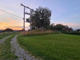
Neolithic and Bronze AgeSite Name: Hen BlasCountry: Wales County: Anglesey Type: Burial Chamber or Dolmen
Nearest Town: Llangefni Nearest Village: Paradwys
Map Ref: SH42577197
Latitude: 53.221388N Longitude: 4.359492W
Condition:
| 5 | Perfect |
| 4 | Almost Perfect |
| 3 | Reasonable but with some damage |
| 2 | Ruined but still recognisable as an ancient site |
| 1 | Pretty much destroyed, possibly visible as crop marks |
| 0 | No data. |
| -1 | Completely destroyed |
| 5 | Superb |
| 4 | Good |
| 3 | Ordinary |
| 2 | Not Good |
| 1 | Awful |
| 0 | No data. |
| 5 | Can be driven to, probably with disabled access |
| 4 | Short walk on a footpath |
| 3 | Requiring a bit more of a walk |
| 2 | A long walk |
| 1 | In the middle of nowhere, a nightmare to find |
| 0 | No data. |
| 5 | co-ordinates taken by GPS or official recorded co-ordinates |
| 4 | co-ordinates scaled from a detailed map |
| 3 | co-ordinates scaled from a bad map |
| 2 | co-ordinates of the nearest village |
| 1 | co-ordinates of the nearest town |
| 0 | no data |
Internal Links:
External Links:
I have visited· I would like to visit
elad13 would like to visit
guile has visited here
")
In the mid nineteenth century a local inhabitant claimed that other stones had been removed and that an urn containing ashes, a ring of blue glass and a great quantity of ashes under a stone slab, had been discovered near the stones. None of these finds have been confirmed. It has been suggested that the stones acted as a natural cromlech, attracting burials. The 'ring of blue glass' could have been an earlier Bronze Age faience bead, or else a later finger ring. The cremation could have been of any date from Bronze Age to Roman.
Sources: Prichard in Archaeologia Cambrensis 3rd series 12 (1866), 466-71
RCAHM Anglesey Inventory (1937), 96
Lynch 'Prehistoric Anglesey' (1970), 167
John Wiles 31.08.07
=====================================================
It has long been a question whether the dolmen at Henblas is a natural collection of boulders or a man-made monument. Mr. Edward Greenly in a geological survey of the island inspected the monument and found on the underside of the capstone glacial striae or ice scratching. This in itself would lead to the supposition that the stones had been turned over, but he also observed that these striae did not correspond with the direction of the ice drift, showing that the stone had also been turned round when it was raised to its present position. The group consists of 3 stones: the NE stone is 13ft 6 inches and 50ft in circumference at the base, and the SW stone is 10ft high and 55ft in circumference at the base. The capstone was 13ft by 13ft 9 inches and 4ft thick in places. Two rubble stones wedged in between the edge of the capstone and one of the supporters suggested that it had all been covered over once. A stone 5ft high and 6ft wide once stood four or five paces in front of the SW upright and may have formed part of a gallery. The direct outlook between the two large stones is due east, All three stones are of hard quartzite which occurs in the district.
A group of three very large blocks of stone, two of which are conical and rest on their bases. It is practically certain that the position of the two upright blocks is due to natural causes, but glacial striae on the underside of the third indicate that this has been moved by human agency. Although this group as a whole is mainly natural, it may have been adapted for use as a burial place and it can not be classified until properly examined.
Collection of three colossal boulders the largest being 4 x 3.5 x 4.5m high. Two boulders are blocky and one is a very large flat slab leaning on one of the other stones. It is possible that it was once raised up on the other stone as well. A smaller stone beneath southern side could have sheared off the larger rock. In conclusion the two larger stones are almost certainly natural - The capstone is also probably natural although this could have been used to form a chambered tomb. Siting on a slight to moderate hillslope above the Cefni.
Sources :
Prehistoric Funerary and Ritual Monument Survey: West Gwynedd & Anglesey , SMITH, G. , 2003 ,
Henblas Burial Chamber , BURNHAM, H. B. , 1994 ,
Transactions of the Honourable Society of Cymmrodorion , NEIL BAYNES, E. , 1910 ,
Anglesey , Royal Commission on Ancient and Historic Monuments , 1937 ,
SH47SW 1 , Ordnance Survey , 1970 ,
Henblas Burial Chamber , DAVIDSON, A. , 1986 ,
Henblas Burial Chamber , Mason, M. , 2004 ,
You may be viewing yesterday's version of this page. To see the most up to date information please register for a free account.
")
")
")
")
")
")
")
")
")
")
Do not use the above information on other web sites or publications without permission of the contributor.
Click here to see more info for this site
Nearby sites
Key: Red: member's photo, Blue: 3rd party photo, Yellow: other image, Green: no photo - please go there and take one, Grey: site destroyed
Download sites to:
KML (Google Earth)
GPX (GPS waypoints)
CSV (Garmin/Navman)
CSV (Excel)
To unlock full downloads you need to sign up as a Contributory Member. Otherwise downloads are limited to 50 sites.
Turn off the page maps and other distractions
Nearby sites listing. In the following links * = Image available
1.7km N 349° St Ceinwen Holy Well* Holy Well or Sacred Spring (SH423737)
3.0km W 278° Din Dryfol* Chambered Tomb (SH3956572490)
3.1km NNW 338° Graiglas* Round Barrow(s) (SH415749)
3.2km SSW 211° Malltraeth* Standing Stone (Menhir) (SH4085569306)
3.3km NNW 341° Druid Farm* Standing Stones (SH416751)
3.6km NE 54° Lledwigan* Standing Stone (Menhir) (SH456740)
4.0km SSE 148° St Caffo (Llangaffo)* Ancient Cross (SH446685)
5.0km SW 235° St Cadwaladr (Llangadwaladr)* Early Christian Sculptured Stone (SH38376927)
5.0km NE 37° Ffynnon Cyngar Sant / St Cyngars Well* Holy Well or Sacred Spring (SH4572875881)
5.3km SSE 148° Maesoglan 1* Standing Stone (Menhir) (SH452674)
5.3km SE 134° Bodowyr* Passage Grave (SH46276816)
5.3km NE 44° Llangefni Gorsedd Circle Modern Stone Circle etc (SH4636875687)
5.4km SSE 148° Maesoglan 2* Standing Stone (Menhir) (SH453673)
5.5km SSE 147° Maesoglan 3* Standing Stone (Menhir) (SH454673)
5.6km NNE 33° Oriel Ynys Mon* Museum (SH458766)
6.1km SE 130° Pont Sarn Las Ancient Village or Settlement (SH471679)
6.2km NW 307° A55 Erratic* Natural Stone / Erratic / Other Natural Feature (SH3774475886)
6.2km SE 142° Bryn Gwyn Stones* Stone Circle (SH4623566927)
6.3km SE 136° Tre'r Dryw Bach W Stone Circle (SH468673)
6.3km SE 139° Castell Bryn-Gwyn* Henge (SH4652867061)
6.3km ENE 65° Hirdre-faig* Standing Stone (Menhir) (SH484745)
6.4km SE 129° Ty Mawr 2* Standing Stone (Menhir) (SH4743667830)
6.5km SE 132° Caer Leb* Ancient Village or Settlement (SH47286747)
6.5km SE 128° Ty Mawr 1 (Trefwri)* Standing Stone (Menhir) (SH4761567794)
7.4km S 191° Crochan Llanddwyn* Holy Well or Sacred Spring (SH40986478)
View more nearby sites and additional images


 We would like to know more about this location. Please feel free to add a brief description and any relevant information in your own language.
 Wir möchten mehr über diese Stätte erfahren. Bitte zögern Sie nicht, eine kurze Beschreibung und relevante Informationen in Deutsch hinzuzufügen.
 Nous aimerions en savoir encore un peu sur les lieux. S'il vous plaît n'hesitez pas à ajouter une courte description et tous les renseignements pertinents dans votre propre langue.
 Quisieramos informarnos un poco más de las lugares. No dude en añadir una breve descripción y otros datos relevantes en su propio idioma.