


<< Our Photo Pages >> Druid Farm - Standing Stones in Wales in Anglesey (Sir Ynys Mon)
Submitted by TimPrevett on Tuesday, 24 September 2002 Page Views: 9341
Neolithic and Bronze AgeSite Name: Druid FarmCountry: Wales County: Anglesey (Sir Ynys Mon) Type: Standing Stones
Map Ref: SH4163475033 Landranger Map Number: 114
Latitude: 53.248619N Longitude: 4.375022W
Condition:
| 5 | Perfect |
| 4 | Almost Perfect |
| 3 | Reasonable but with some damage |
| 2 | Ruined but still recognisable as an ancient site |
| 1 | Pretty much destroyed, possibly visible as crop marks |
| 0 | No data. |
| -1 | Completely destroyed |
| 5 | Superb |
| 4 | Good |
| 3 | Ordinary |
| 2 | Not Good |
| 1 | Awful |
| 0 | No data. |
| 5 | Can be driven to, probably with disabled access |
| 4 | Short walk on a footpath |
| 3 | Requiring a bit more of a walk |
| 2 | A long walk |
| 1 | In the middle of nowhere, a nightmare to find |
| 0 | No data. |
| 5 | co-ordinates taken by GPS or official recorded co-ordinates |
| 4 | co-ordinates scaled from a detailed map |
| 3 | co-ordinates scaled from a bad map |
| 2 | co-ordinates of the nearest village |
| 1 | co-ordinates of the nearest town |
| 0 | no data |
Internal Links:
External Links:
I have visited· I would like to visit
guile TimPrevett have visited here
")
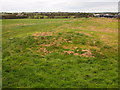
South of RAF Mona; left off A5. This stone is another that had previously eluded me, but was pleased to have got it this time! A large layby on the left, so parking was easy. Take the gate into the 2nd field, and turn right. The stone(s) are parallel to the hedge on a rise. Two large stones lie a short distance from each other; I could not ascertain if they were once together but given their prostrate position, they are near impossible to spot unless you are in the field with them!
You may be viewing yesterday's version of this page. To see the most up to date information please register for a free account.
")
")
Do not use the above information on other web sites or publications without permission of the contributor.
coldrum has found this location on Google Street View:
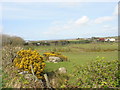
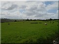
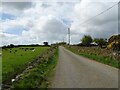
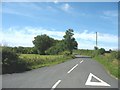
Nearby Images from Geograph Britain and Ireland:
©2008(licence)
©2024(licence)
©2024(licence)
©2008(licence)
©2015(licence)
The above images may not be of the site on this page, they are loaded from Geograph.
Please Submit an Image of this site or go out and take one for us!
Click here to see more info for this site
Nearby sites
Key: Red: member's photo, Blue: 3rd party photo, Yellow: other image, Green: no photo - please go there and take one, Grey: site destroyed
Download sites to:
KML (Google Earth)
GPX (GPS waypoints)
CSV (Garmin/Navman)
CSV (Excel)
To unlock full downloads you need to sign up as a Contributory Member. Otherwise downloads are limited to 50 sites.
Turn off the page maps and other distractions
Nearby sites listing. In the following links * = Image available
188m SW 223° Graiglas* Round Barrow(s) (SH415749)
1.5km SSE 152° St Ceinwen Holy Well* Holy Well or Sacred Spring (SH423737)
3.2km SSE 161° Hen Blas* Burial Chamber or Dolmen (SH42577197)
3.3km SW 217° Din Dryfol* Chambered Tomb (SH3956572490)
4.0km W 280° A55 Erratic* Natural Stone / Erratic / Other Natural Feature (SH3774475886)
4.1km ESE 103° Lledwigan* Standing Stone (Menhir) (SH456740)
4.2km ENE 76° Ffynnon Cyngar Sant / St Cyngars Well* Holy Well or Sacred Spring (SH4572875881)
4.4km ENE 67° Oriel Ynys Mon* Museum (SH458766)
4.8km E 80° Llangefni Gorsedd Circle* Modern Stone Circle etc (SH4636875687)
5.8km S 186° Malltraeth* Standing Stone (Menhir) (SH4085569306)
6.0km W 263° Bodfeddan Inscribed Stone* Standing Stone (Menhir) (SH356745)
6.6km SSW 208° St Cadwaladr (Llangadwaladr)* Early Christian Sculptured Stone (SH38376927)
6.8km E 93° Hirdre-faig* Standing Stone (Menhir) (SH484745)
7.1km NNW 328° Maen Llechgynfarwy* Standing Stone (Menhir) (SH38108116)
7.2km SSE 154° St Caffo (Llangaffo)* Ancient Cross (SH446685)
7.3km W 259° Ty Newydd (Llanfaelog)* Chambered Tomb (SH34437387)
7.5km N 354° Mynydd Mwyn Mawr standing stones* Standing Stones (SH41058256)
8.2km NNW 345° Carmel Standing Stone* Standing Stone (Menhir) (SH39798304)
8.3km SE 144° Bodowyr* Passage Grave (SH46276816)
8.4km SSE 153° Maesoglan 1* Standing Stone (Menhir) (SH452674)
8.5km SSE 153° Maesoglan 2* Standing Stone (Menhir) (SH453673)
8.6km SSE 152° Maesoglan 3* Standing Stone (Menhir) (SH454673)
8.8km NNE 22° Llech Golman* Standing Stone (Menhir) (SH452831)
9.0km SE 141° Pont Sarn Las Ancient Village or Settlement (SH471679)
9.0km NW 309° Presaddfed* Chambered Tomb (SH34768089)
View more nearby sites and additional images


 We would like to know more about this location. Please feel free to add a brief description and any relevant information in your own language.
 Wir möchten mehr über diese Stätte erfahren. Bitte zögern Sie nicht, eine kurze Beschreibung und relevante Informationen in Deutsch hinzuzufügen.
 Nous aimerions en savoir encore un peu sur les lieux. S'il vous plaît n'hesitez pas à ajouter une courte description et tous les renseignements pertinents dans votre propre langue.
 Quisieramos informarnos un poco más de las lugares. No dude en añadir una breve descripción y otros datos relevantes en su propio idioma.