<< Our Photo Pages >> The Thieves - Standing Stones in Scotland in Dumfries and Galloway
Submitted by Tom_Bullock on Sunday, 06 October 2002 Page Views: 10051
Neolithic and Bronze AgeSite Name: The Thieves Alternative Name: Blair HillCountry: Scotland County: Dumfries and Galloway Type: Standing Stones
Nearest Town: Newton Stewart Nearest Village: Minnigaff
Map Ref: NX4044071597 Landranger Map Number: 77
Latitude: 55.013262N Longitude: 4.496904W
Condition:
| 5 | Perfect |
| 4 | Almost Perfect |
| 3 | Reasonable but with some damage |
| 2 | Ruined but still recognisable as an ancient site |
| 1 | Pretty much destroyed, possibly visible as crop marks |
| 0 | No data. |
| -1 | Completely destroyed |
| 5 | Superb |
| 4 | Good |
| 3 | Ordinary |
| 2 | Not Good |
| 1 | Awful |
| 0 | No data. |
| 5 | Can be driven to, probably with disabled access |
| 4 | Short walk on a footpath |
| 3 | Requiring a bit more of a walk |
| 2 | A long walk |
| 1 | In the middle of nowhere, a nightmare to find |
| 0 | No data. |
| 5 | co-ordinates taken by GPS or official recorded co-ordinates |
| 4 | co-ordinates scaled from a detailed map |
| 3 | co-ordinates scaled from a bad map |
| 2 | co-ordinates of the nearest village |
| 1 | co-ordinates of the nearest town |
| 0 | no data |
Internal Links:
External Links:
I have visited· I would like to visit
SumDoood SolarMegalith would like to visit
markj99 visited on 7th May 2022 - their rating: Cond: 3 Amb: 5 Access: 2 There is such a wealth of ancient sites on Drennandow Moor, however The Thieves Standing Stone are the best site to my eyes. I feel a magnetic attraction to Standing Stones generally so a pair of six footers are irresistible.

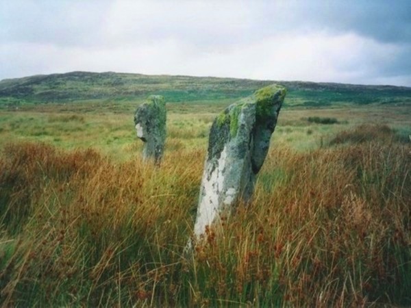
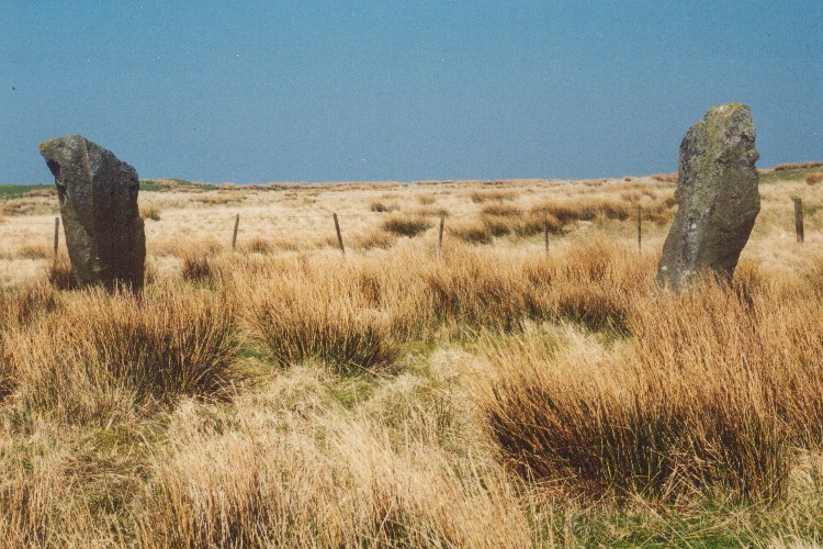
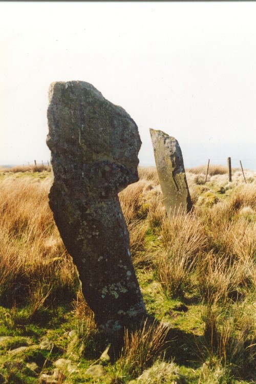
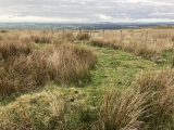
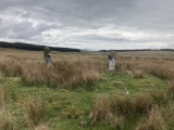
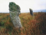
Two stones stand and one is prostrate within an elliptical bank, possibly the remains of a stone circle also known as Blair Hill. Thom calculated that there was a precision lunar alignment at this site.
For more information about these prehistoric standing stones see Canmore site no. 63579, which tells us: "one (stone is) 6ft 8ins and the other 7ft 4ins in height, 14ft 6ins apart with the edge of a broken thin slab 3ft 9ins long protruding through the turf between and a little SE of them. The stones stand in the SE quadrant of an oval enclosure formed by a low rubble wall and measuring axially 30ft by 26ft."
The entry goes onto quote from an 1896 source: "The Thieves' Stones are traditionally said to take their name from the fact that several free-booters were executed at them in the 14th century" and adds that the enclosure they stand in is modern.
You may be viewing yesterday's version of this page. To see the most up to date information please register for a free account.




Do not use the above information on other web sites or publications without permission of the contributor.
Click here to see more info for this site
Nearby sites
Key: Red: member's photo, Blue: 3rd party photo, Yellow: other image, Green: no photo - please go there and take one, Grey: site destroyed
Download sites to:
KML (Google Earth)
GPX (GPS waypoints)
CSV (Garmin/Navman)
CSV (Excel)
To unlock full downloads you need to sign up as a Contributory Member. Otherwise downloads are limited to 50 sites.
Turn off the page maps and other distractions
Nearby sites listing. In the following links * = Image available
460m ESE 120° Drannandow Chambered Cairn* Chambered Cairn (NX40837135)
551m SE 139° Rorie Gill * Cairn (NX40797117)
589m SW 231° Drumfern Cairn* Round Cairn (NX39977124)
754m SW 214° Drannandow Circle* Stone Circle (NX39997099)
758m SSE 159° Drannandow S* Cairn (NX40697088)
802m SW 215° Drumfern S* Cairn (NX39957096)
2.0km S 188° Barclye Rocking Stone* Natural Stone / Erratic / Other Natural Feature (NX4011169664)
2.6km S 175° Boreland* Chambered Cairn (NX40576900)
3.0km SSW 199° Drumwhirn Cairn* Cairn (NX39356884)
3.2km SSW 206° Barclye Cairn* Cairn (NX38906873)
4.7km SSE 167° Wishing Pot (Minnigaff) Holy Well or Sacred Spring (NX4132666941)
4.8km ENE 68° The Laird's Well (Minnigaff) Holy Well or Sacred Spring (NX4492773263)
5.1km S 171° Minnigaff Old Church* Ancient Cross (NX4102666557)
5.1km SE 143° Pot Well (Minnigaff) Holy Well or Sacred Spring (NX4340367419)
5.3km S 189° Barnkirk Hill Hillfort (NX394664)
5.6km SSE 153° Gout Well of Larg (Minnigaff) Holy Well or Sacred Spring (NX4281766466)
6.0km SSE 155° Parliament Knowe Fort Hillfort (NX428661)
6.0km S 171° Charlie's Well (Minnigaff) Holy Well or Sacred Spring (NX4121565608)
6.1km SSE 156° Kirroughtree House N* Cairn (NX42676596)
6.1km NW 307° Clachaneasy Bridge* Cairn (NX35647542)
6.1km SSE 166° Creebridge Cairn* Cairn (NX4168765595)
6.3km SSE 158° Kirroughtree House W* Cairn (NX42576566)
6.3km SSE 157° Kirroughtree House E* Cairn (NX42716568)
6.5km SSE 162° High Lessons* Cairn (NX42266540)
6.5km SSE 160° Low Lessons* Cairn (NX42426539)
View more nearby sites and additional images


 We would like to know more about this location. Please feel free to add a brief description and any relevant information in your own language.
 Wir möchten mehr über diese Stätte erfahren. Bitte zögern Sie nicht, eine kurze Beschreibung und relevante Informationen in Deutsch hinzuzufügen.
 Nous aimerions en savoir encore un peu sur les lieux. S'il vous plaît n'hesitez pas à ajouter une courte description et tous les renseignements pertinents dans votre propre langue.
 Quisieramos informarnos un poco más de las lugares. No dude en añadir una breve descripción y otros datos relevantes en su propio idioma.