<< Our Photo Pages >> Drumwhirn Cairn - Cairn in Scotland in Dumfries and Galloway
Submitted by markj99 on Thursday, 17 September 2020 Page Views: 6705
Neolithic and Bronze AgeSite Name: Drumwhirn CairnCountry: Scotland County: Dumfries and Galloway Type: Cairn
Nearest Town: Newton Stewart Nearest Village: Challock
Map Ref: NX39356884 Landranger Map Number: 83
Latitude: 54.988161N Longitude: 4.512384W
Condition:
| 5 | Perfect |
| 4 | Almost Perfect |
| 3 | Reasonable but with some damage |
| 2 | Ruined but still recognisable as an ancient site |
| 1 | Pretty much destroyed, possibly visible as crop marks |
| 0 | No data. |
| -1 | Completely destroyed |
| 5 | Superb |
| 4 | Good |
| 3 | Ordinary |
| 2 | Not Good |
| 1 | Awful |
| 0 | No data. |
| 5 | Can be driven to, probably with disabled access |
| 4 | Short walk on a footpath |
| 3 | Requiring a bit more of a walk |
| 2 | A long walk |
| 1 | In the middle of nowhere, a nightmare to find |
| 0 | No data. |
| 5 | co-ordinates taken by GPS or official recorded co-ordinates |
| 4 | co-ordinates scaled from a detailed map |
| 3 | co-ordinates scaled from a bad map |
| 2 | co-ordinates of the nearest village |
| 1 | co-ordinates of the nearest town |
| 0 | no data |
Internal Links:
External Links:
I have visited· I would like to visit
SumDoood would like to visit
")
Drumwhirn Cairn and Barclye Cairn are close to one another so visiting both on the same trip is easily achievable.
Directions: Take the A75 turn off to Newton Stewart at the large roundabout. Follow the town centre to the end of Victoria Street & bear left across the Cree Bridge. Turn L about 50 yards from the end of the bridge into Minnigaff. After 0.5 mile you will see a war memorial on your R. Take the next L turn after 100 yards. This is a narrow country lane headed to Cree Woods. Follow this lane past Minigaff Parish Church, Boreland Wood and Boreland Farm. Around 0.5 mile after Boreland Farm a green lane protected by a deer gate starts at NX 39089 68355 on the R. There is limited parking here so I chose to go onto Barclye Wood Parking (NX 38604 69482) around 0.5 miles along the lane.
Having walked back to the green lane I found the gate immovable so I had to climb the high style beside the gate. Follow the green lane uphill for 300 yards, bearing R at a fork then reach another deer gate 150 yards later. I opened this gate with some difficulty (it was heavy and stiff) and followed the field perimeter NE for around 150 yards to another deer gate. Look L to see Drumwhirn Cairn, a significant pile of stones in the adjacent field around 300 yards away. After another deer gate workout there is a stream to cross on stepping stones before reaching the field.
Canmore site no. 62929.
Page originally by Vicky.
You may be viewing yesterday's version of this page. To see the most up to date information please register for a free account.
")
")
")
Do not use the above information on other web sites or publications without permission of the contributor.
Nearby Images from Geograph Britain and Ireland:
©2019(licence)
©2006(licence)
©2010(licence)
©2017(licence)
©2010(licence)
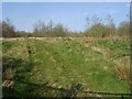
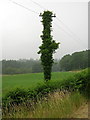
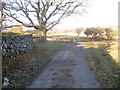
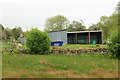
The above images may not be of the site on this page, they are loaded from Geograph.
Please Submit an Image of this site or go out and take one for us!
Click here to see more info for this site
Nearby sites
Key: Red: member's photo, Blue: 3rd party photo, Yellow: other image, Green: no photo - please go there and take one, Grey: site destroyed
Download sites to:
KML (Google Earth)
GPX (GPS waypoints)
CSV (Garmin/Navman)
CSV (Excel)
To unlock full downloads you need to sign up as a Contributory Member. Otherwise downloads are limited to 50 sites.
Turn off the page maps and other distractions
Nearby sites listing. In the following links * = Image available
462m WSW 254° Barclye Cairn* Cairn (NX38906873)
1.1km NE 41° Barclye Rocking Stone* Natural Stone / Erratic / Other Natural Feature (NX4011169664)
1.2km E 80° Boreland* Chambered Cairn (NX40576900)
2.2km NNE 14° Drumfern S* Cairn (NX39957096)
2.2km NNE 14° Drannandow Circle* Stone Circle (NX39997099)
2.4km NNE 31° Drannandow S* Cairn (NX40697088)
2.4km S 177° Barnkirk Hill Hillfort (NX394664)
2.5km NNE 12° Drumfern Cairn* Round Cairn (NX39977124)
2.7km SE 132° Wishing Pot (Minnigaff) Holy Well or Sacred Spring (NX4132666941)
2.7km NNE 30° Rorie Gill * Cairn (NX40797117)
2.8km SE 142° Minnigaff Old Church* Ancient Cross (NX4102666557)
2.9km NNE 28° Drannandow Chambered Cairn* Chambered Cairn (NX40837135)
3.0km NNE 19° The Thieves* Standing Stones (NX4044071597)
3.7km SSE 148° Charlie's Well (Minnigaff) Holy Well or Sacred Spring (NX4121565608)
4.0km SE 142° Creebridge Cairn* Cairn (NX4168765595)
4.2km ESE 122° Gout Well of Larg (Minnigaff) Holy Well or Sacred Spring (NX4281766466)
4.3km ESE 107° Pot Well (Minnigaff) Holy Well or Sacred Spring (NX4340367419)
4.4km SE 129° Kirroughtree House N* Cairn (NX42676596)
4.4km SE 126° Parliament Knowe Fort Hillfort (NX428661)
4.5km SE 138° High Lessons* Cairn (NX42266540)
4.5km SE 133° Kirroughtree House W* Cairn (NX42576566)
4.6km SE 131° Kirroughtree House E* Cairn (NX42716568)
4.6km SE 136° Low Lessons* Cairn (NX42426539)
5.8km SSW 210° Cairn Wood (Barskeoch)* Cairn (NX36266391)
6.7km SSE 150° St Ninian's Well (Upper Barr) Holy Well or Sacred Spring (NX42506286)
View more nearby sites and additional images


 We would like to know more about this location. Please feel free to add a brief description and any relevant information in your own language.
 Wir möchten mehr über diese Stätte erfahren. Bitte zögern Sie nicht, eine kurze Beschreibung und relevante Informationen in Deutsch hinzuzufügen.
 Nous aimerions en savoir encore un peu sur les lieux. S'il vous plaît n'hesitez pas à ajouter une courte description et tous les renseignements pertinents dans votre propre langue.
 Quisieramos informarnos un poco más de las lugares. No dude en añadir una breve descripción y otros datos relevantes en su propio idioma.