<< Our Photo Pages >> Barclye Cairn - Cairn in Scotland in Dumfries and Galloway
Submitted by markj99 on Sunday, 12 July 2020 Page Views: 742
Neolithic and Bronze AgeSite Name: Barclye CairnCountry: Scotland County: Dumfries and Galloway Type: Cairn
Nearest Town: Newton Stewart Nearest Village: Challoch
Map Ref: NX38906873
Latitude: 54.987028N Longitude: 4.519348W
Condition:
| 5 | Perfect |
| 4 | Almost Perfect |
| 3 | Reasonable but with some damage |
| 2 | Ruined but still recognisable as an ancient site |
| 1 | Pretty much destroyed, possibly visible as crop marks |
| 0 | No data. |
| -1 | Completely destroyed |
| 5 | Superb |
| 4 | Good |
| 3 | Ordinary |
| 2 | Not Good |
| 1 | Awful |
| 0 | No data. |
| 5 | Can be driven to, probably with disabled access |
| 4 | Short walk on a footpath |
| 3 | Requiring a bit more of a walk |
| 2 | A long walk |
| 1 | In the middle of nowhere, a nightmare to find |
| 0 | No data. |
| 5 | co-ordinates taken by GPS or official recorded co-ordinates |
| 4 | co-ordinates scaled from a detailed map |
| 3 | co-ordinates scaled from a bad map |
| 2 | co-ordinates of the nearest village |
| 1 | co-ordinates of the nearest town |
| 0 | no data |
Internal Links:
External Links:
I have visited· I would like to visit
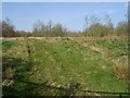
markj99 visited on 11th Jul 2020 - their rating: Cond: 2 Amb: 3 As with many cairns built in farmland the temptation to borrow the stones for a more practical purpose has proved too great so we are left with the footprint of the original cairn. It is easy to visit from the minor road between Newton Stewart and RSPB Wood of Cree Reserve.
")
Directions: Take the A75 turn off to Newton Stewart at the large roundabout. Follow the town centre to the end of Victoria Street & bear left across the Cree Bridge. Turn L about 50 yards from the end of the bridge into Minnigaff. After 0.5 mile you will see a war memorial on your R.
Take the next L turn after 100 yards. This is a narrow country lane headed to Cree Woods. Follow this lane past Minigaff Parish Church, Boreland Wood and Boreland Farm. Around 0.75 mile after Boreland Farm there is a gate at NX 389 686 (approximately) on the R. There is limited parking here so I chose to go onto Barclye Wood Parking (NX 38604 69482) around 0.5 miles along the lane.
Return to the gate, heading N up a slope for around 300 yards when Barclye Cairn will be visible on a hilltop.
Barclye Cairn & Drumwhirn Cairn are close to one another so visiting both on the same trip is ergonomic and easily achievable.
You may be viewing yesterday's version of this page. To see the most up to date information please register for a free account.
")
")
")
Do not use the above information on other web sites or publications without permission of the contributor.
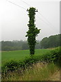
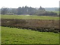
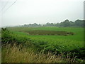
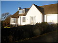
Nearby Images from Geograph Britain and Ireland:
©2006(licence)
©2019(licence)
©2006(licence)
©2010(licence)
©2019(licence)
The above images may not be of the site on this page, they are loaded from Geograph.
Please Submit an Image of this site or go out and take one for us!
Click here to see more info for this site
Nearby sites
Key: Red: member's photo, Blue: 3rd party photo, Yellow: other image, Green: no photo - please go there and take one, Grey: site destroyed
Download sites to:
KML (Google Earth)
GPX (GPS waypoints)
CSV (Garmin/Navman)
CSV (Excel)
To unlock full downloads you need to sign up as a Contributory Member. Otherwise downloads are limited to 50 sites.
Turn off the page maps and other distractions
Nearby sites listing. In the following links * = Image available
462m ENE 74° Drumwhirn Cairn* Cairn (NX39356884)
1.5km NE 50° Barclye Rocking Stone* Natural Stone / Erratic / Other Natural Feature (NX4011169664)
1.7km ENE 79° Boreland* Chambered Cairn (NX40576900)
2.4km SSE 166° Barnkirk Hill Hillfort (NX394664)
2.5km NNE 23° Drumfern S* Cairn (NX39957096)
2.5km NNE 24° Drannandow Circle* Stone Circle (NX39997099)
2.7km NNE 21° Drumfern Cairn* Round Cairn (NX39977124)
2.8km NE 38° Drannandow S* Cairn (NX40697088)
3.0km SE 124° Wishing Pot (Minnigaff) Holy Well or Sacred Spring (NX4132666941)
3.0km SE 134° Minnigaff Old Church* Ancient Cross (NX4102666557)
3.1km NE 36° Rorie Gill * Cairn (NX40797117)
3.2km NE 34° Drannandow Chambered Cairn* Chambered Cairn (NX40837135)
3.2km NNE 26° The Thieves* Standing Stones (NX4044071597)
3.9km SE 141° Charlie's Well (Minnigaff) Holy Well or Sacred Spring (NX4121565608)
4.2km SE 136° Creebridge Cairn* Cairn (NX4168765595)
4.5km ESE 118° Gout Well of Larg (Minnigaff) Holy Well or Sacred Spring (NX4281766466)
4.7km SE 124° Kirroughtree House N* Cairn (NX42676596)
4.7km ESE 104° Pot Well (Minnigaff) Holy Well or Sacred Spring (NX4340367419)
4.7km ESE 122° Parliament Knowe Fort Hillfort (NX428661)
4.7km SE 133° High Lessons* Cairn (NX42266540)
4.8km SE 128° Kirroughtree House W* Cairn (NX42576566)
4.8km SE 131° Low Lessons* Cairn (NX42426539)
4.9km SE 127° Kirroughtree House E* Cairn (NX42716568)
5.5km SSW 207° Cairn Wood (Barskeoch)* Cairn (NX36266391)
6.9km SSE 146° St Ninian's Well (Upper Barr) Holy Well or Sacred Spring (NX42506286)
View more nearby sites and additional images


 We would like to know more about this location. Please feel free to add a brief description and any relevant information in your own language.
 Wir möchten mehr über diese Stätte erfahren. Bitte zögern Sie nicht, eine kurze Beschreibung und relevante Informationen in Deutsch hinzuzufügen.
 Nous aimerions en savoir encore un peu sur les lieux. S'il vous plaît n'hesitez pas à ajouter une courte description et tous les renseignements pertinents dans votre propre langue.
 Quisieramos informarnos un poco más de las lugares. No dude en añadir una breve descripción y otros datos relevantes en su propio idioma.