<< Our Photo Pages >> Clochodrick Stone - Natural Stone / Erratic / Other Natural Feature in Scotland in Renfrewshire
Submitted by AstroGeologist on Wednesday, 22 May 2019 Page Views: 2226
Natural PlacesSite Name: Clochodrick Stone Alternative Name: Clach a' DruidhCountry: Scotland County: Renfrewshire Type: Natural Stone / Erratic / Other Natural Feature
Nearest Town: Johnstone Nearest Village: Howwod
Map Ref: NS37366127
Latitude: 55.817213N Longitude: 4.597339W
Condition:
| 5 | Perfect |
| 4 | Almost Perfect |
| 3 | Reasonable but with some damage |
| 2 | Ruined but still recognisable as an ancient site |
| 1 | Pretty much destroyed, possibly visible as crop marks |
| 0 | No data. |
| -1 | Completely destroyed |
| 5 | Superb |
| 4 | Good |
| 3 | Ordinary |
| 2 | Not Good |
| 1 | Awful |
| 0 | No data. |
| 5 | Can be driven to, probably with disabled access |
| 4 | Short walk on a footpath |
| 3 | Requiring a bit more of a walk |
| 2 | A long walk |
| 1 | In the middle of nowhere, a nightmare to find |
| 0 | No data. |
| 5 | co-ordinates taken by GPS or official recorded co-ordinates |
| 4 | co-ordinates scaled from a detailed map |
| 3 | co-ordinates scaled from a bad map |
| 2 | co-ordinates of the nearest village |
| 1 | co-ordinates of the nearest town |
| 0 | no data |
Internal Links:
External Links:
I have visited· I would like to visit
jeannette visited on 13th Oct 2020 - their rating: Cond: 5 Amb: 5 Access: 5 Easy access. can be viewed from car. Short hop over stone dyke but watch for cows.
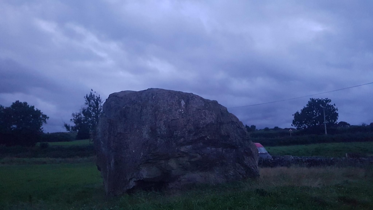
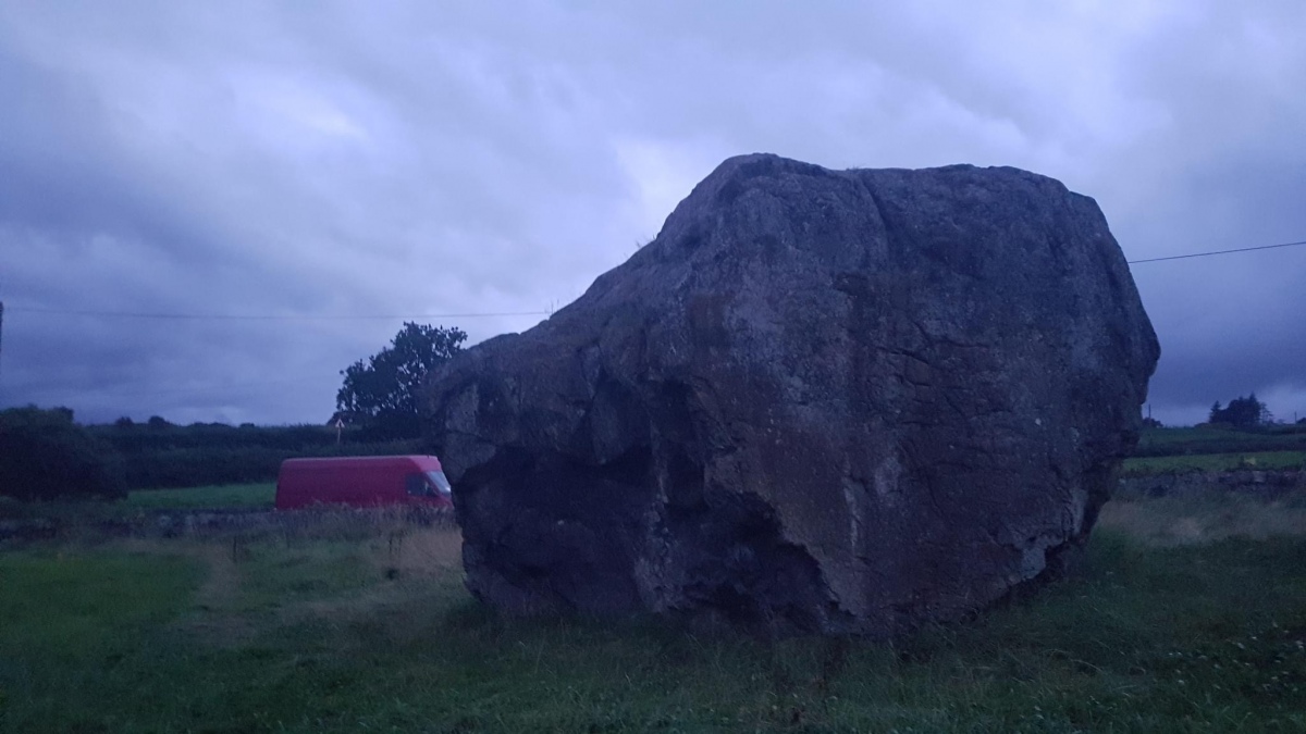
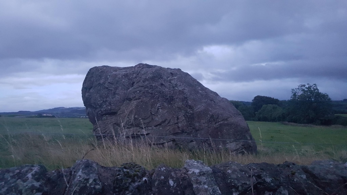
Massive bit of rock!

Situated 100m above sea level, this well documented boulder was first mentioned in a 13th century charter as a mark on the boundary of the lands of Moniabrock.
The large glacial erratic is made of Basalt and crossed by a series of Hematite veins. The boulder rests on lavas of slightly different composition, having been identified as coming from hills 4km to the NW. It measures 6.7m x 6.1m and is almost 4m high, with a circumference of 20.6m.
Legend 1 ; The stone was used by the Druid's as a site for the dispensation of justice. Depending on how the stone moved with the accused sitting on it, they were either declared innocent or guilty.
Legend 2 ; It is said to be the burial site of "Rhydderch Hael", ruler of Alt Clut until his death c.614ad. Although considering this has been here for approx 18,000 years it seems unlikely.
For a Geological Review of the stone,
Or for more information : Canmore ID 42329
You may be viewing yesterday's version of this page. To see the most up to date information please register for a free account.


Do not use the above information on other web sites or publications without permission of the contributor.
Click here to see more info for this site
Nearby sites
Key: Red: member's photo, Blue: 3rd party photo, Yellow: other image, Green: no photo - please go there and take one, Grey: site destroyed
Download sites to:
KML (Google Earth)
GPX (GPS waypoints)
CSV (Garmin/Navman)
CSV (Excel)
To unlock full downloads you need to sign up as a Contributory Member. Otherwise downloads are limited to 50 sites.
Turn off the page maps and other distractions
Nearby sites listing. In the following links * = Image available
1.3km N 352° Dun Bower Hillfort (NS3721962579)
2.3km WNW 282° Knockmade Tumulus Barrow Cemetery (NS35126184)
2.6km SSW 209° Loch Winnoch Crannog Crannog (NS3600358999)
2.8km N 10° Lawmarnock Cup Marks Rock Art (NS3794264004)
4.3km NE 54° Barr Hill Fort Hillfort (NS40946365)
4.5km ESE 121° Walls Hill Fort Hillfort (NS4117058800)
4.6km WSW 245° Dun Connel Hillfort (NS3311459497)
4.7km NNE 23° Broom Cist Cist (NS39356552)
5.0km W 272° Glenward Cairn Cairn (NS32356159)
5.4km N 10° Law Hill Dun Hillfort (NS38506659)
5.5km NW 305° Ladymuir Cairn Cairn (NS3299964600)
5.5km NNW 328° Dun Gotter Hillfort (NS3458666033)
5.8km NNE 26° Houston Tumulus Barrow Cemetery (NS40066640)
5.8km NNE 30° Back O' Hill Farm Cup Marked Stone Rock Art (NS40456623)
5.9km NNE 26° Houston South Mound Cairn (NS4010066487)
5.9km E 87° Craigston Wood Menhir* Standing Stone (Menhir) (NS4332961360)
6.2km SSE 166° Cuff Hill* Chambered Cairn (NS386552)
6.2km E 84° High Craigenfeoch Rock Art* Rock Art (NS43616168)
6.3km S 173° Four Stones (North Ayrshire) Stone Circle (NS379550)
6.5km SW 233° Ladyland Barrow Barrow Cemetery (NS32015759)
7.3km NNE 17° Sewn Dun Hillfort (NS39766816)
7.6km N 358° Barlogan Cairn* Cairn (NS37426887)
7.7km N 6° St Fillan's Seat (Kilallan)* Natural Stone / Erratic / Other Natural Feature (NS38396892)
7.8km SW 225° Langlands Tumulus Cairn (NS31625602)
7.8km N 6° St Fillan's Holy Well (Kilallan)* Holy Well or Sacred Spring (NS38406899)
View more nearby sites and additional images


 We would like to know more about this location. Please feel free to add a brief description and any relevant information in your own language.
 Wir möchten mehr über diese Stätte erfahren. Bitte zögern Sie nicht, eine kurze Beschreibung und relevante Informationen in Deutsch hinzuzufügen.
 Nous aimerions en savoir encore un peu sur les lieux. S'il vous plaît n'hesitez pas à ajouter une courte description et tous les renseignements pertinents dans votre propre langue.
 Quisieramos informarnos un poco más de las lugares. No dude en añadir una breve descripción y otros datos relevantes en su propio idioma.