


<< Text Pages >> Pant-Llech-Clawdd Burnt Mound - Artificial Mound in Wales in Ceredigion
Submitted by coldrum on Saturday, 02 July 2011 Page Views: 3965
Multi-periodSite Name: Pant-Llech-Clawdd Burnt MoundCountry: Wales
NOTE: This site is 3.5 km away from the location you searched for.
County: Ceredigion Type: Artificial Mound
Map Ref: SN28264505
Latitude: 52.077103N Longitude: 4.507498W
Condition:
| 5 | Perfect |
| 4 | Almost Perfect |
| 3 | Reasonable but with some damage |
| 2 | Ruined but still recognisable as an ancient site |
| 1 | Pretty much destroyed, possibly visible as crop marks |
| 0 | No data. |
| -1 | Completely destroyed |
| 5 | Superb |
| 4 | Good |
| 3 | Ordinary |
| 2 | Not Good |
| 1 | Awful |
| 0 | No data. |
| 5 | Can be driven to, probably with disabled access |
| 4 | Short walk on a footpath |
| 3 | Requiring a bit more of a walk |
| 2 | A long walk |
| 1 | In the middle of nowhere, a nightmare to find |
| 0 | No data. |
| 5 | co-ordinates taken by GPS or official recorded co-ordinates |
| 4 | co-ordinates scaled from a detailed map |
| 3 | co-ordinates scaled from a bad map |
| 2 | co-ordinates of the nearest village |
| 1 | co-ordinates of the nearest town |
| 0 | no data |
Be the first person to rate this site - see the 'Contribute!' box in the right hand menu.
Internal Links:
External Links:
Artificial Mound in Ceredigion
Coflein entry.
"A mound, approx. 6.0m by 4.0m, by 0.7m high, composed of black earth, with charcoal and burnt stone, set beside a stream."
https://www.coflein.gov.uk/en/site/304121
You may be viewing yesterday's version of this page. To see the most up to date information please register for a free account.
Do not use the above information on other web sites or publications without permission of the contributor.
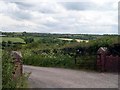
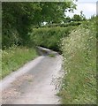
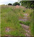
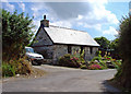
Nearby Images from Geograph Britain and Ireland:
©2009(licence)
©2009(licence)
©2009(licence)
©2008(licence)
©2008(licence)
The above images may not be of the site on this page, they are loaded from Geograph.
Please Submit an Image of this site or go out and take one for us!
Click here to see more info for this site
Nearby sites
Key: Red: member's photo, Blue: 3rd party photo, Yellow: other image, Green: no photo - please go there and take one, Grey: site destroyed
Download sites to:
KML (Google Earth)
GPX (GPS waypoints)
CSV (Garmin/Navman)
CSV (Excel)
To unlock full downloads you need to sign up as a Contributory Member. Otherwise downloads are limited to 50 sites.
Turn off the page maps and other distractions
Nearby sites listing. In the following links * = Image available
3.8km SSW 197° Cenarth Inscribed Stone Early Christian Sculptured Stone (SN27024149)
3.8km SSW 202° Cenarth Churchyard* Standing Stone (Menhir) (SN267416)
3.8km SSW 200° Ffynnon Llawddog* Holy Well or Sacred Spring (SN268415)
4.4km N 10° Caer Pwntan Hillfort (SN29164933)
5.1km SSW 198° Cilfod Fach Maen Hir Standing Stone (Menhir) (SN265403)
5.5km SSE 166° Pengelli Fawr Round Barrow(s) (SN29373963)
5.6km NNE 15° Castell Nadolig Hillfort (SN29855040)
6.4km N 4° Corbalengi Stone* Sculptured Stone (SN2890151375)
6.9km ENE 65° Pensarngerrig* Standing Stones (SN346477)
7.0km WNW 282° Pant y Butler round barrows* Round Barrow(s) (SN21464672)
7.5km WNW 295° Llech Yr Ast Standing Stone (Menhir) (SN216485)
7.6km NNE 12° Gaer Lwyd Hillfort (SN30145240)
7.9km ESE 118° Felin Cwrws Hillfort (SN351411)
8.2km WNW 285° Banc-y-Warren Hillfort (SN20414750)
8.3km NNE 13° Garreg Standing Stones Standing Stones (SN304531)
8.9km SSE 167° Ban-Y-Felin Burnt Mound Misc. Earthwork (SN29963633)
8.9km ENE 59° Caerau Three Promontory Fort / Cliff Castle (SN36054940)
9.1km WSW 253° Cilgerran stone* Standing Stone (Menhir) (SN1945942671)
9.4km WSW 256° Cilgerran Churchyard* Standing Stone (Menhir) (SN19074306)
9.5km SW 222° Maen Colman Stone* Standing Stone (Menhir) (SN21633824)
10.1km SSW 196° St Clydau's Church* Early Christian Sculptured Stone (SN251355)
10.3km NNE 17° Pendinas Lochtyn* Hillfort (SN31565486)
10.5km ENE 60° Crug-Bach Barrow Round Barrow(s) (SN37554995)
10.5km W 273° Cardigan Eisteddfod Commemorative Stone Modern Stone Circle etc (SN1774645894)
10.5km S 178° Hen Caerau Misc. Earthwork (SN283345)
View more nearby sites and additional images


 We would like to know more about this location. Please feel free to add a brief description and any relevant information in your own language.
 Wir möchten mehr über diese Stätte erfahren. Bitte zögern Sie nicht, eine kurze Beschreibung und relevante Informationen in Deutsch hinzuzufügen.
 Nous aimerions en savoir encore un peu sur les lieux. S'il vous plaît n'hesitez pas à ajouter une courte description et tous les renseignements pertinents dans votre propre langue.
 Quisieramos informarnos un poco más de las lugares. No dude en añadir una breve descripción y otros datos relevantes en su propio idioma.