<< Our Photo Pages >> Court Cairn, The May - Cairn in Scotland in Dumfries and Galloway
Submitted by markj99 on Sunday, 04 October 2020 Page Views: 389
Neolithic and Bronze AgeSite Name: Court Cairn, The May Alternative Name: Court CairnCountry: Scotland County: Dumfries and Galloway Type: Cairn
Map Ref: NX30265144
Latitude: 54.828951N Longitude: 4.644026W
Condition:
| 5 | Perfect |
| 4 | Almost Perfect |
| 3 | Reasonable but with some damage |
| 2 | Ruined but still recognisable as an ancient site |
| 1 | Pretty much destroyed, possibly visible as crop marks |
| 0 | No data. |
| -1 | Completely destroyed |
| 5 | Superb |
| 4 | Good |
| 3 | Ordinary |
| 2 | Not Good |
| 1 | Awful |
| 0 | No data. |
| 5 | Can be driven to, probably with disabled access |
| 4 | Short walk on a footpath |
| 3 | Requiring a bit more of a walk |
| 2 | A long walk |
| 1 | In the middle of nowhere, a nightmare to find |
| 0 | No data. |
| 5 | co-ordinates taken by GPS or official recorded co-ordinates |
| 4 | co-ordinates scaled from a detailed map |
| 3 | co-ordinates scaled from a bad map |
| 2 | co-ordinates of the nearest village |
| 1 | co-ordinates of the nearest town |
| 0 | no data |
Internal Links:
External Links:
I have visited· I would like to visit
markj99 visited on 27th Sep 2020 - their rating: Cond: 1 Amb: 3 Access: 3 Directions to Court Cairn (The May): Take the A747 Port William turn off the A75 at Glenluce. Stay on the A747 for c. 6.6 miles to an unsigned left turn onto the B7005 at NX 27136 49953. Travel on the B7005 for c. 2.2 miles to reach a minor road signed for Kirkcowan. Court Cairn (The May) is 0.4 miles on the left at The May farm. There is room to park in a gateway adjacent to the field.
")
I found a flat dressed stone, 4 x 2 x 0.5 feet 20 yards W of the cairn, which may have been a kerb stone
Directions: At the top of the A75 Glenluce Bypass take the A747 Port William road. After 3.5 miles pass through Auchenmalg continuing along the coast to the Rocks of Garheugh, a series of sharp corners uphill. Take the next L signposted as B7005 Wigtown. After 2.5 miles turn L at Culshabbin for Kirkcowan via Drumwalt. Court Cairn, The May is 0.4 miles on the L at The May farm. There is room to park in a gateway adjacent to the field.
You may be viewing yesterday's version of this page. To see the most up to date information please register for a free account.
")
")
Do not use the above information on other web sites or publications without permission of the contributor.
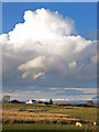
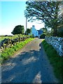
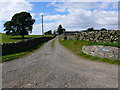
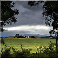
Nearby Images from Geograph Britain and Ireland:
©2008(licence)
©2012(licence)
©2010(licence)
©2013(licence)
©2011(licence)
The above images may not be of the site on this page, they are loaded from Geograph.
Please Submit an Image of this site or go out and take one for us!
Click here to see more info for this site
Nearby sites
Key: Red: member's photo, Blue: 3rd party photo, Yellow: other image, Green: no photo - please go there and take one, Grey: site destroyed
Download sites to:
KML (Google Earth)
GPX (GPS waypoints)
CSV (Garmin/Navman)
CSV (Excel)
To unlock full downloads you need to sign up as a Contributory Member. Otherwise downloads are limited to 50 sites.
Turn off the page maps and other distractions
Nearby sites listing. In the following links * = Image available
172m WSW 258° The May Cairn* Cairn (NX30095141)
367m SW 225° Lang Riggs (The May) Cairn (NX29995119)
461m S 183° Brae Farm NE* Cairn (NX30225098)
594m SSW 197° Brae Farm Central* Cairn (NX30065088)
689m SSW 197° Brae Farm SW* Cairn (NX30035079)
1.2km SSW 211° Brae Moor Cairn* Cairn (NX29595041)
1.4km S 171° Mochrum Fell (Elrig)* Cairn (NX30435004)
1.4km SSW 211° High Moor Hut Circle* Misc. Earthwork (NX29485024)
2.2km SSW 207° Corwall E* Cairn (NX29204953)
2.8km SSW 210° Corwall S* Cairn (NX28774905)
2.9km SE 125° Carlin Stone* Stone Circle (NX32554971)
3.1km SE 131° Elrig Loch* Crannog (NX32544932)
3.2km SSE 157° Airyolland E Cairn* Cairn (NX31414840)
3.3km SSE 158° Airyolland W Cairn* Cairn (NX31374837)
3.3km SE 129° Loch Head* Cairn (NX32774924)
3.5km W 260° Cairn Buy* Cairn (NX26835094)
3.5km SW 222° Chapel Finian Well* Holy Well or Sacred Spring (NX27834892)
3.5km NNW 331° Castle Loch* Cairn (NX28695460)
3.8km W 262° Green House Bridge Cairn* Cairn (NX26485105)
3.9km W 271° Craignarget Hill* Cairn (NX26365166)
4.0km SE 146° Elrig Cairn* Cairn (NX32404802)
4.8km W 280° High Gillespie* Passage Grave (NX25525245)
5.6km WNW 293° Culroy Farm Cairn* Cairn (NX25165383)
5.8km WNW 298° Culroy White Cairn* Cairn (NX25285435)
5.9km W 280° Steeps Park Stone Circle (NX245527)
View more nearby sites and additional images


 We would like to know more about this location. Please feel free to add a brief description and any relevant information in your own language.
 Wir möchten mehr über diese Stätte erfahren. Bitte zögern Sie nicht, eine kurze Beschreibung und relevante Informationen in Deutsch hinzuzufügen.
 Nous aimerions en savoir encore un peu sur les lieux. S'il vous plaît n'hesitez pas à ajouter une courte description et tous les renseignements pertinents dans votre propre langue.
 Quisieramos informarnos un poco más de las lugares. No dude en añadir una breve descripción y otros datos relevantes en su propio idioma.